Toronto Transit Realities and How to Work Around Them
Toronto's transit map looks simple but hides slow surface routes, a disorienting underground maze, and walking distances everyone underestimates.
Toronto Transit Realities and How to Work Around Them
Most visitors plan Toronto as a compact downtown city, then spend half their trip stuck on a streetcar wondering why the map lied. The subway's simple U-shape (Line 1 Yonge-University and Line 2 Bloor-Danforth) creates the illusion of quick access, but the surface routes that actually connect the neighbourhoods where Toronto lives are painfully slow. East-west trips on Queen, King, or Dundas streets can take 40 minutes to cover 3 kilometres in mixed traffic. That is the core reality of getting around Toronto: the subway is fast north-south, the streetcars are unreliable east-west, and the blocks are longer than you expect. Plan around those friction points or lose your itinerary to a slow streetcar.
TTC Subway Streetcar Guide Toronto: What Actually Works and What Does Not
The Toronto Transit Commission (TTC) runs 70 subway stations on three lines, 9 regular streetcar routes, and more than 140 bus routes. About 2.5 million boardings happen on an average weekday. Line 1 runs every 2 to 3 minutes at peak; Line 2 runs every 3 to 4 minutes. That part is good.
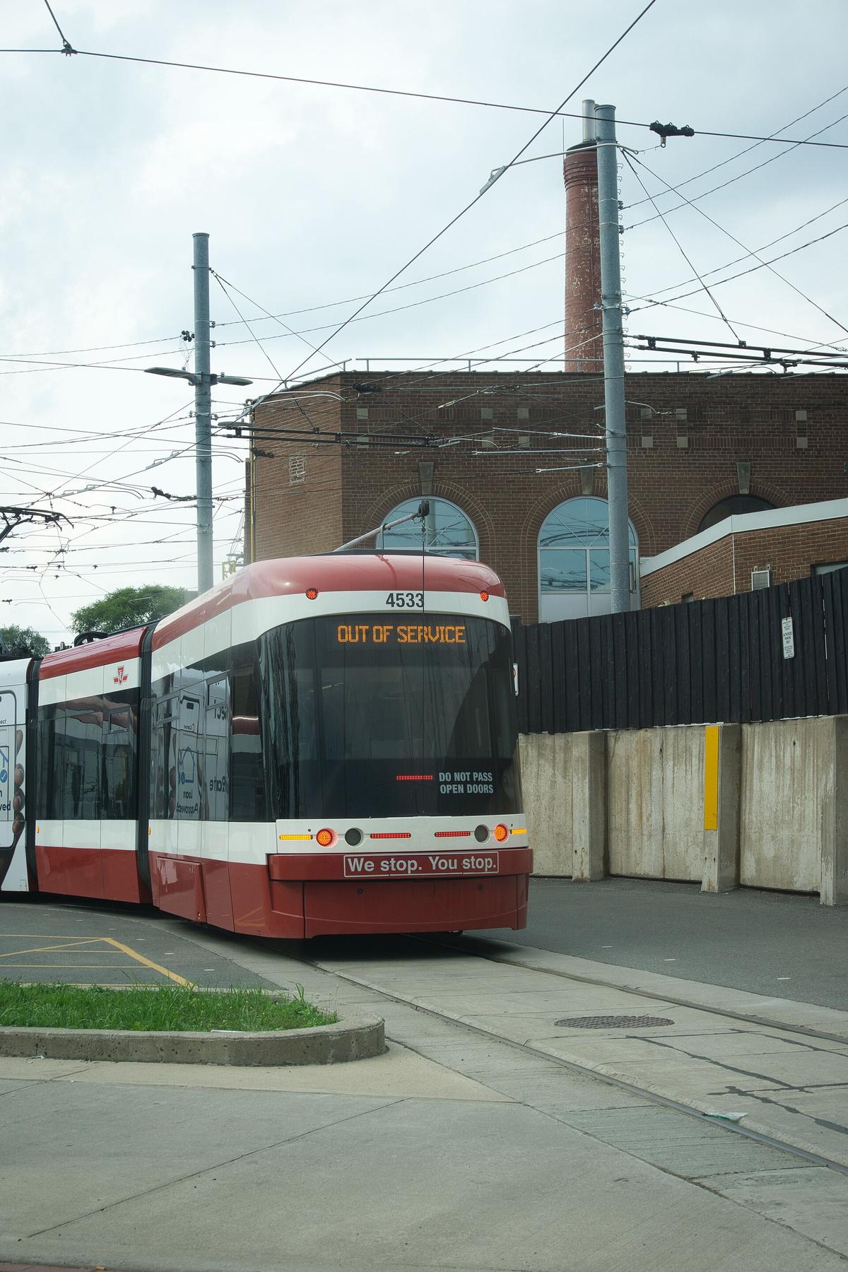
The streetcar network is the problem. The 501 Queen route runs about 24.8 km end to end, one of the longest surface routes in North America, and it shares lanes with cars. The 504 King route is shorter at 13 km but still slow. The King Street Transit Priority Corridor restricts private vehicles between Bathurst and Jarvis, which helps, but only on that one stretch. On Queen, Dundas, and College streets, streetcars idle in traffic.
Streetcars and buses also do not announce every stop reliably. You cannot sit back and trust a recording. You need to watch your phone or the street signs. Miss your stop and you could walk 15 minutes back because the next block is farther than it looks.
The Workaround for Surface Routes
Install the Transit app before you arrive. It provides real-time TTC data and is more reliable than Google Maps for surface routes. The app shows exactly where your streetcar is, how many stops away, and whether it is delayed by traffic or construction. Use it every time you board.

Toronto Transit Mistakes to Avoid: What First-Timers Get Wrong
The most common Toronto transit mistakes to avoid come down to three assumptions: that the subway goes everywhere, that the PATH system helps visitors, and that walking is as fast as it looks.
The Subway Does Not Go Everywhere
The subway only covers the Yonge-University corridor and the Bloor-Danforth line. Many key neighbourhoods have no subway access at all. Liberty Village is served only by the 504 King streetcar and the 63 Ossington bus. The Distillery District has the 504 King and the 121 Fort York-Esplanade bus. Leslieville runs on the 501 Queen and 506 Carlton. The Beaches use the 501 Queen and 64 Main bus. If your hotel or destination is in one of these areas, budget an extra 15 to 20 minutes per trip.
The PATH Is a Weekday Office Worker's Shortcut
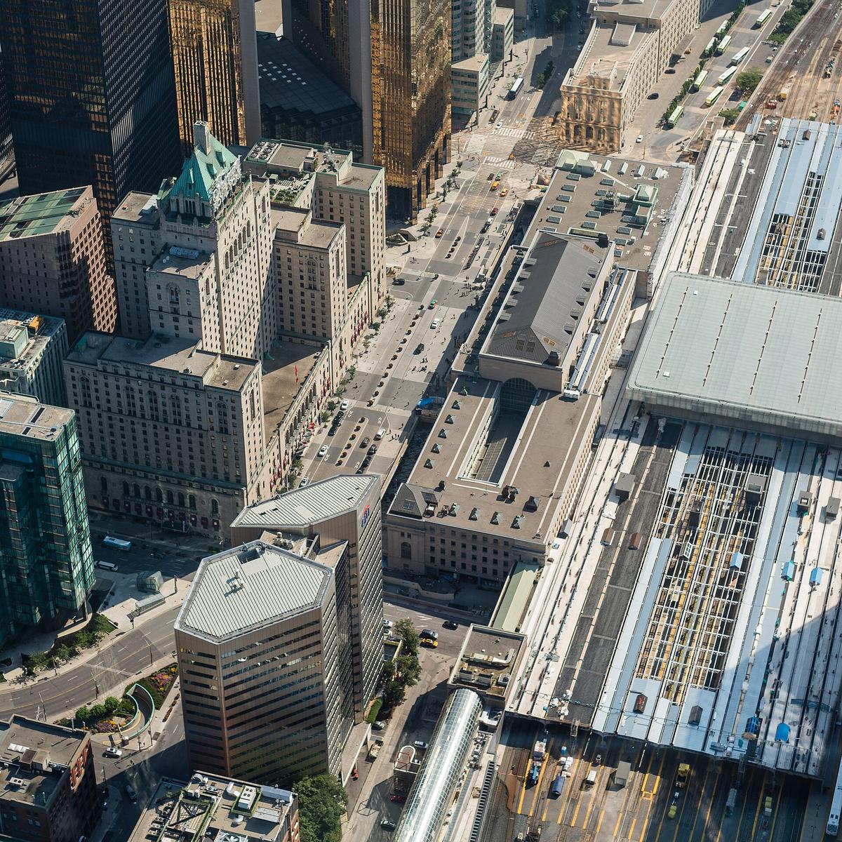
The PATH underground system is the second trap. It stretches 30 km through downtown tunnels and connects Union Station to major office towers, the Eaton Centre, and City Hall. But it closes evenings and weekends. That warning is not theoretical: you can walk into the PATH at 5:30 pm on a Saturday thinking you have found a shortcut, hit a locked gate, and surface three blocks away from where you expected. The PATH is for weekday office workers, not tourists. Do not rely on it.
Walking Takes Longer Than the Map Suggests
Toronto's blocks are long. The downtown core measures roughly 2.5 km from Bloor Street to the lakefront north-south, and about 4 km from Bathurst Street to the Don Valley east-west. Walking distances between neighbourhoods are routinely underestimated. Kensington Market to the Distillery District looks like a 20-minute walk on a map. It takes 35 minutes. Factor that into your schedule.
UP Express Pearson to Union Toronto: the Only Airport Option That Saves Time
The UP Express runs from Toronto Pearson Airport to Union Station in 25 minutes. The adult fare is set by Metrolinx and sits in the $12 CAD range one-way; check the UP Express website for the current price. Payment works with PRESTO, contactless credit or debit, or an online ticket bought through the UP Express app or station kiosks. Trains run frequently; check the UP Express website for the current schedule.
Compare that to a taxi or rideshare: 35 to 60 minutes into downtown, with a flat rate set by the city that runs from $55 to $70 CAD. In peak traffic, the taxi takes the same time as the UP Express but costs five times as much. The UP Express is operated by Alstom under contract to Metrolinx, carries about 4 million passengers per year, and includes free Wi-Fi on all trains.
One caveat: the UP Express stops at Union Station, which is at the south end of the downtown core. If your accommodation is near Bloor or in a midtown neighbourhood, you will need to transfer to Line 1 northbound from Union. Budget 10 more minutes for that connection.
Billy Bishop Airport is the other option, serving eastern Canada and the US northeast. It connects via a free pedestrian tunnel or a 90-second ferry to the foot of Bathurst Street. From there, take the 509 Harbourfront or 511 Bathurst streetcar for a 10-minute ride into the core.
| Method | Cost | How It Works | Best For |
|---|---|---|---|
| Tap contactless credit/debit | Single fare per tap | Tap at subway fare gate, streetcar reader, or bus reader; two-hour unlimited travel loaded automatically | Visitors staying 1 to 4 days; no upfront card purchase needed |
| PRESTO card | Card purchase fee set by Metrolinx, plus load | Buy at TTC stations or Shoppers Drug Mart; tap and go; two-hour transfer same as contactless | Week-long stays or if you prefer a physical card |
| PRESTO in mobile wallet | Same as physical card | Add to Apple Wallet or Google Wallet; no card purchase fee | Phone-dependent travellers |
| TTC day pass | Flat rate per person or family | Buy from PRESTO vending machines; valid for one day; family pass works weekends | Heavy transit users doing multiple neighbourhoods in one day |
| Cash fare | Exact change only | Paper transfer issued; no change given on buses | Emergency backup; avoid as primary method |
PRESTO Card Toronto Visitor Guide: When to Buy One and When to Skip it
For a stay of 1 to 4 days, skip the PRESTO card entirely. Tap your contactless credit or debit card directly at the fare gate on the subway or the reader on a streetcar or bus. The TTC rolled out full contactless payment in 2023. The two-hour unlimited transfer rule works the same way: tap at the start of your journey, then tap again if you switch from subway to streetcar or bus within two hours in any direction. The system handles it automatically.
The PRESTO card carries a purchase fee before you load any fare. For a short visit, that fee is wasted. Buy a PRESTO card only if you are staying a full week, plan to use GO Transit or the UP Express frequently (fare capping is available on GO Transit and the UP Express but not on the TTC), or prefer having a dedicated transit card over tapping a bank card.
If you do use a PRESTO card, you can load value at any TTC station vending machine, Shoppers Drug Mart, or online. The minimum load is set by Metrolinx and changes periodically. For the current figure, check the PRESTO website.

Getting Around Toronto: Neighbourhood-to-Neighbourhood Routes That Work
Getting around Toronto means accepting that some moves will take 40 minutes no matter what you do. The city is a patchwork of distinct neighbourhoods stitched together by long transit rides. Here is the honest routing for the most common visitor moves.
Downtown Core to Kensington Market and Chinatown
From Union Station, take Line 1 north to Dundas station, then walk west 10 minutes along Dundas Street. Walking beats transit here; the streetcar on Dundas is slow. Kensington Market and Chinatown connect on foot. The neighbourhoods where walking beats transit are Kensington Market, Chinatown, Queen West, the Distillery District, St. Lawrence, and Yorkville.
Queen West to the Distillery District
Take the 504 King streetcar eastbound. Get off at Parliament Street and walk south 5 minutes. The 504 King is one of the more reliable surface routes because of the King Street Transit Priority Corridor, but weekend diversions are common due to construction on Line 1 and Line 2. Check the Transit app before you board.
Yorkville and The Annex to the Danforth
Take Line 2 east from Museum or Bay station to Broadview or Pape station. The full trip is about 20 minutes on the subway. Line 2 runs every 3 to 4 minutes at peak. This is one of the fastest neighbourhood-to-neighbourhood moves in the city.
Leslieville or The Beaches to Scarborough
From the 501 Queen streetcar, transfer to Line 2 at Victoria Park station, then ride east to Kennedy station. From Kennedy, take a GO train or a TTC bus into Scarborough. Scarborough has the region's best Sri Lankan and Chinese food, but budget 60 minutes each way from downtown. Accept the time or skip it on a short trip.
Night Transit and Construction: What to Do When the Normal Route Fails
The TTC subway closes nightly. Buses and streetcars on designated routes run 24 hours through the Blue Night Network, approximately 1:30 am to 5:30 am. If you are out late, know which Blue Night route serves your area before you leave. Cab or rideshare costs from Queen West to the Annex run about $20 to $25 CAD, which may be worth it at 2 am.
Construction is constant and disruptive. Weekend subway closures happen on sections of Line 1 and Line 2 for maintenance. Line 1 closures are most frequent north of Bloor; Line 2 closures are most frequent east of Woodbine. The Gardiner Expressway and Queen Street streetcar diversions can break a schedule. Check the TTC website or the Transit app for service alerts before you head out.
In winter, heavy snow and freezing rain delay streetcars and buses. Summer brings its own problems: weekend closures plus humidity that makes waiting on an unsheltered platform unpleasant. Pack a transit backup plan for every trip that matters.
The single thing that most often goes wrong: staying only in the financial core and judging the city by its least interesting streets. Toronto's value is in its neighbourhoods, and a downtown hotel without a plan to leave the core produces the most common complaint that the city felt sterile and soulless. The transit system will take you to those neighbourhoods, but only if you budget the time, use the right payment method, and accept that some trips are just slow. Do not fight it. Plan around it.
Common Questions
Should I buy a PRESTO card for a 3-day trip?
No. Tap your contactless credit or debit card instead. The PRESTO card carries a purchase fee, and you get no benefit from it on a short TTC-only stay. The two-hour transfer rule works the same way with any tap method.
Does the PATH network help me get around as a tourist?
No. The PATH is 30 km of underground tunnels that close evenings and weekends. It connects office towers, not the neighbourhoods most visitors want. Relying on it will get you lost or trapped behind a locked gate.
What is the fastest way from Pearson Airport to a hotel near Bloor Street?
Take the UP Express to Union Station, then transfer to Line 1 north to Bloor-Yonge station. Total time about 35 minutes. A taxi or rideshare to the same area takes 35 to 60 minutes and costs $55 to $70 CAD.
Why do streetcars feel so slow compared to the subway?
Streetcars share lanes with cars on most routes except the King Street Transit Priority Corridor. The 501 Queen route is 24.8 km long and can take over 90 minutes end to end. The subway moves faster because it is grade-separated.
Read next
-
 Toronto Hotels and What the Price Bands Actually Get You
Toronto hotel prices cluster into bands that deliver distinctly different experiences, from suburban chain functionality to character-rich midrange spots in
Toronto Hotels and What the Price Bands Actually Get You
Toronto hotel prices cluster into bands that deliver distinctly different experiences, from suburban chain functionality to character-rich midrange spots in
-
 Where to Stay in Toronto and What Each District Costs You
Where you stay in Toronto shapes everything about your trip. Each district comes with a tradeoff in transit time, street life, and what you can walk to after dinner.
Where to Stay in Toronto and What Each District Costs You
Where you stay in Toronto shapes everything about your trip. Each district comes with a tradeoff in transit time, street life, and what you can walk to after dinner.
-
 Flying Into Toronto Pearson or Billy Bishop and Getting Downtown
Flying into Toronto means choosing between Pearson and Billy Bishop. Here's how each airport works and how to get downtown from both.
Flying Into Toronto Pearson or Billy Bishop and Getting Downtown
Flying into Toronto means choosing between Pearson and Billy Bishop. Here's how each airport works and how to get downtown from both.
-
 What to Do in Toronto Ordered by Whether It Is Worth the Time
Toronto's attractions compete for your limited days. Some earn their time cost, others don't. This ranks them by what you actually get for the hours you spend.
What to Do in Toronto Ordered by Whether It Is Worth the Time
Toronto's attractions compete for your limited days. Some earn their time cost, others don't. This ranks them by what you actually get for the hours you spend.
-
 When to Visit Toronto and What Each Season Does to the City
Toronto shifts dramatically with the seasons, from festival-packed spring and fall shoulders to humid summer patios and bitter winter sidewalks that never
When to Visit Toronto and What Each Season Does to the City
Toronto shifts dramatically with the seasons, from festival-packed spring and fall shoulders to humid summer patios and bitter winter sidewalks that never
-
 How to Spend Two or Three Days in Toronto Without Rushing
A Toronto itinerary that works: how to spend two or three days in the city's neighbourhoods instead of getting stuck in the financial core.
How to Spend Two or Three Days in Toronto Without Rushing
A Toronto itinerary that works: how to spend two or three days in the city's neighbourhoods instead of getting stuck in the financial core.
-
 Canada Travel Guide for First-Timers Who Have No Idea How Big It Is
Canada is the second-largest country on earth, and its vastness punishes anyone who mistakes it for a quick trip between iconic sights.
Canada Travel Guide for First-Timers Who Have No Idea How Big It Is
Canada is the second-largest country on earth, and its vastness punishes anyone who mistakes it for a quick trip between iconic sights.
-
 Staying Connected Across Canada Without Roaming Surprises
A mobile plan bought from Rogers in Toronto can trigger roaming charges the moment you cross into Manitoba. That is not a glitch. That is Canada.
Staying Connected Across Canada Without Roaming Surprises
A mobile plan bought from Rogers in Toronto can trigger roaming charges the moment you cross into Manitoba. That is not a glitch. That is Canada.
-
 When to Visit Canada and What Each Season Actually Delivers
Canada's reliable travel window runs June to September. Outside that, rural attractions close, daylight vanishes, and winter is aggressively extreme.
When to Visit Canada and What Each Season Actually Delivers
Canada's reliable travel window runs June to September. Outside that, rural attractions close, daylight vanishes, and winter is aggressively extreme.