A Straightforward Guide to Travelling New Zealand
New Zealand packs glaciers, fjords, rainforest, and volcanoes into two narrow islands.
- Flag
-
- ISO code
- NZ
- Population
- 4,885,500
- Currency
- NZD
- Dial code
- +64
A Straightforward Guide to Travelling New Zealand
Two islands hold landscapes so dense that you can stand on a glacier in the morning and sit beside a rainforested fiord by late afternoon. That is the pull. The catch: 268,021 km² of land, 15,134 km of coastline, and roads that wind through mountain passes and along coastal cliffs make every journey longer than the map suggests. The distances are punishing. The weather swings from blazing UV to horizontal rain in one stop. Sandflies on the West Coast and in Fiordland bite through thin clothing. DEET repellent is non negotiable. But the payoff, a country where you drive yourself through every shift in terrain, is why self drive dominates every itinerary. Below you find the facts that let you decide between the islands, plan the road trip, and avoid the mistakes that cost travellers days of their holiday.
- Capital: Wellington
- Largest City: Auckland
- Population: 5,338,500 (annual figure; the 2024 estimate is published by Stats NZ)
- Land Area: 268,021 km²
- Highest Point: Aoraki / Mount Cook, 3,724 m
- Driving Side: Left
- Currency: New Zealand Dollar (NZD)
- Emergency Number: 111
- Entry Requirement for Visa Waiver Countries: NZeTA (NZD 17 via app, NZD 23 via website; verify current fee with Immigration New Zealand) plus International Visitor Conservation and Tourism Levy of NZD 35 (verify current amount)
- Peak Season: December to February
- Minimum Days for Both Islands: 3 weeks
- Time Zone: NZST (UTC+12), NZDT (UTC+13) during daylight saving (late September to early April)
North Island vs South Island: What Actually Differs
North Island: Geothermal Core and Cultural Heart
North Island and South Island are not two versions of the same thing. They ask different things of a traveller. The North Island stretches 1,600 km from Cape Reinga to the capital. Its geography is volcanic, geothermal, and fertile. Rotorua smells of sulphur because geysers and mud pools sit in the middle of town. Lake Taupō, the largest lake in the country at 616 km², fills a collapsed caldera. The Tongariro Alpine Crossing, a 19.4 km day hike across an active volcanic landscape, does not require a booking for the walk itself but does need a shuttle reservation to access the trailhead. The East Coast gives you Hawke's Bay with Art Deco Napier, dry sunny climate, and vineyards on gravel soils. The West Coast of the North Island is Taranaki, a symmetrical cone, and the wild beaches of Whanganui. The capital is windy, compact, walkable, home to Te Papa museum which has free entry and needs no booking.
South Island: Alpine Spine and Raw Wilderness
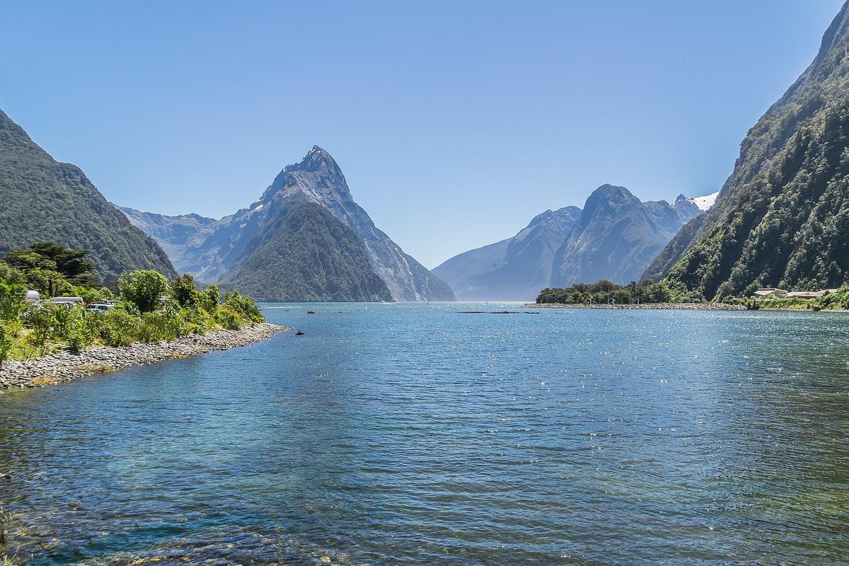
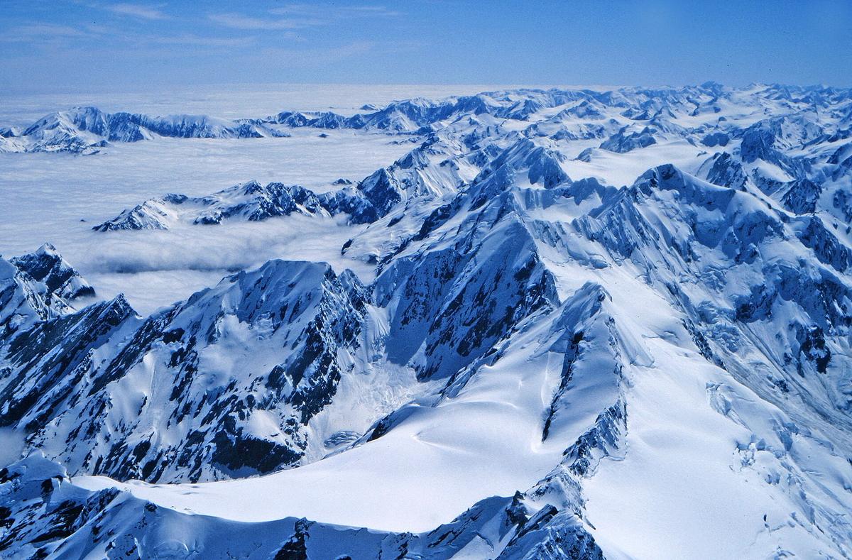
The South Island runs 840 km from Picton to Bluff. Its west coast is one of the wettest places on earth. Franz Josef Glacier sits in rainforest; you can heli hike it but that requires an advance booking and is weather dependent. Fiordland is rain soaked wilderness. Milford Sound is reachable by a 287 km drive from Queenstown that takes 3.5 to 4 hours each way. Book boat tours ahead. The inland spine is the Southern Alps, with Aoraki / Mount Cook at 3,724 m and the Hooker Valley track that needs no booking. The east side is drier. Marlborough is Sauvignon Blanc country with dry hot summers. Canterbury gives you Christchurch, the Banks Peninsula, and the road west into the Alps. The West Coast has sparse population, Pancake Rocks at Punakaiki which is a short free walk, and the Moeraki Boulders best seen at low tide.
Culture and Your Route
Culture is a real difference. Māori history concentrates in the North Island, particularly Northland where the Treaty of Waitangi was signed in 1840 at Waitangi in the Bay of Islands, and Rotorua where Māori cultural shows run nightly. The South Island has a stronger pioneer and gold rush history. A traveller who skips the North Island misses the geothermal core and much of the cultural depth. A traveller who skips the South Island misses the rawest alpine scenery. Minimum realistic time for North Island highlights is 7 to 10 days. For the South Island it is 10 to 14 days. For both islands you need three weeks minimum.

What to Know Before Visiting New Zealand: the Realities That Catch Travellers Out
Reservations You Must Make in Advance
Hobbiton Movie Set is guided tour only and you must book weeks ahead. Waitomo Glowworm Caves boat ride needs pre booking in peak season. The 10 Great Walks (with one more opening in 2026; verify exact date with the Department of Conservation) have a booking system that opens months ahead and sells out fast. The Milford Track is 53.5 km over four days. The Routeburn Track is 32 km over two to four days. The Kepler Track is 60 km over three to four days. If you want any of these in peak season, mark the on sale date and be ready at a computer.
Driving Habits and Road Rules
You drive on the left. If your licence is in English and your stay is under 12 months, you do not need an International Driving Permit. If it is not in English, you need an official translation. Automatic transmission is standard in rentals. If you want a manual, specify it explicitly because many smaller depots do not stock them. One lane bridges exist across both islands. Yield to traffic already on the bridge. Tourists freeze or misread the signs constantly. Speed cameras are fixed and mobile, signed in some areas. Alcohol limit for drivers 20 and over is 0.05 mg per 100 mL of blood. For drivers under 20 it is 0.00. Mobile phone use while driving is banned unless hands free. Seatbelts are mandatory for all occupants, child restraints mandatory up to seven years.
Fuel, Supplies, and Connectivity
Petrol is expensive. Stations are sparse outside towns. Fill up before long rural stretches, especially on the West Coast and through the Mackenzie Basin. Supermarkets and shops close early, often by 6 pm, and many small towns have nothing open on Sunday or public holidays. Mobile phone coverage vanishes on many rural highways and on most hiking tracks. Download offline maps before you drive anywhere. Buy a local SIM from Spark, One NZ, or 2degrees at the airport or any supermarket. Free WiFi is rare and often slow. Cafes and libraries are your best bet.
Weather and Sun Protection
UV index in summer often reaches 11+, which is extreme. SPF 50+ is recommended. Rain on the West Coast of the South Island is relentless. The eastern South Island is much drier. Autumn colours peak in April and May. Winter, June to August, brings snow to South Island mountains. Snow season for skiing runs June to October, varying with snowfall. Daylight saving runs from late September to early April.
Self-Drive New Zealand Itinerary: How the Roads Dictate Your Route
Realistic Driving Times
The single most common mistake travellers make is underestimating driving times. Google Maps assumes you will drive 100 km/h on open roads. You will not. The roads are narrow, two lane, winding, without median barriers. They follow terrain that forces your average speed to 60 to 70 km/h. Add 25 to 30 percent to any journey over 100 km. A 650 km drive from the largest city to the capital takes 8 to 9 hours non stop. Christchurch to Queenstown is 480 km and takes 6 to 7 hours non stop. Queenstown to Milford Sound is 287 km and takes 3.5 to 4 hours one way. That is a 12 hour day if you go and come back.
The Cook Strait Crossing
The Cook Strait ferry crossing is 22 km at its narrowest point and takes 3 to 3.5 hours with either Interislander or Bluebridge. Book ahead, especially December to February. The ferry carries vehicles so you bring your rental car or campervan. Add 25 minutes from Picton to Blenheim after you dock. The crossing can be cancelled in bad weather. Budget a buffer day if you have a flight out of the South Island after a ferry crossing.
Trains, Flights, and Campervans
Three long distance rail routes exist: the TranzAlpine from Christchurch to Greymouth, 223 km in 4.5 to 5 hours; the Northern Explorer from the largest city to the capital, 681 km in 10.5 to 11 hours; and the Coastal Pacific from Picton to Christchurch, 348 km in 5 to 5.5 hours. These are scenic but they do not replace a car for flexibility. Domestic flights connect the main airports: Auckland, Wellington, Christchurch, Queenstown. Air New Zealand and Jetstar fly the routes. Auckland to Christchurch is 1 hour 20 minutes. Auckland to Wellington is 1 hour. Wellington to Queenstown is 1 hour 20 minutes. But you still need a car at the destination to see anything beyond the airport town.
Campervan rental is widely available. Peak season books out. Freedom camping is restricted by district; many areas require a self contained vehicle certified to NZS 5465:2001. The Freedom Camping Act 2011 governs it, but local council bylaws vary. Use the CamperMate app to find legal spots. Holiday parks (Top 10, Kiwi Holiday Parks, and independents) provide powered sites and facilities. Department of Conservation campsites range from serviced to basic. Backcountry huts number over 950; the Great Walks require bookings, most others are first come. A Backcountry Hut Pass works for frequent users.
New Zealand Road Trip Planning: Which Regions Get How Many Days
North Island Region by Region
A realistic self drive New Zealand itinerary allocates days by region based on the research above, not by what looks close on a map. The typical travel patterns tell you what each area requires. Northland works as a coastal loop from the largest city, 3 to 5 days. The city itself is 2 to 3 days as a base with day trips. Coromandel Peninsula loops in 2 to 3 days. Bay of Plenty coastal beaches take 2 to 3 days. Rotorua and Taupō together need 2 to 4 days for geothermal parks, the lake, and the Tongariro Crossing. Hawke's Bay wine and Art Deco towns require 2 to 3 days. The capital is compact, 2 days.
South Island Region by Region
On the South Island, Marlborough wine region around Blenheim takes 1 to 2 days. Nelson and Tasman beaches and national parks need 2 to 4 days. The West Coast linear route between glaciers and coast needs 2 to 3 days. Canterbury with Christchurch and Southern Alps access gets 2 to 4 days. Otago, where Queenstown and Wanaka sit, needs 3 to 5 days as an adventure base. Fiordland access for Milford and Doubtful Sounds takes 1 to 2 days. Southland, the southern coast and Stewart Island access, needs 1 to 2 days. Stewart Island itself is reached by a 1 hour ferry from Bluff or a flight from Invercargill. Its population is about 400. Rakiura Track is 32 km over 3 days.
Fitting It All In
If you have 14 days. You cannot do both islands properly. Pick one. Two weeks on the South Island lets you do Christchurch to Queenstown via the West Coast, with side trips to Fiordland and the Mackenzie Basin. Two weeks on the North Island lets you do the largest city to the capital via Rotorua, Taupō, and Hawke's Bay, with a Northland loop. Any less than 14 days forces you to cut major regions even within a single island.
If you have three weeks. You can cross the Cook Strait. A common route is North Island first, ferry from the capital to Picton, then South Island southward. Budget at least 2 days for the ferry itself including weather buffers. Add the TranzAlpine or Coastal Pacific as a one way scenic ride if you want to avoid one driving day, then pick up another car at the destination.
Seasonal Windows and Closure Dates
Summer Peak and Holiday Crush
Peak season is December through February. New Zealand summer brings the warmest weather and the busiest roads, campsites, and attractions. School holidays run from late December to late January. That is the most crowded period for both international tourists and domestic travellers. Avoid the window around Christmas Day, Boxing Day, New Year's Day, and 2 January. Almost everything shuts on those days. Campsites and motels are booked solid. Roads are clogged. The week around Easter is similar for domestic travel pressure and limited trading hours.
Winter, Skiing, and Track Seasons
Winter, June to August, is ski season in the South Island. Snowfall determines conditions, but the season runs June to October. The eastern South Island is far drier and sunnier in winter than the West Coast. The roads are quieter but some mountain passes can close temporarily with snow. The Great Walks operate on a defined season from late October to late April for most tracks. Outside that, huts may still be open but the weather is more challenging and the booking system does not apply.
Matariki, the Māori New Year, is a public holiday that falls in June or July on a date set by the Māori lunar calendar. Waitangi Day is 6 February. Anzac Day is 25 April. These are public holidays when many businesses close or have reduced hours.
| Route | Distance (km) | Non Stop Drive Time | Realistic Time With Stops |
|---|---|---|---|
| Auckland to Wellington | 650 | 8 to 9 hours | 10 to 11 hours |
| Christchurch to Queenstown | 480 | 6 to 7 hours | 8 to 9 hours |
| Queenstown to Milford Sound | 287 | 3.5 to 4 hours | 4 to 5 hours (one way) |
| Auckland to Rotorua | 230 | 2.5 to 3 hours | 3.5 to 4 hours |
| Wellington to Picton (ferry) | 22 km of water | 3 to 3.5 hours | Add 25 min to Blenheim |
| Franz Josef to Queenstown | 350 | 4.5 to 5 hours | 6 to 7 hours |
.jpg)
Arrival and Getting Around: the Logistical Details
Airports and City Transfers
Four main international airports serve as entry points. Auckland Airport (AKL) is the largest. The SkyBus to the city centre takes 35 to 60 minutes and costs NZD 17 to 19. A taxi or rideshare costs NZD 75 to 100. Christchurch Airport (CHC) is 20 to 30 minutes from the city centre by bus for NZD 8.50 or taxi for NZD 45 to 65. Wellington Airport (WLG) has an Airport Flyer bus for NZD 12 taking 20 to 30 minutes, or a taxi for NZD 35 to 50. Queenstown Airport (ZQN) is 15 to 20 minutes from town by bus for NZD 10 or taxi for NZD 45 to 60.
Getting Around the Country
Do not plan around public transport between regions. Intercity buses connect most towns and the backpacker bus networks offer hop on hop off passes, but neither matches the flexibility of a rental car or campervan. Self drive is the only way to see the country properly. The state highway network runs approximately 11,000 km, almost all sealed and two lane. Road user charges apply to diesel vehicles. EV charging is expanding but strongest in cities and main routes. Left hand drive vehicles are permitted only with special conditions, so you will not find one at a standard rental depot.
Biosecurity Rules
Biosecurity is strict. Every passenger must complete a biosecurity declaration on arrival. Food, outdoor equipment, animal products, and plant material are all strictly controlled. Kauri dieback disease is present in Northland and the largest city's region; track closures are possible and you must clean your footwear at cleaning stations. Didymo algae is present in South Island rivers; cleaning fishing gear is required. If you fly to offshore islands such as Stewart Island or the Chatham Islands, expect additional biosecurity checks.
Food, Friction, and Practicalities
What to Eat
Food worth seeking out includes hāngī, meat and vegetables slow cooked in an earth oven available at Rotorua cultural evenings. Whitebait fritter is a West Coast delicacy, tiny translucent fish held together with egg, seasonal in spring. Bluff oysters are dredged from Foveaux Strait, available from March to August, eaten raw. Pavlova is a meringue cake with cream and kiwifruit. Lolly cake is an unbaked slice of crushed malt biscuits, butter, condensed milk, and fruit puffs. Cheese roll is a Southland speciality, rolled white bread filled with cheese and onion, toasted. Feijoa is an autumn fruit, common in garden trees and roadside stalls, used in smoothies and baking.
Sandflies and Water Safety
Sandflies are not a minor nuisance. They are thick on the West Coast, in Fiordland, and anywhere near water. They are most active at dawn and dusk, year round. They bite through thin clothing. DEET repellent is non negotiable. Possum, stoat, and rat control programmes are widespread but that does not reduce the sandfly population in the areas that matter to travellers.
Tap water is safe to drink in urban areas. Giardia is present in some backcountry water sources, so treat water before drinking on hikes. River crossings in the backcountry are high risk, especially after rain. Avalanche risk runs through winter and spring in alpine areas. The New Zealand Mountain Safety Council provides current advice. MetService is the weather forecast authority. Coastguard New Zealand covers marine conditions.
Money and Payments
Tipping is not expected and is optional for exceptional service. GST is 15 percent and is included in displayed prices. Tax refund for tourists is not available. EFTPOS and credit cards are accepted near universally. Smaller operators may surcharge for credit cards. Cash use is declining but still accepted. ATMs are widely available in towns. Banking hours are 9 am to 4:30 pm weekdays.
One Week, Two Weeks, or Three: How Much Time You Actually Need
14 Days: Pick One Island
14 days is the minimum. Anything less forces you to pick either the North Island or the South Island, and even then you will cut major regions. 7 to 10 days on the North Island lets you see the geothermal zone from Rotorua to Taupō, the Waitomo Caves, the Bay of Islands, and a couple of days in the largest city with a Waiheke Island day trip. You will skip Eastland, Taranaki, and the Wairarapa. 10 to 14 days on the South Island lets you do a loop from Christchurch to Queenstown via the West Coast, with a side trip to Milford Sound. You will skip the Marlborough Sounds, the Catlins, and Stewart Island.
Three Weeks: Both Islands, With Choices
With 3 weeks you can see both islands without cutting everything. Even then you are choosing. The West Coast versus the Mackenzie Basin. Fiordland versus the Abel Tasman Coast Track. The Coromandel versus Hawke's Bay. The travel patterns above give you the days per region. Add them up for the itinerary that matters to you and see whether the total fits your trip length. It will be tighter than you expect because the roads force it to be.
What New Zealand is Best for and Who Should Skip it
New Zealand suits self driving road trippers who love long days behind the wheel, serious hikers and multi day trampers hitting the Great Walks, adrenaline junkies chasing bungy, skydiving, and jet boating, Lord of the Rings location pilgrims, and wine and food travellers focused on cool climate varietals. It is not for travellers who want a cheap beach holiday with warm swimmable water year round. It is not for anyone who dislikes driving or expects efficient public transport between regions. It is not for big city nightlife seekers. The largest city and the capital punch above their weight but this is not a late night destination.
Common Questions
Do I need a visa to visit New Zealand from a visa waiver country?
If your country is on the visa waiver list (60 countries including the United States, United Kingdom, Canada, Japan, South Korea, and most EU member states), you need an NZeTA before you travel. The NZeTA is valid for 2 years. The cost was NZD 17 via app and NZD 23 via website at the time of writing; verify the current fee with Immigration New Zealand. You also pay the International Visitor Conservation and Tourism Levy of NZD 35, charged together with the NZeTA or visa. Verify the current amount.
Is it safe to drink tap water in New Zealand?
Yes, tap water is safe to drink in all urban areas. In the backcountry, Giardia is present in some water sources, so treat or boil water before drinking on hikes.
What is the best way to get between the North and South Islands?
The Cook Strait ferry runs between Wellington and Picton, taking 3 to 3.5 hours with Interislander or Bluebridge. Book ahead, especially December to February. You drive your rental car or campervan onto the ferry. Alternatively, domestic flights connect the capital to Blenheim, Nelson, or Christchurch, but you will need a car at the other end.
When is the best time to visit New Zealand?
Summer, December to February, gives the warmest weather but is also peak season with the most crowds and highest prices. If you want fewer people and lower prices, shoulder seasons of October to November and March to April are good. Winter, June to August, is for skiing in the South Island. The West Coast of the South Island is wet year round.
How many days do I need for a New Zealand road trip?
14 days is the minimum, and even that forces you to pick one island. 7 to 10 days is realistic for North Island highlights. 10 to 14 days works for South Island highlights. To see both islands with reasonable coverage, budget 3 weeks.
Do I need to book activities in advance in New Zealand?
Yes, many popular activities require advance booking. Hobbiton Movie Set is guided tour only, book weeks ahead. Waitomo Glowworm Caves boat rides need pre booking in peak season. Milford Sound cruises should be booked ahead. Great Walks sell out months in advance when their booking system opens. Tongariro Alpine Crossing shuttle bookings are essential but the walk itself does not require a booking.
What should I know about driving in New Zealand?
You drive on the left. Automatic transmission is standard in rentals; specify if you want a manual. One lane bridges require you to yield to traffic already on the bridge. Speed limit on open roads is 100 km/h but winding terrain means your average will be 60 to 70 km/h. Add 25 to 30 percent to Google Maps estimates. Mobile phone coverage drops on many rural roads. Download offline maps. Petrol stations are sparse outside towns; fill up before long stretches.
Read next
-
 Staying connected in New Zealand eSIM local SIM or offline maps
New Zealand cannot fix its mobile service. No carrier will, because the geography does not permit it.
Staying connected in New Zealand eSIM local SIM or offline maps
New Zealand cannot fix its mobile service. No carrier will, because the geography does not permit it.
-
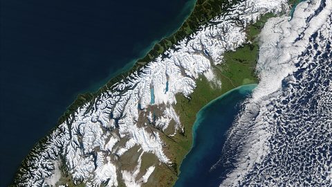 Best Time to Visit New Zealand, What Each Season Actually Delivers
New Zealand summer runs December to February and brings crowds, sandflies, and booked-out campsites. Here is what each season actually means for your trip.
Best Time to Visit New Zealand, What Each Season Actually Delivers
New Zealand summer runs December to February and brings crowds, sandflies, and booked-out campsites. Here is what each season actually means for your trip.
-
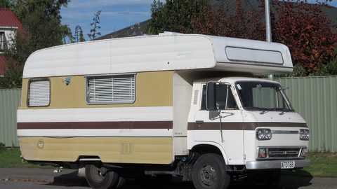 Getting Around New Zealand, Why Self-Drive Is the Default and What the Map Hides
New Zealand has no efficient inter-regional public transport. A rental car is the default, and driving times are far longer than the map suggests.
Getting Around New Zealand, Why Self-Drive Is the Default and What the Map Hides
New Zealand has no efficient inter-regional public transport. A rental car is the default, and driving times are far longer than the map suggests.
-
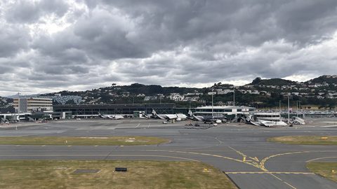 New Zealand Visa Requirements, Who Needs an NZeTA and Who Does Not
Most visitors need an NZeTA before boarding a flight to New Zealand. Here is who needs a full visa, who qualifies for the waiver, and how long each takes.
New Zealand Visa Requirements, Who Needs an NZeTA and Who Does Not
Most visitors need an NZeTA before boarding a flight to New Zealand. Here is who needs a full visa, who qualifies for the waiver, and how long each takes.
-
 Money in New Zealand, Cards, Cash and What Actually Works at the Till
New Zealand runs on contactless cards and EFTPOS, but rural cafes and roadside stalls still want cash. Here is what to carry and when.
Money in New Zealand, Cards, Cash and What Actually Works at the Till
New Zealand runs on contactless cards and EFTPOS, but rural cafes and roadside stalls still want cash. Here is what to carry and when.
-
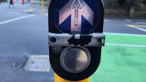 New Zealand Safety Advice, Reading the Warnings Without Being Misled by Them
New Zealand has a low crime rate, but the real risks are driving fatigue, alpine weather swings, and sandfly swarms. Here is what the safety pamphlets underplay.
New Zealand Safety Advice, Reading the Warnings Without Being Misled by Them
New Zealand has a low crime rate, but the real risks are driving fatigue, alpine weather swings, and sandfly swarms. Here is what the safety pamphlets underplay.
-
 A Ground-Level Logistics Guide to Independent Travel in China
First-time independent travel in China: what you need to know about visas, rail booking, eSIMs, mobile payments, and power adapters.
A Ground-Level Logistics Guide to Independent Travel in China
First-time independent travel in China: what you need to know about visas, rail booking, eSIMs, mobile payments, and power adapters.
-
 How Solo Travelers Stay Ahead of Flight Delays and Cancellations
How solo travelers can track inbound aircraft, claim rebooking rights, and adjust ground transport when flights go wrong — step by step.
How Solo Travelers Stay Ahead of Flight Delays and Cancellations
How solo travelers can track inbound aircraft, claim rebooking rights, and adjust ground transport when flights go wrong — step by step.
-
 Why Your eSIM Might Not Work Abroad and How to Check Before You Go
Buying an eSIM doesn't guarantee signal abroad. Learn why coverage fails by location and how to verify reach before you commit to a plan.
Why Your eSIM Might Not Work Abroad and How to Check Before You Go
Buying an eSIM doesn't guarantee signal abroad. Learn why coverage fails by location and how to verify reach before you commit to a plan.