Ireland Is Smaller, Wetter and Slower Than the Map Suggests
Ireland is greener and wilder than photos suggest, but slower to drive, wetter than expected and more expensive. Plan around narrow west coast roads.
- Flag
-

- ISO code
- IE
- Population
- 4,853,506
- Currency
- EUR
- Dial code
- +353
Ireland is Smaller, Wetter and Slower Than the Map Suggests
On a map, Ireland looks small enough to cross in a morning. In reality, a 100 km route on the west coast can take two hours or more. The roads in Kerry, Connemara and Donegal are narrow by design. Many are single track with grass growing in the centre, and they demand patience. This is the first thing any first‑time traveller needs to understand: distances lie. The second is that the weather changes several times a day, the west coast carries most of the landscape weight, and seven days is the minimum for a coherent route. This guide frames the real place so you can plan a trip that matches it, not the map.
- Currency: Euro (EUR)
- Emergency number: 112 or 999
- Driving side: Left
- Country calling code: +353
- Time zone: Irish Standard Time (UTC+1 in summer) / Greenwich Mean Time (UTC+0 in winter)
- International vehicle registration code: IRL
- Electrical plug type: Type G (three rectangular pins)
- Mains voltage: 230 V
- Mains frequency: 50 Hz
- Government travel advisory issuer: Department of Foreign Affairs (Ireland) for outbound travel; inbound advisories are issued by each visitor's own government
- Passport requirement for UK nationals: No passport required for most UK nationals on the Common Travel Area, but airline/ferry photo ID rules apply
- Passport requirement for EU/EEA/Swiss nationals: National identity card or passport accepted
- Passport requirement for US, Canada, Australia, New Zealand nationals: Valid passport required; no visa for tourist stays up to 90 days
- Visa-free tourist stay for non-EU visitors: Typically 90 days within a 180-day period, depending on nationality
- Main international airport: Dublin Airport (DUB)
- Main ferry ports from Britain: Dublin Port, Rosslare Europort
- Main ferry ports from France: Cork (Ringaskiddy), Rosslare Europort
- National rail operator: Iarnród Éireann (Irish Rail)
- Road classification: Motorways (M), national primary (N), national secondary (N), regional (R), local (L)
- Speed limit on motorways: 120 km/h
- Speed limit on national roads: 100 km/h
- Speed limit on regional and local roads: 80 km/h
- Speed limit in urban areas: 50 km/h
- Driving licence recognition: EU/EEA licences valid; most non-EU licences valid for up to 12 months for visitors
- International Driving Permit requirement: Not required for UK, EU, EEA, US, Canada, Australia, New Zealand licences for short visits
- Population of Republic of Ireland: Approximately 5.3 million
- Population of Northern Ireland: Approximately 1.9 million
- Highest peak: Carrauntoohil, 1,038.6 m
- Border arrangement with Northern Ireland: No fixed border controls under the Common Travel Area
Ireland Road Trip Planning: What You Actually Need to Know
A rental car is the only practical way to see most of the country. Outside Dublin, public transport is workable for point‑to‑point travel between cities but poor for rural sightseeing. Local Link bus services cover many rural areas on low‑frequency schedules, and the rail network has no service to County Donegal, most of County Cavan, most of County Monaghan, or large parts of the northwest. If you refuse to rent a car, you will spend your trip waiting for buses that run one to four times a day.
Automatic transmission costs significantly more and must be booked well ahead. The main rental firms are Hertz, Europcar, Enterprise, Avis, Budget, Sixt, Dooley and Irish Car Rentals. The minimum age is usually 25, though some companies rent to 21‑24‑year‑olds with a surcharge. Fuel is expensive; check the AA Ireland website for current pump prices before you land. The electric‑vehicle charging network is expanding but thinner in the rural west and northwest.
How the Roads Actually Behave
Most travellers trip up by underestimating journey time on regional and local roads. On the west coast, expect 40 to 60 km/h and often lower in summer. Road‑sign distances are in kilometres in the Republic of Ireland and in miles in Northern Ireland. The motorway network radiates from Dublin to Belfast, Cork, Limerick, Galway and Waterford, but there is no motorway on the west coast north of Galway.
Entry Points and Arrival
Dublin Airport is the main gateway. Aircoach and Dublin Express buses run to the city centre in 30 to 45 minutes; check their sites for current fares. A taxi costs about €30 to €40. Shannon Airport serves the west and is better for Clare, Galway and Kerry; Bus Éireann Route 343 connects to Limerick in about 30 to 40 minutes. Cork Airport is small and efficient, with a local bus to Cork city in about 20 to 30 minutes. Ireland West Airport Knock serves Mayo and Sligo but has limited public transport.
When to Go
Peak season runs June to August. Long daylight hours, the best chance of drier weather, and school holidays drive domestic and international demand. Prices for car hire and accommodation peak, and popular sites such as the Cliffs of Moher and Ring of Kerry are busiest from late morning to mid‑afternoon. The August bank‑holiday weekend and early August see heavy domestic travel. Mid‑March around St Patrick's Day, especially 15 to 18 March, brings parades, closed roads and inflated city prices. Christmas Eve to St Stephen's Day, 24 to 26 December, shuts down much of the country: many restaurants close and all public transport stops.
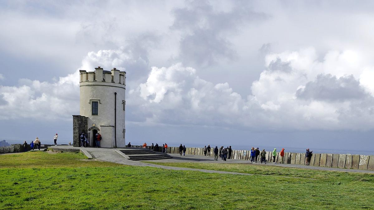

West Coast of Ireland Driving Route: Where the Real Landscape Lives
The west coast carries most of the landscape weight. The southwest, covering Kerry and Cork, offers mountain peninsulas, slow winding coastal roads and high tourist density in summer. The west, taking in Galway and Connemara, gives you Atlantic coastline, narrow roads, and rail only as far as Galway and Westport. The far northwest, Donegal, is the most remote part of the island: no rail, lowest road density, longest journey times per kilometre, remote dramatic sea cliffs, and the strongest traditional culture.
A west‑coast loop covering Galway, Connemara and Clare needs a minimum of 4 to 6 days. A southwest loop covering Kerry and Cork needs 5 to 7 days. A northwest‑focused trip around Donegal needs 4 to 5 days. Do not try to combine all three in a single week; you will spend too much of it in transit on roads where the average speed is 40 km/h.
Key Routes and What They Cost in Time
Galway to Clifden takes roughly 1.5 hours for about 80 km. That is 53 km/h average. Killarney to Dingle is roughly 1 to 1.5 hours for about 60 km. Cork to Skibbereen is roughly 1.5 hours for about 85 km. Dublin to Galway takes about 2.5 hours by motorway. Dublin to Killarney takes about 3.5 to 4 hours. Dublin to Donegal town takes about 3 to 3.5 hours. These numbers assume clear roads. In July and August, add time.
On the Ring of Kerry, drive it anti‑clockwise. This keeps you on the inside lane against the cliff and puts the best views on your side. Book parking online at the Cliffs of Moher. For Slieve League in Donegal, the sea cliffs are higher than Moher and the crowds are smaller, but the roads to get there are some of the narrowest in the country.
| Region | Minimum Days | Rail Access | Road Character |
|---|---|---|---|
| Dublin city only | 2-3 | Excellent | City streets, motorway access |
| Dublin plus east coast loop | 4-5 | Good | Fastest road and rail links |
| Southwest (Kerry, Cork) | 5-7 | Rail to Killarney and Tralee | Mountain peninsulas, slow winding coastal roads |
| West coast (Galway, Connemara, Clare) | 4-6 | Rail to Galway and Westport | Atlantic coastline, narrow roads |
| Northwest (Donegal) | 4-5 | None | Most remote, lowest road density |
| Full island circuit | 14-21 | Radial from Dublin | Varies by region |
Ireland for First-Time Visitors: What to Expect and What to Skip
Ireland is greener and more beautiful than photos suggest. It is also wetter, windier and more expensive than most first‑timers expect. The famous warmth of the people is real but does not extend to efficient queues or fast service. Rural roads are narrow. Parking is scarce. The pace of everything is slower than planned.
Rain gear is needed even in summer; weather can shift within an hour. The temperature range in summer is 15 to 20 Celsius. In winter, 4 to 8 Celsius. Snowfall is rare and brief. Daylight ranges from about 7.5 hours in late December to 17 hours in late June. The west and northwest are wettest, with rainfall over 2,000 mm per year in western mountains. The east and southeast are driest, with about 750 mm per year.
Many rural B&Bs and restaurants close from October to March. If you travel outside peak season, book accommodation ahead and confirm opening hours. Parking in small towns is limited and often requires coins. Tipping is not required in pubs; 10 percent is common in restaurants.
What to Eat
Oysters in Galway, especially native oysters from September to April. Seafood chowder with brown soda bread along the west coast. Dingle crab and langoustines at the harbour. Cork's English Market for drisheen, spiced beef and local cheese. Boxty in the northwest, a potato pancake specific to the region. Full Irish breakfast with black and white pudding, best at B&Bs. Irish stew made with lamb, root vegetables and pearl barley. Soda bread, brown and white, served with butter and smoked salmon.
Common Mistake to Avoid
Trying to see the whole island in one week by staying in Dublin and doing day trips, or planning a route that covers too many regions with too little time for the slow, narrow roads that define travel in Ireland. A full island circuit needs 14 to 21 days. Less than that forces you to choose between the west coast and everything else. Choose the west coast.
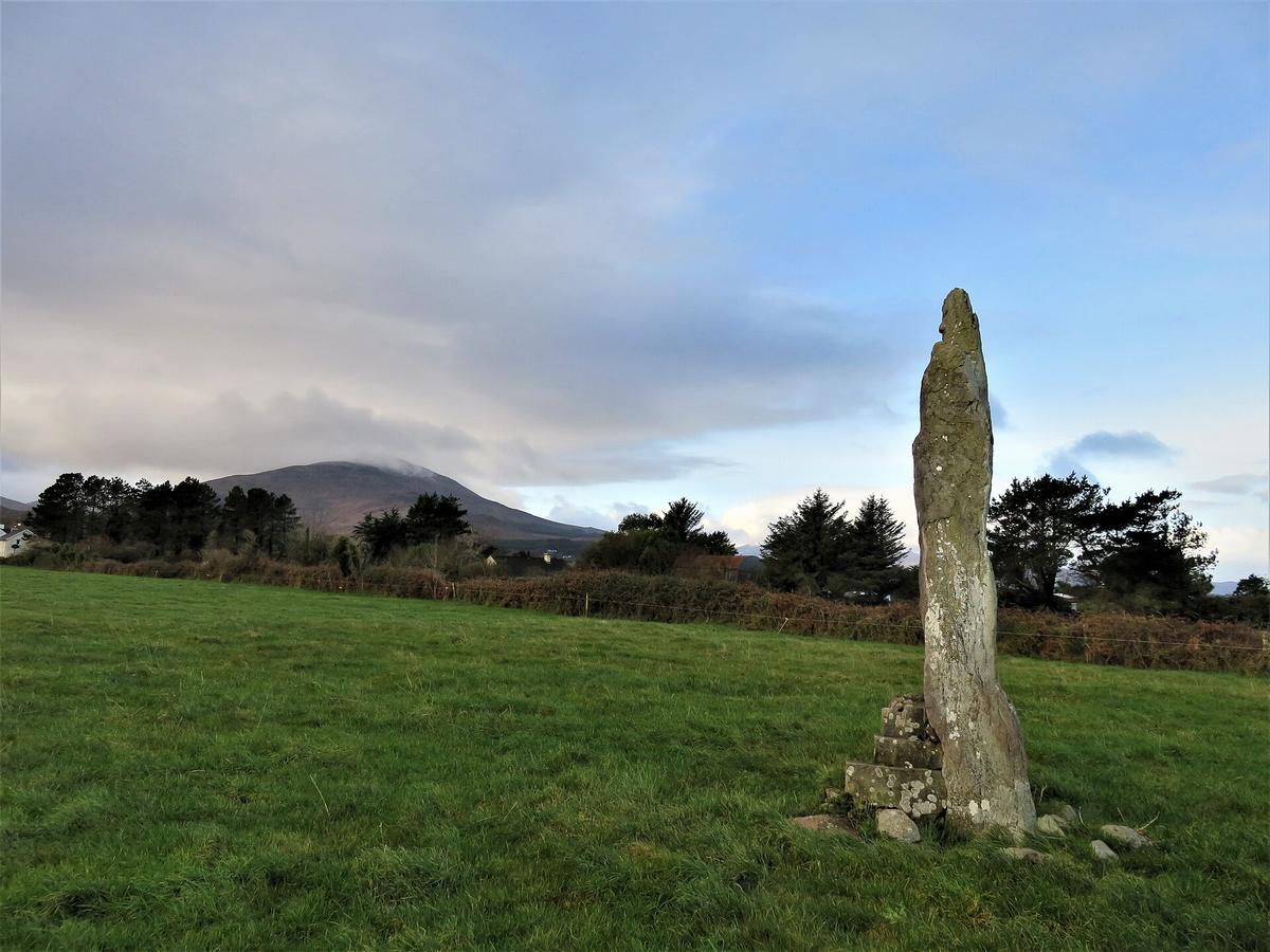

How Many Days in Ireland is Enough
Seven days is the minimum for a coherent route. Less than a week forces you to choose between the west coast and everything else, and you will spend too much of it in transit. With seven days, you can do a southwest loop covering Kerry and Cork, a west‑coast loop covering Galway, Connemara and Clare, or a northwest‑focused trip around Donegal. You cannot do all three.
With 10 to 14 days, you can add a second region. The most logical combination is a southwest loop plus a west‑coast loop, connected by the drive from Killarney to Galway via the Shannon estuary. With 14 to 21 days, you can attempt a full island circuit that includes Northern Ireland and the Antrim coast, the Giant's Causeway, and the Derry walls. Note that Northern Ireland uses a different currency, the pound sterling, and distance signs are in miles, not kilometres.
If you have only 4 to 5 days, pick one region. The southwest loop covering Kerry and Cork works well. Skip Dublin entirely or add it as a single arrival day. Three days in Dublin plus three days rushing the west coast is worse than six days in the west alone.
Who Ireland Suits and Who it Does Not
Ireland suits road trippers who enjoy slow scenic driving with frequent unplanned stops. It suits hikers and coastal walkers, history and folklore lovers, traditional‑music fans, and photographers chasing moody landscapes and Atlantic light. It suits anyone willing to pilot a car on narrow roads at 40 km/h and stop when the weather shifts and the clouds break over a headland.
Ireland does not suit travellers who need reliable hot dry weather. It does not suit strict budget backpackers; the country is more expensive than most first‑timers expect. It does not suit people who dislike being behind the wheel or refuse to rent a car; waiting for a bus that runs twice a day on a remote peninsula is not a holiday. It does not suit anyone expecting fast‑paced city breaks or Mediterranean‑style beach holidays. The pace is slower than planned. That is the point.
Common Questions
Do I need a rental car in Ireland?
A rental car is the only practical way to see most of the country. Outside Dublin, public transport works for point‑to‑point travel between cities but is poor for rural sightseeing. Local Link bus services cover many rural areas on low‑frequency schedules. The rail network has no service to County Donegal, most of County Cavan, most of County Monaghan, or large parts of the northwest.
How much does fuel cost in Ireland?
Petrol and diesel are expensive. Check the AA Ireland website for current pump prices. The electric‑vehicle charging network is expanding but thinner in the rural west and northwest.
What is the best time of year to visit Ireland?
Peak season is June to August, with long daylight hours and the best chance of drier weather. The shoulder seasons of April to May and September to October offer lower prices and fewer crowds. November to March is low season, excluding Christmas and New Year, when many B&Bs and restaurants close.
How long does it take to drive from Dublin to Galway?
Approximately 2.5 hours by motorway. Driving times on the west coast are much slower. Galway to Clifden, for example, takes about 1.5 hours for roughly 80 km.
What should I book ahead in Ireland?
Automatic‑transmission cars must be booked well ahead. Parking at the Cliffs of Moher should be booked online. Timed tickets for Kilmainham Gaol, Trinity College and the Book of Kells should be booked weeks ahead. Skellig Michael requires an advance boat permit. Summer accommodation on the coastal west and southwest books out furthest ahead.
Do I need travel insurance for Ireland?
EU and EEA visitors can use a European Health Insurance Card for necessary public healthcare. UK visitors may be covered under the Common Travel Area with a Global Health Insurance Card or UK passport. Non‑EU visitors require private travel health insurance; public hospital charges apply without it.
Is mobile coverage reliable in rural Ireland?
Mobile coverage is good in towns and along main roads but patchy in mountains and remote peninsulas. Buy a prepaid SIM from Three, Vodafone or Eir in any town. eSIMs work but local SIMs are cheaper for data. Download offline maps before driving the west coast.
Read next
-
 A Ground-Level Logistics Guide to Independent Travel in China
First-time independent travel in China: what you need to know about visas, rail booking, eSIMs, mobile payments, and power adapters.
A Ground-Level Logistics Guide to Independent Travel in China
First-time independent travel in China: what you need to know about visas, rail booking, eSIMs, mobile payments, and power adapters.
-
 How Solo Travelers Stay Ahead of Flight Delays and Cancellations
How solo travelers can track inbound aircraft, claim rebooking rights, and adjust ground transport when flights go wrong — step by step.
How Solo Travelers Stay Ahead of Flight Delays and Cancellations
How solo travelers can track inbound aircraft, claim rebooking rights, and adjust ground transport when flights go wrong — step by step.
-
 Why Your eSIM Might Not Work Abroad and How to Check Before You Go
Buying an eSIM doesn't guarantee signal abroad. Learn why coverage fails by location and how to verify reach before you commit to a plan.
Why Your eSIM Might Not Work Abroad and How to Check Before You Go
Buying an eSIM doesn't guarantee signal abroad. Learn why coverage fails by location and how to verify reach before you commit to a plan.