A Travel Guide to Florida, Written Around the Distances
Florida is 500 miles of peninsula where the fantasy of endless summer meets the logistics of long drives. Here is how to plan a trip that fits together.
- Flag
-

- ISO code
- US
- Currency
- USD
A Travel Guide to Florida, Written Around the Distances
Florida is 832 miles long from Pensacola to Key West. A one week trip fits one coast plus Orlando, or the Keys plus the Everglades, not all three. That single constraint shapes every realistic Florida trip, because the fantasy of an endless summer where you bounce from theme parks to white sand beaches to coral reefs in a few days collides hard with the logistics of a car dependent peninsula that takes 12 to 13 hours to drive end to end. Even a single coast sampler requires significant transit between anchor points. The Keys are the emotional hook for most visitors: the Overseas Highway, the sunset rituals, the promise of Key West. But the moment you start planning, the map demands you choose.
- State Length (Pensacola to Key West): Approx. 832 miles (1,339 km) by road
- Minimum Days Needed: 7 days, because a single-coast sampler requires significant transit
- Peak Season: Mid-February through April (snowbirds and spring breakers); secondary peak June-July
- Avoid Window: Late August through September (hurricane peak); Christmas to New Year's (theme parks at capacity)
- Primary Airports: MIA (Miami), MCO (Orlando), FLL (Fort Lauderdale), TPA (Tampa), RSW (Fort Myers), JAX (Jacksonville)
- Dominant Transport: Rental car with SunPass transponder for toll roads; limited public transit outside Miami-Dade and the Orlando tourist corridor
- Time Zones: Eastern Time for the peninsula and Keys; Central Time for the Panhandle west of the Apalachicola River
Florida Trip Planning: the Four Regions and What They Cost You in Drive Time
The state divides into four regions. North Florida covers inland pine woods, freshwater springs, and colonial era cities. Central Florida holds the theme park corridor, lake dotted interior, Atlantic surf beaches, and the highest visitor volume in the state. South Florida is a tropical metropolis with the Everglades, barrier island beaches, and multilingual urbanism. The Florida Keys are a coral cay archipelago with single road access, maritime culture, and zero natural sand beaches. You cannot sightsee across all four in a week. You can manage two, and only if they border each other.
Miami to Key West alone is 3.5 to 4 hours each way without traffic, 165 miles one direction. Orlando to Miami is 3.5 hours. A one week trip pairing Orlando with the Space Coast or Tampa Bay Area works. A trip pairing the Keys with the Everglades works. A trip attempting the Panhandle, Orlando, and Key West does not. The single biggest trip up is assuming you can walk between attractions in Orlando or along coastal strips when distances are routinely two to four miles in punishing heat with no shade.
Rental Cars and Airport Transfers
Book a rental car with the SunPass transponder included. Florida's Turnpike and the interstate system are extensive but cashless in many locations. Rental cars without the transponder rack up hefty admin fees on top of the tolls. In Orlando and Miami, toll roads are unavoidable. Budget 40 to 60 dollars for a rideshare from Orlando International Airport to the theme park corridor, and note that no rail link exists from MCO to the hotels. Miami International connects to downtown via the free Metrorail Orange Line in 15 minutes. Tampa International is a 15 minute, 30 dollar rideshare to downtown.

Florida Driving Distances: the Numbers That Matter
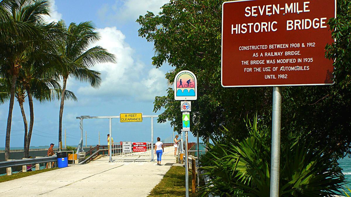
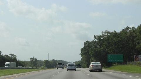
Readers searching Florida driving distances need the real numbers, not the maps app estimates during a midnight test. Miami to Key West drive time is 3.5 to 4 hours in low traffic. Orlando to Miami is 3.5 hours. Orlando to Tampa is about 1.5 hours on I 4. The Overseas Highway from Florida City to Key West runs 113 miles across 42 bridges, including the Seven Mile Bridge at 6.79 miles. A single accident on US 1 halts all traffic for hours because the Keys are a chain with one road and no alternative route. Pack snacks, water, and an offline map for the Everglades segment where cell coverage drops sharply.
The Panhandle runs on Central Time, west of the Apalachicola River, while the peninsula and Keys run on Eastern Time. That lost or gained hour matters when you book a tour, catch a flight, or time a sunset at a Key West pier. The state's width ranges from 361 miles across the Panhandle at its widest to about 100 miles across the peninsula at its narrowest. You are never more than about 60 miles from a coastline, but that coastline has 1,350 miles of general shoreline. The beaches you want are concentrated in specific zones, and they behave differently on each coast.
| Region Pair | Key Drive Times | Who This Trip Suits | Primary Airports |
|---|---|---|---|
| Central Florida + Space Coast | Orlando to Kennedy Space Center: 45 min to 1 hr. Orlando to Cocoa Beach: 1 hr. | Families with young children wanting theme park immersion plus beach days and a rocket launch. | MCO |
| South Florida + the Keys | Miami to Key West: 3.5 4 hr. Miami to Everglades Shark Valley: 45 min. | Road trippers willing to cover 300+ miles; beachcombers who want variety from Atlantic surf to coral reefs. | MIA, FLL |
| Tampa Bay + Southwest Gulf Coast | Tampa to Sanibel Island: 2.5 hr. Tampa to Sarasota: 1 hr. | Winter escapees from cold climates; travelers seeking calm Gulf waters and shelling beaches. | TPA, RSW |
| North Florida + Panhandle | Jacksonville to Pensacola: 5.5 hr. Jacksonville to St. Augustine: 45 min. | Travelers seeking a slower pace, freshwater springs and colonial cities. | JAX, PNS, ECP |
| Central Florida + Tampa Bay | Orlando to Tampa: 1.5 hr on I 4. Orlando to Clearwater Beach: 2 hr. | Travelers wanting theme parks plus Cuban sandwiches and Tampa Bay waterfront. | MCO, TPA |

Florida Regions Map: How to Read the State Before You Book
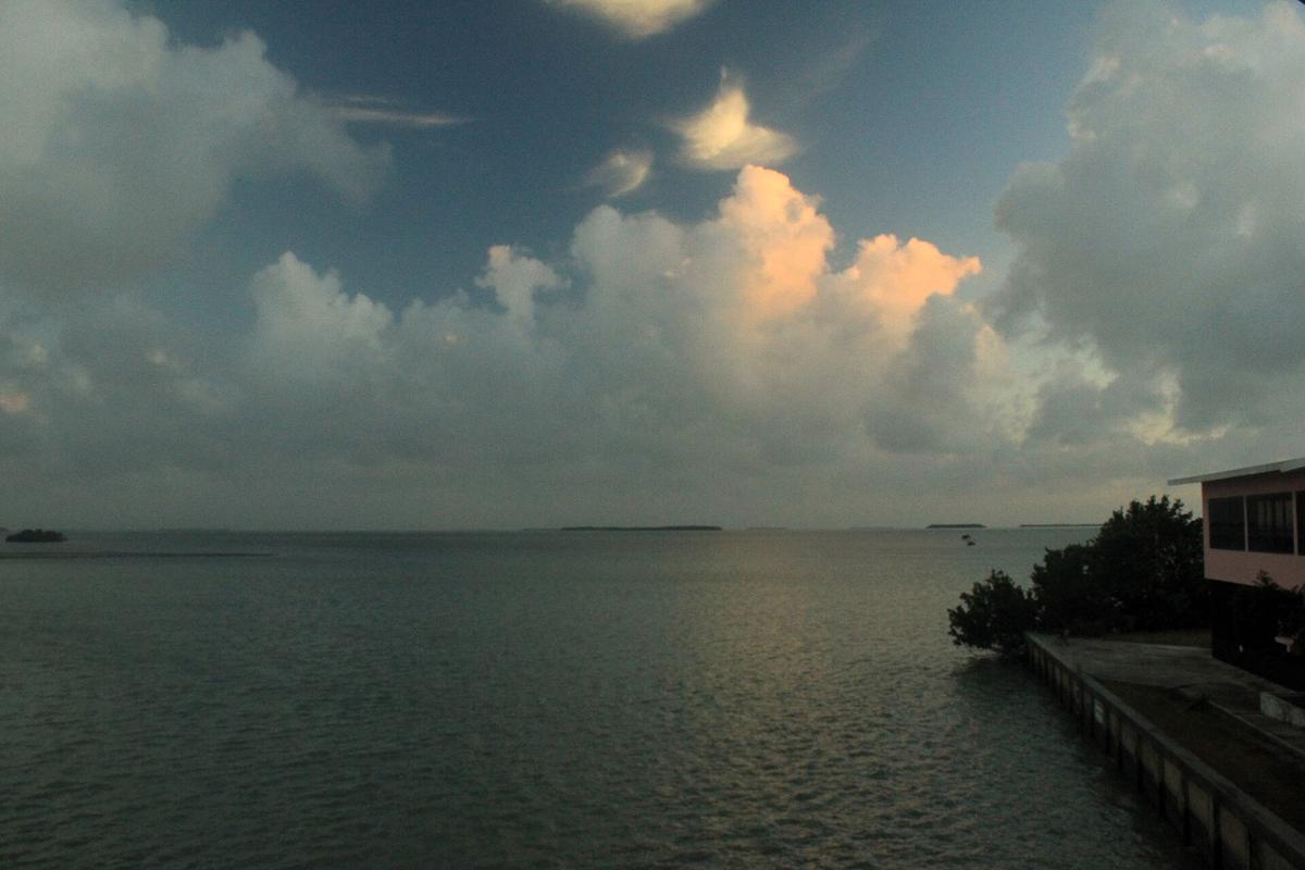
A Florida regions map shows ten distinct districts, not the four broad zones. The subdivisions matter for trip planning because character changes abruptly at county lines. The Panhandle contains Gulf front towns with sugar sand beaches and a Southern pace. North Central Florida holds freshwater springs, horse farms, caverns, and quiet rivers. Greater Orlando is the theme park corridor with chain restaurants and toll roads. The Space Coast has rocket launches, surf beaches, and a wildlife refuge. Tampa Bay Area offers Cuban sandwiches, waterfront downtowns, and spring training baseball.
Southwest Gulf Coast runs shelling beaches, retiree calm, and mangrove tunnels. The Everglades is sawgrass prairie, airboat territory, and alligator sightings. The Keys are the Overseas Highway, coral reefs, high prices, and sunset rituals. The Gold Coast from Palm Beach to Miami is glossy high rises, Latin culture, and nightlife. The Treasure Coast gives you low rise Atlantic beaches, citrus history, and a slower tempo. You can drive from one end of the Gold Coast to the other in an hour. Driving from the Panhandle to the Keys takes the better part of two days, and you should not attempt it on a short trip.
Day Trips Worth the Drive
Book your lodging in the region you intend to explore. Day trips between regions are possible only at the edges: St. Augustine from Orlando is 1 hour 45 minutes. Blue Spring State Park from Orlando is 45 minutes for manatee viewing November to March. Sanibel Island from Fort Myers is 40 minutes, but check hurricane recovery status before you plan. Crystal River from Tampa is 1 hour 20 minutes for in water manatee tours in winter. A full day trip to Dry Tortugas National Park from Key West requires a 2.5 hour ferry each way and a reservation booked six months or more ahead.
What the Four Broad Regions Actually Mean
North Florida is inland pine woods, freshwater springs, colonial era cities, and the slowest pace in the state. Peak travel here is spring and autumn when temperatures are mild and humidity low. Summer brings high heat, humidity, and afternoon thunderstorms. This region holds the St. Augustine Historic District with the oldest masonry fort in the US, Castillo de San Marcos, which needs no advance booking, and the Salvador Dali Museum in St. Petersburg with the largest Dali collection outside Spain.
Central Florida is the theme park corridor with lake dotted interior, Atlantic surf beaches, and the highest visitor volume. Peak season is winter and early spring when weather is dry and mild. Low season is late summer and early autumn during hurricane peak. This region includes Walt Disney World, Kennedy Space Center Visitor Complex where you must book launch day tickets months ahead, and Ichetucknee Springs State Park for tubing down a crystal clear spring run.
South Florida is a tropical metropolis with the Everglades, barrier island beaches, and multilingual urbanism. Peak season is winter when lodging demand is highest. Low season runs summer through early autumn with heat, humidity, daily rain, and hurricane risk. This region holds Everglades National Park at 1.5 million acres with three main entrances, Vizcaya Museum and Gardens as a Gilded Age bayfront villa, and Coral Castle, a hand carved limestone oddity built by one man.
The Florida Keys are a coral cay archipelago with single road access, maritime culture, and zero natural sand beaches. Peak season is winter and early spring when weather is dry and warm. Low season is late summer and autumn with hurricane threat, highest rainfall, and oppressive humidity. Key West sits 90 miles from Havana, Cuba, and 165 miles from Miami by road. The highest point in Key West is about 18 feet above sea level, which makes hurricane evacuations serious business. Book Blue Heaven early for key lime pie with meringue topping.
Places in Florida
Common Questions
Can I visit both coasts and Orlando in one week?
No. Miami to Key West alone is 3.5 to 4 hours each way without traffic. Orlando to Miami is 3.5 hours. A one week trip fits one coast plus Orlando, or the Keys plus the Everglades, not all three.
How long does it take to drive the Overseas Highway?
The Overseas Highway from Florida City to Key West is 113 miles and takes 3.5 to 4 hours in low traffic. It crosses 42 bridges including the Seven Mile Bridge. One accident can halt all traffic for hours.
Do I need a SunPass for Florida toll roads?
Yes. Florida's Turnpike and many expressways use electronic tolling and are cashless in many locations. Rental cars without a SunPass transponder incur pay by plate surcharges plus rental company admin fees.
What is the best month to visit Florida?
That depends on the region. For the Keys and South Florida, winter months (December through April) offer dry, warm weather. For Central Florida theme parks, winter and early spring avoid the worst heat and storms. For North Florida, spring and autumn bring mild temperatures and lower humidity.
What is the difference between North Florida and South Florida?
North Florida has inland pine woods, freshwater springs, and colonial cities with a slower pace. South Florida is a tropical metropolis with the Everglades, barrier island beaches, and multilingual urbanism. They feel like different states. North Florida experiences winter cold snaps below freezing; South Florida rarely drops below 60 degrees.
How should I get from Miami airport to Key West?
Rent a car at Miami International and drive the Overseas Highway. The drive is 3.5 to 4 hours. There is no passenger rail to Key West. The Key West Express ferry from Fort Myers Beach and Marco Island is an alternative if you are starting from the Gulf Coast.
Is it safe to drive through the Everglades?
Yes, but cell coverage drops sharply inside Everglades National Park and across Big Cypress National Preserve. Download offline maps before you enter. The Shark Valley entrance on US 41 (Tamiami Trail) has a 15 mile tram loop with ranger tours you should book ahead.
Read next
-
 When to Go to Florida and What Each Season Actually Does to Your Trip
Florida's seasons are not just about temperature. Crowds, storms, love bugs, and red tide each have their own calendar. Here is what each window actually delivers.
When to Go to Florida and What Each Season Actually Does to Your Trip
Florida's seasons are not just about temperature. Crowds, storms, love bugs, and red tide each have their own calendar. Here is what each window actually delivers.
-
 Getting Around Florida Without Losing Your Mind to Toll Roads and Traffic
Florida is built for cars, and the toll road system punishes visitors who do not prepare. Here is where a rental car is mandatory and how to avoid SunPass penalties.
Getting Around Florida Without Losing Your Mind to Toll Roads and Traffic
Florida is built for cars, and the toll road system punishes visitors who do not prepare. Here is where a rental car is mandatory and how to avoid SunPass penalties.
-
 Staying Safe in Florida Without the Scaremongering
Florida's real safety concerns are rip currents, lightning storms, and alligators in freshwater. Here is what to watch for without the exaggerated fears.
Staying Safe in Florida Without the Scaremongering
Florida's real safety concerns are rip currents, lightning storms, and alligators in freshwater. Here is what to watch for without the exaggerated fears.
-
 What a Florida Trip Costs in Shape, Not in Numbers
Florida trip costs are shaped by theme park tickets, rental cars, and seasonal accommodation swings. The surprises are in the parking fees and the add-ons.
What a Florida Trip Costs in Shape, Not in Numbers
Florida trip costs are shaped by theme park tickets, rental cars, and seasonal accommodation swings. The surprises are in the parking fees and the add-ons.
-
 Miami
Miami is two cities that share a name: the mainland grid where people live and work, and the barrier island across the bay that most visitors picture when
Miami
Miami is two cities that share a name: the mainland grid where people live and work, and the barrier island across the bay that most visitors picture when
-
 United States Travel Guide for First-Timers Who Want the Real Picture
The United States delivers extraordinary geographic and cultural variety, but its sheer scale, car dependency, and tipping economy surprise first-timers. Start here.
United States Travel Guide for First-Timers Who Want the Real Picture
The United States delivers extraordinary geographic and cultural variety, but its sheer scale, car dependency, and tipping economy surprise first-timers. Start here.
-
 Staying Connected While Traveling Through the United States
Prepaid eSIMs work well in US cities, but a physical T-Mobile or AT&T SIM bought at arrival gives better rural coverage for national parks and long highway drives.
Staying Connected While Traveling Through the United States
Prepaid eSIMs work well in US cities, but a physical T-Mobile or AT&T SIM bought at arrival gives better rural coverage for national parks and long highway drives.
-
 Best Time to Visit the United States by Region and Season
The United States spans so many climates that no single season works everywhere. Here is what each region delivers, and when to stay away.
Best Time to Visit the United States by Region and Season
The United States spans so many climates that no single season works everywhere. Here is what each region delivers, and when to stay away.
-
 Getting Around the United States Without Underestimating the Distances
Outside the Northeast Corridor, the United States runs on cars and domestic flights. Distances are enormous and Amtrak is scenic but slow.
Getting Around the United States Without Underestimating the Distances
Outside the Northeast Corridor, the United States runs on cars and domestic flights. Distances are enormous and Amtrak is scenic but slow.