Georgia, From the Blue Ridge Mountains to the Golden Isles
Georgia is a sprawling state of mountain, Piedmont, and coastal regions best explored by car over at least a week.
- Flag
-

- ISO code
- US
- Currency
- USD
- Timezone
- America/New_York
Georgia Travel Guide for Road Trippers and Regional Explorers
A five hour drive separates the Blue Ridge Mountains from the Golden Isles. That is the central fact of any Georgia travel guide for road trippers. At 59,425 square miles, Georgia is the 24th largest US state. Its 100 miles of coastline, its 438,000 acre Okefenokee Swamp, and its 729 foot Amicalola Falls do not sit next to each other. They sit at the ends of long, hot, humid drives. Summer heat in Atlanta reaches a July average high of 89 degrees Fahrenheit. In Savannah it is 92 degrees. In Blairsville, up in the high country, it is 84 degrees, but the humidity still pins you. Plan for that heat. Plan for the distances. Georgia rewards you with scenery that shifts from pine flatwoods to granite domes to blackwater swamps to marsh coast in a way few other states can match.
- State area: 59,425 sq mi (153,909 sq km)
- State population: 11,029,227 (2020 US Census)
- Statehood date: January 2, 1788 (4th state)
- Capital: Atlanta
- Highest point: Brasstown Bald, 4,784 ft
- Coastline length: 100 miles (Atlantic Ocean)
- Number of state parks: 48
- Busiest airport: Hartsfield-Jackson Atlanta International (ATL), busiest in the world with 104,653,451 passengers (2023)
- Major interstates: I-75, I-85, I-95, I-20, I-16, I-285 (Atlanta beltway, 64 mi loop)
- Time zone: Eastern Time Zone (UTC-5 standard, UTC-4 daylight)
Georgia Road Trip Planning
Georgia road trip planning starts with a confession: you cannot do it all in one trip. A drive from the Blue Ridge Mountains to the Golden Isles takes five to six hours without traffic. Add the capital's congestion, and that number climbs. I 285, the 64 mile loop around the metro, can add an hour to any route passing through. I 75 runs from the Tennessee border to the Florida border straight down the spine of the city. I 16 runs from Macon to Savannah. Both are fast and dull. State and US highways are slower and far more scenic. US 441 runs north south along the ridgelines. GA 180, the Richard B. Russell Scenic Highway, loops 40.6 miles across the high country. GA 520 and US 17 trace the coast.
Reserve a car the day you book your flight. A personal car is essential for exploring the state as a whole. Hartsfield Jackson Atlanta International Airport (ATL) is the main gateway, roughly 10 miles south of downtown. MARTA rail reaches downtown in about 20 minutes for $2.50. Savannah Hilton Head International Airport (SAV) serves the coast, about 10 miles northwest of downtown Savannah. A taxi or rideshare takes 20 to 25 minutes. Smaller airports with limited commercial service include Augusta Regional (AGS), Columbus (CSG), Valdosta (VLD), and Brunswick Golden Isles (BQK). Fly into one, pick up a car, and start driving.
Connectivity and Navigation
Download offline maps before you leave. Major carriers cover cities and interstates well, but GPS and streaming fail in large stretches of the Chattahoochee and Oconee National Forests and inside the Okefenokee. Cell service is patchy in the highlands. Do not rely on streaming for directions.
_3_10.JPG)
Regions of Georgia to Visit
Georgia breaks into ten distinct regions, each with a different feel and a different reason to stop. The Blue Ridge Mountains are cooler highlands with waterfalls, apple orchards, and hiking trails. Brasstown Bald, the highest point at 4,784 feet, gives you summit views. Amicalola Falls State Park holds the tallest cascading waterfall in the Southeast at 729 feet. Tallulah Gorge State Park has a roughly 1,000 foot deep gorge with permit required gorge floor hikes. Cloudland Canyon State Park delivers waterfalls and rim views in the northwest. The Appalachian Trail runs roughly 79 miles through Georgia, starting at Springer Mountain at 3,782 feet of elevation.
The Ridge and Valley region in northwest Georgia holds Civil War sites and caves, adjacent to Chattanooga. The Atlanta Metro is a sprawling capital with heavy traffic and major museums including the High Museum of Art, the Atlanta History Center, the Georgia Aquarium at 11 million gallons, and Zoo Atlanta on 40 acres. The Martin Luther King Jr. National Historical Park covers his birth home and church.
Heartland and History
The Classic South holds antebellum towns, lakes, golf, and Augusta, home of the Masters Tournament the first full week of April. The Middle Georgia region holds peach orchards, military aviation at Robins Air Force Base, and small agricultural towns. The Black Belt is rolling farmland with Civil Rights history and rural courthouse squares. Jimmy Carter National Historical Park in Plains covers the boyhood farm and the railroad depot.
Coast and Swamp
The Coastal Plain holds pine flatwoods, pecan groves, and quiet small towns. The Golden Isles are marshes, barrier islands, live oaks, and resort beaches including Jekyll Island, St. Simons Island, Sea Island, and Cumberland Island. Driftwood Beach on Jekyll Island has sculptural dead oaks. The Jekyll Island Historic District covers Gilded Age club cottages on 240 acres. Cumberland Island National Seashore has wild horses and ferry only access. The Okefenokee is a vast blackwater swamp at approximately 438,000 acres with dark sky paddling and alligators. The Plantation Trace is quail hunting country with grand old towns and a deep South feel.
| Region | Best For | Key Landmarks | Typical Drive Time From Atlanta |
|---|---|---|---|
| Blue Ridge Mountains | Hiking, waterfalls, cooler temps | Amicalola Falls, Brasstown Bald, Tallulah Gorge | 1.5 2.5 hours |
| Atlanta Metro | Museums, food, urban culture | Georgia Aquarium, MLK National Park, Fox Theatre | Within 30 minutes |
| Classic South | Antebellum towns, golf | Augusta, Masters Tournament | 2 hours (Augusta) |
| Middle Georgia | Peaches, military aviation | Lane Southern Orchards, Robins AFB | 1.5 hours (Macon) |
| Black Belt | Civil Rights history, small towns | Jimmy Carter NHP, Andersonville | 2 hours (Plains) |
| Golden Isles | Beaches, marshes, wild horses | Cumberland Island, Jekyll Island, Driftwood Beach | 4.5 5 hours |
| Okefenokee | Swamp paddling, wildlife | Okefenokee National Wildlife Refuge | 4.5 5 hours |
How Many Days in Georgia and Building Your Georgia Trip Itinerary
Seven days is the minimum. That is enough to combine two regions, such as the high country and coast or high country and Black Belt, without spending every day in transit. A common mistake is trying to see the mountains, the capital, and the coast in one short trip without accounting for the five plus hour drives between regions. Do not attempt it.
Seven Day Itinerary Option One: Mountains and Coast
Day one: Fly into Atlanta, drive north to the Blue Ridge Mountains. Base yourself in Dahlonega, 65 miles from the airport, roughly 1.25 hours by car. Gold history and mountain vineyards are here. Day two: hike Amicalola Falls or Tallulah Gorge. Day three: drive five to six hours to the Golden Isles. Day four: explore Cumberland Island via the ferry from St. Marys. Book that ferry weeks ahead. Day five: Jekyll Island, including Driftwood Beach. Day six: drive back toward Atlanta, stopping at Wormsloe Historic Site for the live oak avenue and colonial tabby ruins, then Savannah for the historic district with its 21 remaining original squares. Day seven: fly out of Savannah or Atlanta.
Seven Day Itinerary Option Two: Black Belt and Coast
Day one: Atlanta. Visit the Martin Luther King Jr. National Historical Park. Arrive before 10:00; the queue builds fast. Day two: drive to Plains, roughly two hours south. Tour the Jimmy Carter National Historical Park. Day three: Andersonville National Historic Site, the Civil War prison camp and cemetery with over 20,000 burials. Day four: drive to the Okefenokee National Wildlife Refuge for a blackwater swamp paddle. Put in at the Stephen C. Foster State Park entrance for the darkest sky paddling. Day five: drive to the Golden Isles. Day six: Jekyll Island Historic District and Driftwood Beach. Day seven: Savannah and depart.
When to Go
Peak season runs March through May and October through November. Spring brings dogwoods, azaleas, and mild temperatures. Fall brings drier air and leaf color in the highlands. Peak fall foliage in north Georgia runs mid October through early November. The week of the Masters Tournament in Augusta in early April spikes hotel prices regionally. Avoid July and August across most of the state for heat and humidity, except the immediate coast where summer family beach vacations peak. Hurricane season runs June through November with peak activity August through October. Tornado season has a primary peak March through May.
What to Eat Along the Way
Peach cobbler and peach ice cream in season from Pearson Farm or Lane Southern Orchards near Macon. Boiled peanuts from roadside stands in south Georgia. Brunswick stew, a thick tomato based meat stew, in the coastal and Piedmont regions. Fried catfish and hushpuppies at small town fish camps. Pimento cheese as a sandwich spread or burger topping. Pecan pie and pecan pralines from south Georgia pecan country. Lowcountry boil with shrimp, sausage, corn, and potatoes on the coast. Meat and three plate lunches at rural cafes and country cooking restaurants. Many small town restaurants and attractions close early, by 8 p.m. or on Sundays and Mondays. Plan accordingly.
.jpg)
Getting Around and What to Skip
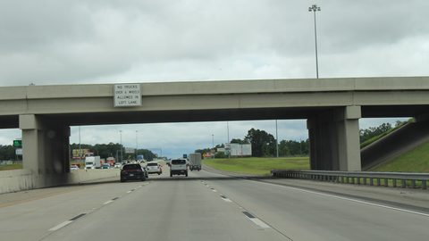
Interstates in Georgia are fast but dull. I 75, I 85, I 95, I 20, and I 16 move you between regions efficiently and show you nothing worth stopping for. State and US highways are slower and far more scenic. Take the Russell-Brasstown Scenic Byway, a 40.6 mile loop across the high country. It is worth the slower speed. The drive along US 441 along the ridgelines and GA 520 along the coast repays the extra time.
Most toll lanes around the capital are electronic only and require a Peach Pass or compatible transponder. Visitors without one receive a bill by mail but pay a higher rate. If you rent a car at ATL, ask the rental desk whether the car has a transponder already.
Day Trips That Work
Skip the idea of day tripping both the high country and the coast from the capital. Athens is 70 miles from the city, 1.5 hours by car, and works as a day trip for music history and the university town. Macon is 85 miles, 1.5 hours, for music heritage and Ocmulgee Mounds. Dahlonega is 65 miles, 1.25 hours, for gold history and mountain vineyards. Madison is 60 miles, one hour, for preserved antebellum homes. St. Simons Island from Savannah is 80 miles, 1.5 hours. Sapelo Island from Darien requires a 30 minute ferry and a reservation. The high country and the coast cannot be day tripped from the capital. That is a five hour drive one way.
Friction Points
Summer heat and humidity make outdoor sightseeing unpleasant from late morning onward. Start hikes by 07:00 and finish by noon. Many small town restaurants and attractions close early, by 8 p.m. or on Sundays and Mondays. Cell service is patchy in the highlands and parts of the Okefenokee. Download offline maps before entering those areas. The week of the Masters Tournament in Augusta in early April spikes hotel prices regionally. Major holiday weekends on interstates, especially I 75 and I 16, add hours to any drive.
Common Questions
How many days should I spend in Georgia for a road trip?
Seven days is the minimum. That allows you to combine two regions, such as the high country and coast or the high country and the Black Belt, without spending every day driving. Trying to visit the mountains, the capital, and the coast in fewer than seven days forces five-plus-hour drives between regions and leaves no time to actually see anything.
What is the best time of year to visit Georgia?
March through May and October through November are the best months. Spring brings dogwoods, azaleas, and mild temperatures. Fall brings drier air and leaf color in the highlands. Avoid July and August across most of the state due to heat and humidity, except the immediate coast where family beach vacations peak in summer.
Do I need a car to travel around Georgia?
Yes. A personal car is essential for exploring the state as a whole. Interstates are fast but dull. State and US highways are slower and far more scenic. No single walkable destination covers enough of the state to justify skipping a rental car.
How far is it from the mountains to the coast in Georgia?
About five to six hours of driving without traffic. The capital's congestion can add an hour or more to any route passing through the metro area. The distance between the Blue Ridge Mountains and the Golden Isles is the single most underestimated fact among first time visitors.
Which Georgia airport should I fly into?
Hartsfield-Jackson Atlanta International Airport (ATL) is the main gateway, roughly 10 miles south of downtown. Savannah/Hilton Head International Airport (SAV) serves the coast. Smaller airports with limited commercial service include Augusta Regional (AGS), Columbus (CSG), Valdosta (VLD), and Brunswick Golden Isles (BQK). Fly into whatever region you want to start in.
What should I avoid when planning a Georgia trip?
Trying to see the mountains, the capital, and the coast in one short trip without accounting for the five-plus-hour drives between regions. Also avoid July and August across most of the state for heat and humidity, and avoid the week of the Masters Tournament in Augusta in early April when hotel prices spike regionally.
Is Georgia good for travelers who dislike driving?
No. Georgia is not for travelers who want a single compact, walkable destination. It is also not for those seeking desert or alpine landscapes, or visitors who struggle with heat and humidity. Georgia rewards road trippers who enjoy varied scenery over several days and are willing to rent a car and drive long distances.
Read next
-
 Best Time to Visit Georgia by Region and Season
Georgia's best travel windows are spring and fall, but the mountains and coast follow different seasonal rules.
Best Time to Visit Georgia by Region and Season
Georgia's best travel windows are spring and fall, but the mountains and coast follow different seasonal rules.
-
 Getting Around Georgia Without Losing a Day to the Interstate
A personal car is essential for exploring Georgia, but route choices and Atlanta traffic determine how much of your day actually goes to travel.
Getting Around Georgia Without Losing a Day to the Interstate
A personal car is essential for exploring Georgia, but route choices and Atlanta traffic determine how much of your day actually goes to travel.
-
 Practical Safety in Georgia Without the Scaremongering
Georgia travel safety is mostly about heat, long drives, and remote areas where preparation matters more than worry.
Practical Safety in Georgia Without the Scaremongering
Georgia travel safety is mostly about heat, long drives, and remote areas where preparation matters more than worry.
-
 What a Georgia Trip Costs in Shape Rather Than Figures
Georgia trip costs are shaped less by daily expenses than by region, season, and how many entry fees and long drives you stack.
What a Georgia Trip Costs in Shape Rather Than Figures
Georgia trip costs are shaped less by daily expenses than by region, season, and how many entry fees and long drives you stack.
-
 United States Travel Guide for First-Timers Who Want the Real Picture
The United States delivers extraordinary geographic and cultural variety, but its sheer scale, car dependency, and tipping economy surprise first-timers. Start here.
United States Travel Guide for First-Timers Who Want the Real Picture
The United States delivers extraordinary geographic and cultural variety, but its sheer scale, car dependency, and tipping economy surprise first-timers. Start here.
-
 Staying Connected While Traveling Through the United States
Prepaid eSIMs work well in US cities, but a physical T-Mobile or AT&T SIM bought at arrival gives better rural coverage for national parks and long highway drives.
Staying Connected While Traveling Through the United States
Prepaid eSIMs work well in US cities, but a physical T-Mobile or AT&T SIM bought at arrival gives better rural coverage for national parks and long highway drives.
-
 Best Time to Visit the United States by Region and Season
The United States spans so many climates that no single season works everywhere. Here is what each region delivers, and when to stay away.
Best Time to Visit the United States by Region and Season
The United States spans so many climates that no single season works everywhere. Here is what each region delivers, and when to stay away.
-
 Getting Around the United States Without Underestimating the Distances
Outside the Northeast Corridor, the United States runs on cars and domestic flights. Distances are enormous and Amtrak is scenic but slow.
Getting Around the United States Without Underestimating the Distances
Outside the Northeast Corridor, the United States runs on cars and domestic flights. Distances are enormous and Amtrak is scenic but slow.
-
 A Ground-Level Logistics Guide to Independent Travel in China
First-time independent travel in China: what you need to know about visas, rail booking, eSIMs, mobile payments, and power adapters.
A Ground-Level Logistics Guide to Independent Travel in China
First-time independent travel in China: what you need to know about visas, rail booking, eSIMs, mobile payments, and power adapters.