Mexico Beyond the Beach
Mexico is a high-contrast country where ancient pyramids meet chaotic megacities and Caribbean reefs sit hours from arid canyons. Here is how to choose your route.
- Flag
-

- ISO code
- MX
- Population
- 126,190,788
- Currency
- MXN
- Dial code
- +52
Mexico Beyond the Beach
Mexico is 1,964,375 km² and the assumption that it works as a single trip is the fastest way to waste a holiday. This guide exists to stop you from booking a week in Cancún and calling it done. That is like landing in Miami and checking off North America. The nation splits into six macro-regions, each demanding a minimum of 10 days to feel anything close to a real visit: the Central Highlands at 2,250 m where the air thins and the sun burns, the Yucatán Peninsula where inland heat and humidity can wreck an unprepared itinerary, Oaxaca and Chiapas where road blockades can halt you for hours, the Pacific Coast with its own hurricane season, the Bajío's winding colonial routes, and the vast North where summer desert temperatures regularly pass 45°C. Pick one vertical slice. Go deep. The rest can wait for the next trip.
- Country Name (Spanish / English): México / Mexico
- Capital: Mexico City (Ciudad de México, CDMX)
- Official Language: Spanish (de facto; 68 indigenous languages also recognised)
- Land Area: 1,964,375 km²
- Coastlines: Pacific Ocean and Gulf of Mexico / Caribbean Sea (9,330 km total)
- States: 32 (31 states plus Mexico City)
- Population (2025 Projection): 131.4 million (CONAPO projection)
- Currency: Mexican peso (MXN)
- Mains Voltage / Plug Type: 127 V, 60 Hz; Type A and B outlets
- Driving Side: Right
- International Calling Code: +52
- Time Zones: 4 (UTC-8 to UTC-5; most of the country ended DST in 2023, but border municipalities may observe a different scheme, verify with the government)
- Emergency Number: 911
- Travel Advisories Issued By: U.S. Department of State, UK FCDO, Canada Travel.gc.ca, Australia Smartraveller
- Minimum Stay: 10 days to experience even two connected regions
- Entry Documents: Visa-free for Schengen Area, UK, Canada, US, Japan, South Korea, and most Latin American countries for tourism up to 180 days. Several African, Middle Eastern, and Asian nationalities require a visa obtained in advance. Citizens of Russia, Turkey, and Ukraine can apply for an SAE online if holding a valid US, Canada, Japan, UK, or Schengen visa. All visitors must complete a Forma Migratoria Múltiple (FMM) at the port of entry. The passport must be valid for the duration of the stay.
- Vaccination Recommendations: CDC, NaTHNaC, and WHO recommend routine jabs (hepatitis A, typhoid, tetanus-diphtheria-pertussis). Malaria prophylaxis is not recommended for most tourist areas; risk is limited to rural low-elevation zones in Chiapas, Oaxaca, and Quintana Roo verify the current CDC malaria map. Dengue is endemic and peaks June-November. Altitude sickness risk begins above 2,400 m.
- Getting There: Five hub airports: MEX (Mexico City), CUN (Cancún), GDL (Guadalajara), MTY (Monterrey), TIJ (Tijuana). Cancún International to Cancún centro by ADO bus costs ~MXN 120. Mexico City International to the centre by official taxi costs ~MXN 350.
- Best For: Culture and archaeology enthusiasts, food-focused travellers, backpackers and overlanders, divers and marine life lovers, couples wanting high-design hotels at lower prices than the Caribbean equivalents.
- Not For: Travellers seeking a quiet, orderly, or sanitised experience. Anyone with severe respiratory issues or low tolerance for air pollution. Those who need strict punctuality. People unwilling to use basic Spanish beyond resort zones.
Mexico Beyond Resorts
The all-inclusive strip along the Zona Hotelera in Cancún represents roughly 0.02% of Mexico's land area. The country beyond that strip is louder, dustier, more complicated, and far more rewarding. You will deal with aggressive street vendors in the Centro Histórico of Mexico City. You will encounter police shakedowns targeting rental cars with foreign plates between Tulum and Bacalar, keep your licence and a passport copy on hand and stay calm. You will face the reality that tap water is not potable anywhere, that toilet paper goes in the bin beside the bowl, not into it, and that ATMs in airports and resort zones dispense USD at terrible rates if you accept the machine's conversion offer. Always decline that offer. Withdraw pesos instead.
What you gain is access to the Museo Nacional de Antropología, which requires half a day and rewards it with the most comprehensive collection of Pre-Columbian artefacts in the Americas. You gain the experience of walking the Avenue of the Dead at Teotihuacán before the hot-air balloon crowds arrive. You gain cochinita pibil slow-roasted in banana leaf in Mérida, tlayudas folded on a Oaxaca street corner, and aguachile that burns more than any ceviche you have tasted. The warmth of the people is genuine, but the pace of bureaucracy and the indirect communication style will frustrate anyone accustomed to linear efficiency. Book a courtyard room in the Roma Norte and Condesa districts, leafy, walkable, café-dense, and accept that you will need basic Spanish beyond the resort zones. The country does not owe you a sanitised experience. That is not a flaw. That is the point.
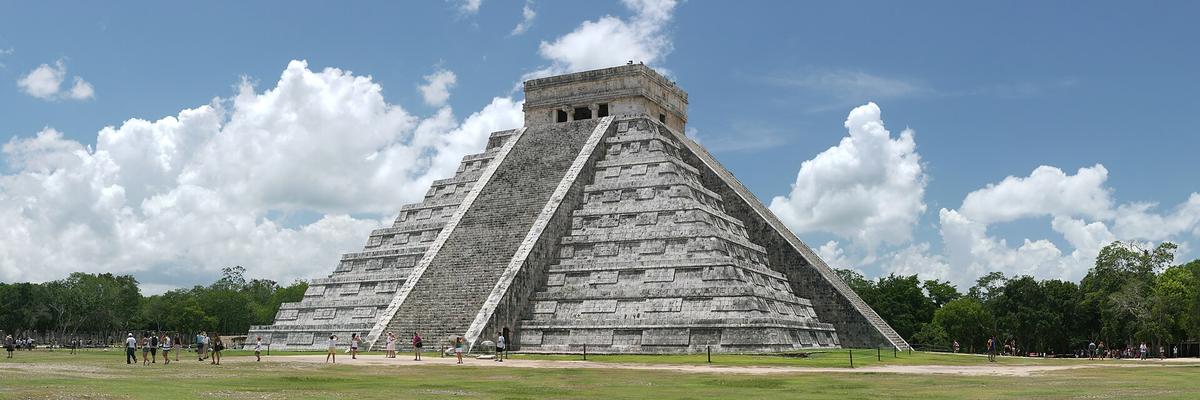

Yucatán and Oaxaca Itinerary: Which Vertical Slice Fits Your Appetite
The most common mistake in Mexican travel is trying to connect Yucatán and Oaxaca in a single trip. The research calls this out explicitly: burning three full days in transit between Mexico City, Oaxaca, and the Yucatán leaves no time to absorb any single region. You choose one. The question is which.
What The Yucatán Peninsula Offers
The Yucatán sits at 0-200 m elevation with hot, humid weather year-round. Minimum recommended stay is 10-14 days. You fly into Cancún International (CUN), take a 30-minute ADO bus to Cancún centro for MXN 120, or book a private shuttle straight to Playa del Carmen or Tulum. The region delivers the major Maya sites: Chichén Itzá (arrive by 8am or you share the pyramid with bus tours), the Tulum Ruins on their cliff above a tiny beach (book online), and Calakmul, a remote jungle pyramid where howler monkeys provide the soundtrack. The cenote network is the real draw. Cenote Dos Ojos for stalactite snorkel in twin sinkholes. Bacalar for the lagoon of seven colours with its low-rise development. The quieter swimming holes inland. ADO buses connect the cities; colectivo vans rule short routes and require cash in pesos. Book a courtyard room in Mérida for the food: marquesitas from a street crepe cart, cochinita pibil, and the best café de olla of any Mexican city. Inland heat and humidity peak April-September, and sargassum seaweed on the east-coast beaches varies year-to-year. August through October brings hurricane risk.
What Oaxaca And Chiapas Deliver
The Oaxaca and Chiapas macro-region spans 0-2,900 m in elevation, with Oaxaca City at 1,550 m and San Cristóbal de las Casas at 2,200 m. Minimum stay is 10-14 days. This is the territory of indigenous markets, mountain pueblos, Pacific surf towns, and Maya ruins buried in jungle. Monte Albán, the Zapotec hilltop plaza, delivers 360° views from its platform. Hierve el Agua, a petrified waterfall with mineral pools, sits 2.5 hours from Oaxaca City by colectivo. Palenque rises from mist and howler monkey roar. The food is the most distinctive in Mexico: tlayudas with asiento and tasajo, the full universe of moles, street-corner esquites scooped from carts into paper cups. San Cristóbal de las Casas offers highland charm, textile cooperatives, and cool nights. The underestimated factor is road blockades and protests that can halt overland travel for hours or days with no notice. Build slack into any itinerary through this region. The reward is a density of indigenous culture and culinary tradition that the Yucatán, for all its pyramids, cannot match.
| Factor | Yucatán Peninsula | Oaxaca & Chiapas |
|---|---|---|
| Altitude | 0-200 m (hot, humid year-round) | 0-2,900 m (varies sharply with elevation; Oaxaca City at 1,550 m, San Cristóbal at 2,200 m) |
| Minimum Stay | 10-14 days | 10-14 days |
| Main Archaeology | Chichén Itzá, Tulum Ruins, Calakmul, Uxmal | Monte Albán, Palenque, Mitla |
| Signature Food | Cochinita pibil, marquesitas, sopa de lima | Tlayudas, moles, tamales oaxaqueños, chapulines |
| Marine/Water | Cenotes, Caribbean reef, whale sharks (summer) | Pacific surf towns (Puerto Escondido, Mazunte); Hierve el Agua mineral pools |
| Underestimated Friction | Inland heat April-Sept, sargassum seaweed, hurricane risk Aug-Oct | Road blockades and protests can halt travel with no notice |
| Best For | Divers, cenote lovers, resort-booking couples, first-time archaeology visitors | Food-focused travellers, indigenous culture seekers, mountain pueblo explorers, surfers |
Mexico City Cultural Travel
Mexico City sits at 2,250 m in the Central Highlands macro-region. Cold nights and intense sun at elevation are the underestimated factors, not heat. The city demands 7-10 days minimum for its own macro-region, and you should dedicate at least that to the capital alone if cultural travel is your aim.
What To Prioritise
The Museo Nacional de Antropología in Chapultepec Park is non-negotiable. It requires half a day and delivers a path from the Olmec heads to the Aztec Sun Stone. The Palacio de Bellas Artes holds Rivera murals inside an Art Nouveau shell. The Centro Histórico surrounds the monumental Zócalo with grand colonial buildings and chaotic commerce. For staying, Roma Norte and Condesa offer leafy streets, walkable café culture, and an expat-friendly base. The Zona Hotelera of Cancún this is not: you are here for food markets, mezcalerías, and the experience of a megacity that functions on its own terms.
Day Trips From The Capital
Teotihuacán sits one hour from Mexico City by Uber or bus from Terminal del Norte. Arrive by 8am to walk the Avenue of the Dead before the crowds. The hot-air balloon option exists but the ground perspective is the superior one. For a different direction, Grutas de Tolantongo delivers hot springs cascading down a cliff face, worth the journey for the surreal landscape. Budget for the elevation: café de olla with cinnamon and piloncillo is essential, and the thin air will leave you breathless until you acclimatise. Entry fees for Teotihuacán are published by the Instituto Nacional de Antropología e Historia; check their official site for the current figure.
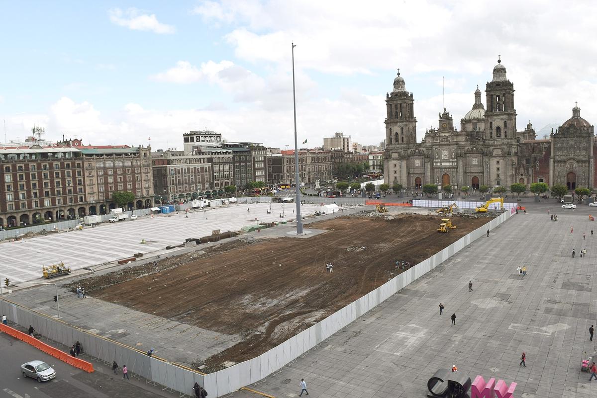

Backpacking Mexico Routes: How to Move and Where to Sleep
Backpacking Mexico requires a flexible schedule and cash in pesos. The ADO bus network forms the backbone of overland travel, connecting all major cities and most towns. Classes range from luxury double-deckers with lie-flat seats down to second-class buses that stop at every hamlet and may lack a toilet. Pay cash or card at the station. For shorter routes in the Yucatán, colectivo vans charge by the seat and run when full.
The Single Biggest Friction Point In Transport
Uber functions legally in major cities but faces violent opposition from taxi syndicates in Cancún and Los Cabos. You may need to walk off airport or hotel grounds to meet a driver. Didi and Cabify operate in select cities but availability varies. Self-drive is feasible with a valid home driving licence; an International Driving Permit is not legally required but recommended for police checkpoints. The toll road network (cuota) runs approximately 10,000 km and is significantly faster and safer than the free roads. Tolls require cash or an electronic tag. Pemex is the dominant fuel retailer; prices vary by region and station, with regulated maximums published weekly by the government. Fuel price bands are released by CRE; check their site for the figure in force.
Where Backpackers Stay
The neighbourhoods that matter for budget travellers: Roma Norte and Condesa in Mexico City, Oaxaca Centro for mezcalerías and markets, San Cristóbal de las Casas for highland hostels, Mérida for base-camping the Yucatán, and Puerto Vallarta's Romantic Zone for cobblestone streets and gay-friendly hillside dining. In Bacalar, low-rise hostels sit on the lagoon of seven colours. In Tulum, the Beach Zone offers barefoot luxury at high prices with generator hum; the Pueblo is cheaper and more authentic. Book a courtyard room on the far side from the lift. Buy a Telcel (Amigo) physical SIM at any OXXO convenience store using your passport for the broadest 4G coverage, including rural Chiapas and the Copper Canyon. eSIMs from uPhone work but cost more. Download offline Google Maps and a Spanish translation app before leaving Wi-Fi zones. Public Wi-Fi in city plazas is useless for anything beyond messaging.
The Macro-Region That Requires The Most Time
The North and Copper Canyon macro-region demands 14-21 days for a northern loop. It includes the El Chepe tourist train running from Chihuahua to Los Mochis through the Copper Canyon, vaster than the Grand Canyon, with rims above 2,400 m that can see winter snow. This region also holds Cabo Pulmo, a living coral reef best snorkelled (no scuba needed), Isla Espiritu Santo for swimming with sea lions in a UNESCO site, and the Valle de Guadalupe wine country with its dusty roads and architectural wineries. Summer heat in the desert regularly passes 45°C. This is not a region for a short trip. It is a region for a dedicated journey.
Peak Season, Avoid Windows, and What You Need to Know Before Booking
The peak season runs December through March. Dry, sunny weather across most of the country brings a surge of international visitors over Christmas, New Year, and North American spring break. Prices for flights and coastal accommodation can double during this window. Semana Santa (Easter week, dates vary) is the single worst time to travel Mexican beaches: entire families flood the coast, highway traffic clogs, and hotel availability collapses. August through October on the Caribbean and Pacific coasts brings high humidity, intense heat, and hurricane risk from June to November on the Atlantic side and May to November on the Pacific.
The climate pattern varies sharply by macro-region. The Yucatán is hot and humid year-round with heaviest rain June-October. The Central Highlands offer mild days year-round with cold nights December-February, and rain concentrated June-September. The Pacific Coast is hot and humid May-October, dry and warm November-April. The North sees extreme heat May-September and cold nights with occasional snow at elevation December-February. Oaxaca and Chiapas vary with the terrain: highlands cool and rainy May-September, lowlands hot and humid year-round.
Mexico is best for travellers who go for: culture and archaeology enthusiasts willing to move beyond the beach, food-focused travellers who plan entire days around markets and street stalls, backpackers and overlanders with flexible schedules, divers and marine life lovers seeking reefs and cenotes, and couples wanting high-design boutique hotels at lower prices than equivalent Caribbean islands. Mexico is not for travellers seeking a quiet, orderly, or sanitised experience. It is not for anyone with severe respiratory issues or low tolerance for air pollution, especially in Mexico City. It is not for those who need strict punctuality in transport or service. And it is not for people unwilling to use basic Spanish beyond resort zones. The country is 1,964,375 km² of high-contrast chaos and genuine warmth. It rewards the traveller who meets it on its own terms rather than demanding it shrink to fit a week at an all-inclusive.
Common Questions
How many days do I need for a Mexico trip that includes more than a beach resort?
The absolute floor is 10 days, because connecting two distinct regions like the capital and a coast requires at least two internal flights or a full-day bus ride. For a single macro-region like the Yucatán Peninsula or the Central Highlands, budget 10-14 days minimum.
Is it safe to travel independently in Mexico beyond the resort zones?
Millions of independent travellers navigate Mexico annually without incident, but the safety calculus changes by state and route. Consult the U.S. Department of State, UK FCDO, Canada Travel.gc.ca, and Australia Smartraveller advisories for your specific itinerary. Police shakedowns targeting rental cars with foreign plates occur between Tulum and Bacalar; stay calm and carry a passport copy.
Can I drink the tap water in Mexico?
No. Tap water is not potable anywhere. Even locals use garrafones (large purified water jugs). Ice in reputable bars is fine; street ice blocks are a gamble. Use bottled or purified water for drinking and tooth-brushing.
What is the best time to visit Mexico for cultural travel?
December through March is peak season across most of the country: dry, sunny weather, but prices for flights and coastal accommodation can double. For the Yucatán, avoid Semana Santa (Easter week) when Mexican families travel en masse, beaches fill to capacity, and hotel availability collapses. August through October brings hurricane risk on both coasts.
Do I need to speak Spanish to travel in Mexico?
Beyond resort zones and the Roma Norte/Condesa expat neighbourhoods in Mexico City, basic Spanish is essential. The country has 68 recognised indigenous languages operating alongside it. A few phrases will smooth every interaction from ordering tlayudas to negotiating colectivo fares.
How do I avoid being overcharged as a tourist?
The tourist price is a daily reality. Menus without prices in beach zones can yield shocking bills. ATMs at airports and resort strips dispense USD at terrible rates; always decline the machine's conversion offer and withdraw pesos. At land borders, a fee applies for the FMM tourist card; verify the current figure with INM.
Can I travel between Mexico City, Oaxaca, and the Yucatán in two weeks?
Technically yes, but you will spend three full days in transit and have no time to absorb any single region. The research is clear: pick one vertical slice, central highlands or Yucatán peninsula, and go deep. Save the other for a separate trip.
Read next
-
 Staying Connected in Mexico, eSIM, Telcel SIM, or Roaming
Compare eSIM providers against a physical Telcel SIM for a Mexico trip. Coverage in remote areas like the Copper Canyon and Chiapas decides the winner.
Staying Connected in Mexico, eSIM, Telcel SIM, or Roaming
Compare eSIM providers against a physical Telcel SIM for a Mexico trip. Coverage in remote areas like the Copper Canyon and Chiapas decides the winner.
-
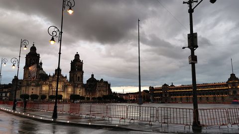 When to Go to Mexico Without Melting, Getting Rained Out, or Paying Double
Mexico's dry season runs December to March with perfect weather and peak prices. Hurricane season hits the coasts from August to October.
When to Go to Mexico Without Melting, Getting Rained Out, or Paying Double
Mexico's dry season runs December to March with perfect weather and peak prices. Hurricane season hits the coasts from August to October.
-
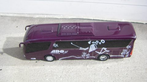 Getting Around Mexico When the Map Makes Distances Look Shorter Than They Are
Mexico is 1.96 million square kilometres. ADO buses are the backbone, colectivos rule the Yucatán, and Uber works until it doesn't.
Getting Around Mexico When the Map Makes Distances Look Shorter Than They Are
Mexico is 1.96 million square kilometres. ADO buses are the backbone, colectivos rule the Yucatán, and Uber works until it doesn't.
-
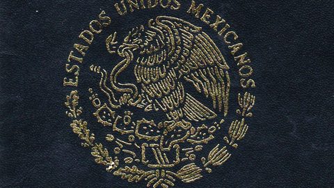 Mexico Visa Rules and the FMM Tourist Card Explained Without the Guesswork
Most visitors to Mexico do not need a visa, but everyone needs an FMM tourist card. Here is who qualifies, how to get it, and what it costs.
Mexico Visa Rules and the FMM Tourist Card Explained Without the Guesswork
Most visitors to Mexico do not need a visa, but everyone needs an FMM tourist card. Here is who qualifies, how to get it, and what it costs.
-
 Cash or Card in Mexico and Why the ATM Keeps Asking You a Weird Question
Mexico runs on pesos and cash still rules markets, colectivos, and street food. Here is how to avoid the ATM conversion trap and when to use a card.
Cash or Card in Mexico and Why the ATM Keeps Asking You a Weird Question
Mexico runs on pesos and cash still rules markets, colectivos, and street food. Here is how to avoid the ATM conversion trap and when to use a card.
-
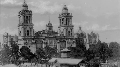 Mexico Safety Advice That Does Not Come From a Clickbait Headline
Mexico's safety headlines rarely describe the risks travellers actually face. Here is how to read the advice, avoid police shakedowns, and navigate taxi conflicts.
Mexico Safety Advice That Does Not Come From a Clickbait Headline
Mexico's safety headlines rarely describe the risks travellers actually face. Here is how to read the advice, avoid police shakedowns, and navigate taxi conflicts.
-
 How to Budget a Trip Based on Purchasing Power, Not Just Exchange Rates
Exchange rates tell only half the story. See how purchasing power shapes your real travel budget across Southeast Asia, Eastern Europe, and Latin America.
How to Budget a Trip Based on Purchasing Power, Not Just Exchange Rates
Exchange rates tell only half the story. See how purchasing power shapes your real travel budget across Southeast Asia, Eastern Europe, and Latin America.
-
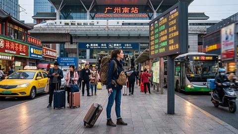 A Ground-Level Logistics Guide to Independent Travel in China
First-time independent travel in China: what you need to know about visas, rail booking, eSIMs, mobile payments, and power adapters.
A Ground-Level Logistics Guide to Independent Travel in China
First-time independent travel in China: what you need to know about visas, rail booking, eSIMs, mobile payments, and power adapters.
-
 How Solo Travelers Stay Ahead of Flight Delays and Cancellations
How solo travelers can track inbound aircraft, claim rebooking rights, and adjust ground transport when flights go wrong — step by step.
How Solo Travelers Stay Ahead of Flight Delays and Cancellations
How solo travelers can track inbound aircraft, claim rebooking rights, and adjust ground transport when flights go wrong — step by step.