What to Know Before You Go to Nevada
Nevada is a state of extreme contrasts: the 24-hour artificial fantasy of the Las Vegas Strip gives way to vast, silent desert where services vanish and the
- Flag
-

- ISO code
- US
- Currency
- USD
What to Know Before You Go to Nevada
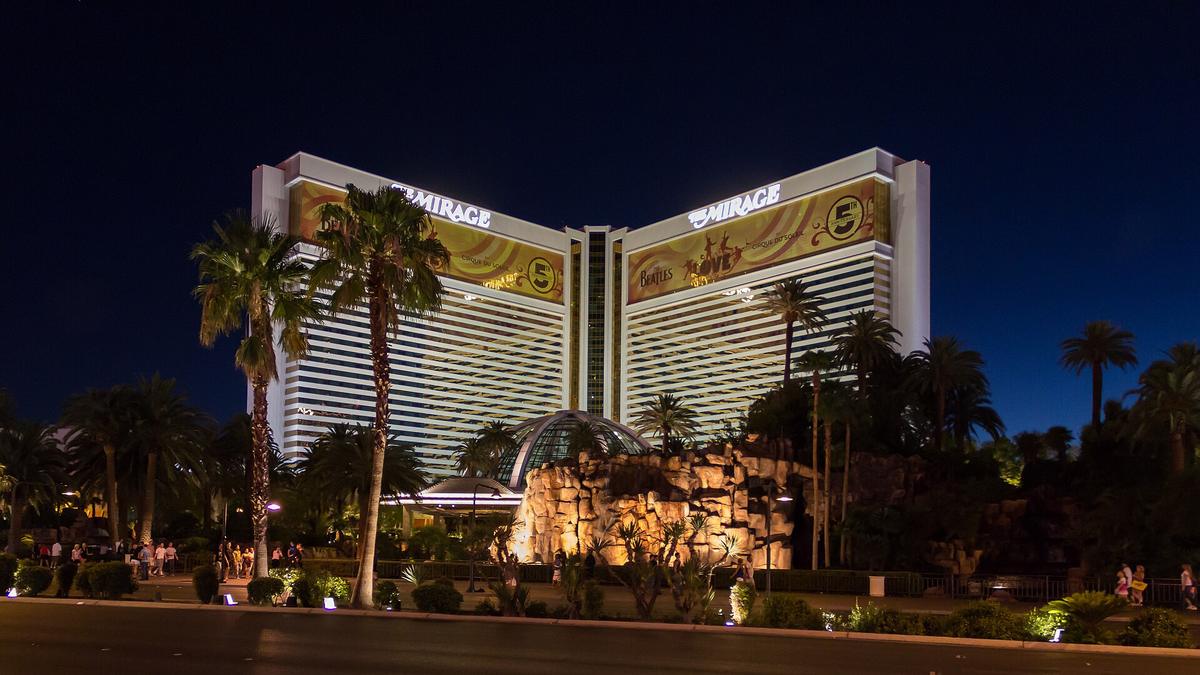
Nevada is 110,577 square miles of extreme sensory whiplash. The Strip pumps artificial overstimulation through themed mega resorts, 24 hour alcohol sales, and casino air that can irritate contact lens wearers and asthmatics. Drive four hours north and the landscape shifts to silent basin and range emptiness where services vanish and the terrain feels actively hostile rather than scenic. This Nevada travel guide exists for the traveler who wants both the desert and the vice but refuses to be flattened by the scale. A personal car is non negotiable outside the Las Vegas Reno corridors. Credit cards are the dominant payment method at fuel pumps, though some remote stations reject contactless so carry a physical card. The thing that trips visitors up is fuel range: gas stations can sit 100 or more miles apart on US 50 and US 6, and a next services sign means exactly that: no restroom, no water, just a pump.
- State Area: 110,577 sq mi (286,380 km²)
- Federal Land: Approximately 80% (verify figure at travelnevada.com)
- Population (2024 estimate): 3,194,176 per U.S. Census Bureau
- Population in Clark County: Approximately 73% (verify at U.S. Census Bureau)
- Counties: 16, plus 1 independent city (Carson City)
- Counties Under 10,000 Population: 7 (verify at U.S. Census Bureau)
- Longest Straight Line Distance: Approximately 490 mi (789 km) north-south
- Highest Point: Boundary Peak, 13,147 ft (4,007 m)
- Lowest Point: Colorado River at Arizona border, 481 ft (147 m)
- Average Elevation: 5,500 ft (1,676 m)
- Mountain Ranges: More than 300 named ranges
- Number of National Parks (entirely within state): 1 (Great Basin National Park)
- Number of State Parks: 27
- Number of Designated Wilderness Areas: Approximately 70 (verify at BLM.gov)
- Annual Las Vegas Visitation (2023): Approximately 40.8 million per LVCVA
- Annual Great Basin National Park Visitation (2023): Approximately 143,000 per NPS
Nevada Road Trip Planning: the Non Negotiable Reality
Distances And Fuel Gaps
Underestimating driving distances is the single most common mistake visitors make. Reno to Las Vegas is a seven hour drive. Las Vegas to Great Basin National Park is four and a half hours one way, making a day trip impossible. The longest straight line distance across Nevada is about 490 miles north to south, and the state contains more than 300 named mountain ranges that force roads into long detours. Interstate highways crossing Nevada are I 15, I 80, and a partial I 11. US 50, dubbed the Loneliest Road in America, runs nearly 408 miles across the state with stretches where cell service vanishes completely.
For Nevada road trip planning, download offline maps before leaving any town. Cell service drops on US 50, US 6, NV 375, and across the Black Rock Desert. Casino resorts also block mobile data signals on the gaming floor; step toward the lobby or pool to get a signal back. The state speed limit on rural interstates is 80 mph, and on two lane rural highways it is 70 mph. The longest stretch of US 6 without services runs close to 168 miles between Tonopah and Ely. The longest stretch of US 93 without services runs about 100 miles between Alamo and Caliente. Plan fuel stops around those gaps, not between them.
Timing Your Trip
The minimum days for any Nevada trip that includes both the Las Vegas vortex and the desert is seven. Fewer than that forces you to choose: vice or solitude, alpine or alkali, north or south. March through May and September through November deliver tolerable desert temperatures between 60 and 85 degrees Fahrenheit. July and August routinely exceed 110 degrees in the low desert, making outdoor activity dangerous. The Burning Man festival in late August through early September causes a run on Reno area rentals, RVs, and supplies, spiking prices across the north. November brings the Formula 1 Las Vegas Grand Prix, which now distorts pricing and access statewide for a week.
,_The_Strip_--_2012_--_6215.jpg)
Las Vegas to Great Basin Drive: What the Distance Actually Means
The Drive And The Fuel Gap
The Las Vegas to Great Basin drive covers about 290 miles, but the time required is four and a half hours one way. This is not a day trip. Treat it as a two night stop. The route takes I 15 north to US 93, then east through the Mojave Desert into the Great Basin Desert, crossing the hydrographic region that covers nearly 100 percent of Nevada an endorheic basin with no outlet to sea. Services thin out as you pass through Alamo and Caliente, and the stretch of US 93 between them runs around 100 miles without a fuel station. Fill up in Las Vegas before leaving.
Great Basin National Park
Great Basin National Park receives about 143,000 visitors annually compared to Las Vegas's 40.8 million. That ratio tells you everything about the experience. Wheeler Peak rises to 13,147 feet, and the park contains ancient bristlecone pines and the Lehman Caves tour that requires advance reservation. The five developed campgrounds offer roughly 150 sites. Summer through early autumn is the peak season because high elevation backroads are snow free only then. Winter through late spring makes many of those roads impassable.
Altitude And Temperature Swings
Altitude sickness hits visitors who fly into Reno at 4,500 feet and then drive over passes above 8,900 feet. The same applies on the approach to Great Basin from the south. Budget for the diurnal temperature swing of 30 to 40 degrees between day and night. A typical winter daytime high in Elko runs 35 to 45 degrees; a typical summer high hits 85 to 95 degrees. The high desert does not do moderate.
Nevada Beyond the Strip: Where Solitude Begins
Who The State Is Built For
Seventy three percent of Nevada's population lives in Clark County. Seven counties have populations under 10,000. Of the 19 incorporated cities, most function as supply stops, not historic walkable cores. Travelers who need pedestrian friendly charm should skip Nevada entirely. The state is built for road trippers who love long meditative drives through alien terrain, stargazers heading into the Great Basin, off road and overlanding enthusiasts, and gamblers who want 24 hour adult playgrounds.
Districts Worth The Detour
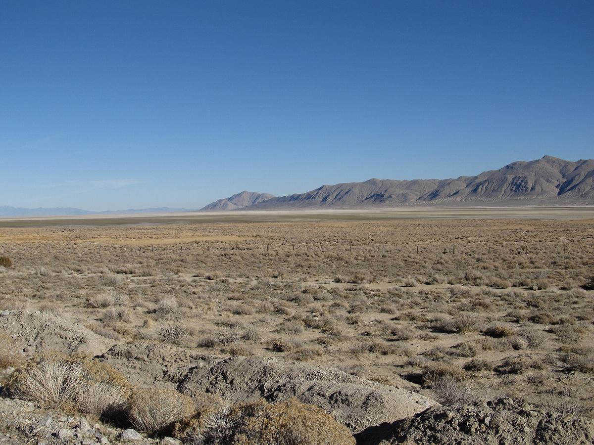
The major districts beyond the Strip include the Lake Tahoe Basin with its alpine blue water and ski resorts, the Great Basin with its absolute dark sky silence, the Black Rock Desert's alkaline playa and extreme nothingness, Valley of Fire's Jurassic sandstone formations 50 miles from Las Vegas, and Red Rock Canyon's striated escarpment with a 13 mile scenic loop that requires a timed reservation from October through May. Elko and the Ruby Mountains offer Basque culture and Lamoille Canyon's glacial scenery. Virginia City preserves a 19th century silver boom wooden boardwalk town. Rhyolite Ghost Town near Beatty sits as open air ruins with no tickets needed.
Rules And Risks
Legal cannabis is sold everywhere but cannot be consumed in public, hotels, or casinos. Tourists have almost no legal place to use it. Monsoon flash floods in July and August can close highways and strand vehicles in washes with zero warning. Casino air filtration systems pump scented air; contact lens wearers and asthmatics should prepare accordingly. Free casino drinks require you to be actively gambling. A one dollar video poker bet counts, but standing at the bar does not.
| Decision | South (Las Vegas Corridor) | North (Reno And Great Basin) |
|---|---|---|
| Climate | Mojave Desert; summer highs 100-110°F | Great Basin Desert; summer highs 85-95°F |
| Primary Airport | Harry Reid International (LAS) handles >90% of state air traffic | Reno-Tahoe International (RNO); taxi to downtown in 10 minutes |
| Hotel Rooms | Approximately 154,000 in metro area | Approximately 20,000 in Reno/Sparks; 10,000 in rural areas |
| Day Trip Radius | Valley of Fire (1 hr), Hoover Dam (45 min), Rhyolite (2 hr) | Virginia City (40 min), Lamoille Canyon (30 min from Elko) |
| Crowd Density | 40.8 million annual visitors; constant overstimulation | 143,000 annual visitors to Great Basin; genuine solitude |
| When To Go | Spring and autumn for tolerable temperatures | Summer through early autumn for snow-free roads |
| Transport | Taxi flat rate to Strip $21-$27; rideshare $15-$25 | Taxi to downtown Reno $15-$20; rental car mandatory beyond city |
| Risk | Heat exhaustion; casino sensory overload | Altitude sickness; 100+ mile service gaps on US 6 and US 93 |
Nevada Desert Travel Tips: What Goes Wrong and How to Prevent it
Fuel And Water Discipline
Nevada desert travel tips begin with fuel discipline. Fill up when you see a station, not when your gauge reads a quarter tank. The longest stretch of US 6 without services runs close to 168 miles between Tonopah and Ely. The longest stretch of US 93 without services runs about 100 miles between Alamo and Caliente. Carry a physical credit card because some remote pumps reject contactless. Carry water beyond what you think you need. The diurnal temperature swing of 30 to 40 degrees means a 100 degree afternoon can drop to 60 degrees at night, and the dry air accelerates dehydration.
Weather And Remote Access
Monsoon flash floods in July and August require serious caution. They can close highways and strand vehicles in washes with zero warning. Check the Nevada DOT road conditions hotline by dialing 511 before setting out. If rain is forecast, delay travel. The Black Rock Desert Playa is accessible only when dry and has no services. The International Car Forest of the Last Church in Goldfield and Fly Geyser on private land require advance planning. Fly Geyser is a technicolor geothermal cone accessible only by tour.
Land Ownership And Boundaries
Approximately 80 percent of Nevada land is federally owned. That means Bureau of Land Management territory, more than 70 designated wilderness areas, and roughly 700 public land grazing allotments. The state also contains approximately 100 wild horse management areas and 20 federally recognized tribes with 27 reservations and colonies. The Pyramid Lake Paiute Tribe Reservation covers roughly 475,000 acres. Respect boundaries. Do not enter tribal land without permission.
.jpg)
Food and Friction: What to Eat and What to Watch for
What To Eat
Nevada food breaks into three categories: vintage Vegas coffee shop prime rib and shrimp cocktail, Basque family style dinner in Gardnerville or Winnemucca served at communal tables with Picon Punch, and the fiercely competitive off Strip all you can eat sushi scene in Las Vegas. The Awful Awful burger at the Little Nugget in Reno and Lotus of Siam's northern Thai in Las Vegas's Chinatown are worth the detour. Basque chorizo and sheepherder's bread from a Winnemucca bakery travel well. Shrimp cocktail in a tulip glass at a downtown Las Vegas casino bar is the original version.
What To Watch For
The friction points matter more. Altitude sickness hits visitors who fly into Reno and immediately drive over 8,900 foot passes. Casino air filtration systems pump scented air that irritates contact lens wearers and asthmatics. Free casino drinks require active gambling, not standing at the bar. Legal cannabis is sold everywhere but cannot be consumed in public, hotels, or casinos, leaving tourists with almost no legal place to use it. Monsoon flash floods in July and August can close highways without warning. Cell service vanishes on US 50, US 6, NV 375, and across the Black Rock Desert. Download offline maps before leaving any town.
Who Nevada Suits and Who it Does Not
Nevada suits road trippers who accept that 85 percent of its roads are classified as rural and that the California Zephyr Amtrak route is the only passenger rail service, stopping at Reno, Winnemucca, and Elko. It suits stargazers who understand that Great Basin National Park's 143,000 annual visitors represent genuine dark sky silence compared to Las Vegas's 40.8 million. It suits off road and overlanding enthusiasts who know that the Black Rock Desert Playa is accessible only when dry and has no services. It suits gamblers who want the 24 hour adult playground of the Strip and understand that 154,000 hotel rooms in the Las Vegas metro mean constant noise and scented air.
Nevada does not suit travelers who need walkable historic cores. The 19 incorporated cities are largely functional, not scenic. It does not suit anyone made anxious by legal vice on open display. It does not suit people who dislike dry heat and relentless sun. It does not suit budget travelers without a car outside Las Vegas. The two commercial airports with scheduled passenger service beyond LAS and RNO are Elko and Ely, and Greyhound serves only the I 80 corridor from Reno through Winnemucca and Elko to Salt Lake City. Without a personal car, you cannot reach the Great Basin, the Ruby Mountains, Valley of Fire, or any of the 27 state parks and roughly 70 designated wilderness areas that define the state beyond the Strip.
Common Questions
How many days do I need for Nevada if I hate crowds and casinos?
Seven days minimum. Fewer forces you to choose between the Las Vegas vortex and a rushed dash across 110,000 square miles of desert. Four and a half hours one way to Great Basin National Park means you cannot do it as a day trip.
What is the biggest mistake people make driving across Nevada?
Underestimating distances and treating Nevada like a compact state. Reno to Las Vegas is a seven hour drive. Gas stations can be 100 or more miles apart on US 50 and US 6, and a next services sign means exactly that no restroom, no water, just a pump.
Can I use my phone for navigation in rural Nevada?
Not reliably. Cell service vanishes on US 50, US 6, NV 375, and across the Black Rock Desert. Download offline maps before leaving any town. Casino resorts also block mobile data on the gaming floor; step toward the lobby or pool to get a signal back.
When is the worst time to visit Nevada for outdoor activities?
July and August. Low desert temperatures routinely exceed 110 degrees Fahrenheit, making any outdoor activity dangerous. Monsoon flash floods can close highways with zero warning. Winter through late spring makes many high elevation backroads impassable.
Is prostitution legal everywhere in Nevada?
No. Licensed brothels exist only in counties under 700,000 population. Prostitution is illegal in Clark County, Washoe County, Carson City, and others by local ordinance.
Where can I legally consume cannabis in Nevada?
Almost nowhere. Legal cannabis is sold statewide but cannot be consumed in public, hotels, or casinos. Tourists have almost no legal place to use it. Consult local ordinances before purchasing.
How do I get a free drink at a Nevada casino?
You must be actively gambling. A one dollar video poker bet counts, but standing at the bar does not. Casino air filtration pumps scented air that can irritate contact lens wearers and asthmatics.
Read next
-
 Best Time to Visit Nevada and When the Desert Tries to Kill You
Nevada's shoulder seasons of March through May and September through November deliver tolerable temperatures and clear skies.
Best Time to Visit Nevada and When the Desert Tries to Kill You
Nevada's shoulder seasons of March through May and September through November deliver tolerable temperatures and clear skies.
-
 Getting Around Nevada Without Running Out of Gas or Cell Signal
Outside Las Vegas and Reno, a personal car is non-negotiable in Nevada. Gas stations can be 100 miles apart, cell service vanishes, and preparation is the
Getting Around Nevada Without Running Out of Gas or Cell Signal
Outside Las Vegas and Reno, a personal car is non-negotiable in Nevada. Gas stations can be 100 miles apart, cell service vanishes, and preparation is the
-
 Staying Safe in Nevada Without the Scaremongering
The real safety concerns in Nevada are environmental: flash floods that strand vehicles, altitude sickness above 8,900 feet, imperceptible dehydration in
Staying Safe in Nevada Without the Scaremongering
The real safety concerns in Nevada are environmental: flash floods that strand vehicles, altitude sickness above 8,900 feet, imperceptible dehydration in
-
 What a Nevada Trip Costs in Shape Not in Figures
A Nevada trip budget is shaped by the high-cost Las Vegas Strip vortex, the non-negotiable expense of a rental car and fuel for vast distances, and the
What a Nevada Trip Costs in Shape Not in Figures
A Nevada trip budget is shaped by the high-cost Las Vegas Strip vortex, the non-negotiable expense of a rental car and fuel for vast distances, and the
-
 United States Travel Guide for First-Timers Who Want the Real Picture
The United States delivers extraordinary geographic and cultural variety, but its sheer scale, car dependency, and tipping economy surprise first-timers. Start here.
United States Travel Guide for First-Timers Who Want the Real Picture
The United States delivers extraordinary geographic and cultural variety, but its sheer scale, car dependency, and tipping economy surprise first-timers. Start here.
-
 Staying Connected While Traveling Through the United States
Prepaid eSIMs work well in US cities, but a physical T-Mobile or AT&T SIM bought at arrival gives better rural coverage for national parks and long highway drives.
Staying Connected While Traveling Through the United States
Prepaid eSIMs work well in US cities, but a physical T-Mobile or AT&T SIM bought at arrival gives better rural coverage for national parks and long highway drives.
-
 Best Time to Visit the United States by Region and Season
The United States spans so many climates that no single season works everywhere. Here is what each region delivers, and when to stay away.
Best Time to Visit the United States by Region and Season
The United States spans so many climates that no single season works everywhere. Here is what each region delivers, and when to stay away.
-
 Getting Around the United States Without Underestimating the Distances
Outside the Northeast Corridor, the United States runs on cars and domestic flights. Distances are enormous and Amtrak is scenic but slow.
Getting Around the United States Without Underestimating the Distances
Outside the Northeast Corridor, the United States runs on cars and domestic flights. Distances are enormous and Amtrak is scenic but slow.