What You Need to Know Before Going to Chile
Chile runs 4,300 km from desert to ice, and its north and south are effectively separate trips connected by a flight through Santiago.
- Flag
-

- ISO code
- CL
- Population
- 18,729,160
- Currency
- CLP
- Dial code
- +56
What You Need to Know Before Going to Chile
Chile is 4,300 km long and never more than 350 km wide. The Atacama Desert in the north and the Patagonian ice fields in the south are not part of the same trip. Most visitors need two separate holidays connected only by a flight through the capital. This guide uses the north to south spine as its organising principle. It tells you how to choose which end to tackle, when to go, and how much time to budget for each. It does not describe individual sights in detail. That belongs to the destination pages for each region.
- Length: 4,300 km north to south; maximum width 350 km, minimum 90 km
- Capital: Santiago
- Regions: 16 administrative regions
- Population: 20,086,377 (2024 estimate, Instituto Nacional de Estadísticas)
- Currency: Chilean peso (CLP)
- Time Zone: Continental Chile UTC−4/UTC−3 (daylight saving); Easter Island UTC−6/UTC−5
- Emergency Numbers: Police 133, Ambulance 131, Fire 132
- Visa Free Entry: US, Canada, UK, EU, Australia, New Zealand, Japan, South Korea, most Latin American countries (up to 90 days)
- Airport Hub: Arturo Merino Benítez (SCL) in Santiago
How Chile Itinerary Planning Works
Chile itinerary planning starts with a single decision: north or south. The distances force it. Flying from the capital to Calama for the desert takes two hours. Flying from the capital to Punta Arenas for the far south takes three and a half. Connecting the two requires doubling back through the hub each time. A two week trip that tries to cover both burns at least three full days on internal flights and transfers. You lose the north, the south, or your sanity.
Two weeks is the minimum for any single region. The Norte Grande (Atacama Desert, altiplano, coastal cities) needs 5 to 10 days at a base like San Pedro de Atacama. The Zona Sur (lake district, volcanoes, Mapuche territory) needs 7 to 14 days based in Pucón or Puerto Varas. Southern Patagonia (Torres del Paine, Punta Arenas, Tierra del Fuego) needs 7 to 14 days out of Punta Arenas or Puerto Natales. The Carretera Austral in the Aysén region demands 10 to 21 days round trip. Pick one. Do it properly.
Why Most Travellers Skip The Middle
First time visitors land in the capital and assume they can string together the desert, the lake district, and Patagonia in a single itinerary. They cannot. The logistics defeat the plan. Getting from Punta Arenas to the Torres del Paine trailhead consumes a full day. Flying between the far north and the far south requires a connection back through the hub. The sensible route is a two week loop in one region. Save the other for a second trip.

Chile Trip Logistics: the Real Constraints
The dominant long distance mode is the semi-cama bus with fully reclining seats. Overnight routes from the capital to Puerto Montt run 12 to 14 hours. The capital to Antofagasta takes 18 to 20 hours. Do not assume these are smooth highway cruises. The routes wind through valleys and over passes. The driver sets the air conditioning to arctic. The bathroom is locked. Bring a sleeping bag liner and a neck pillow.
Foreign credit cards are frequently rejected on Turbus and Pullman Bus websites. Buy tickets physically at the terminal with cash or a Chilean debit card. ATMs in Patagonia and the Atacama run out of money by midday on weekends. Carry enough cash for three days of expenses in rural areas. Street addresses in the capital are logical but long: Avenida Providencia 2650, Depto 402. Finding a specific apartment block without a precise number is hopeless. Use a map pin and a landmark reference.
Internal Flights And The Hub Bottleneck
The primary domestic flight corridor runs from the capital to Calama, to Puerto Montt, and to Punta Arenas. LATAM Airlines Chile, Sky Airline, and JetSMART operate these routes. Every connection between the Atacama and Patagonia goes through the central hub. There is no shortcut. Budget for the extra flight and the lost day.
Why You Need A Chilean RUT For Connectivity
Prepaid SIMs from Entel or WOM require a Chilean RUT tax ID to register. Some kiosks will register the SIM under their own RUT. eSIMs from global providers bypass the problem entirely. WiFi is fast and ubiquitous in cities. On the Carretera Austral and in the Atacama interior, there is zero signal for hundreds of kilometres. Download offline maps and park permits in advance.
When to Visit Each Region
The peak season runs December through February. Patagonia is warmest and most accessible. Torres del Paine and the Carretera Austral are fully booked. The Atacama is hot but clear. The capital empties out. Accommodation and rental car prices in the south double.
Avoid the window around September 18 and 19 for Fiestas Patrias. Nationwide travel chaos, sold out buses, and closed businesses last a full week. Avoid the southern fjords and the Carretera Austral in June and July. Heavy rain and ferry cancellations make them impassable. The Altiplano in January and February can suffer the Bolivian winter: sudden heavy rains that wash out roads around San Pedro de Atacama.
Seasonal Windows For Specific Activities
Ski season in the Andes runs June through September, snow dependent. Wine harvest season runs March through April. Whale watching season in the south runs December through April. Penguin colony peak viewing runs October through March.
| Region | Years Of Experience | Years Of Experience | Years Of Experience | Years Of Experience |
|---|---|---|---|---|
| Norte Grande (Atacama) | 5 to 10 days | San Pedro de Atacama or coastal cities | Hyper-arid desert, salt flats, geysers above 4,000 m | Altitude sickness risk; acclimatisation days mandatory |
| Norte Chico (La Serena) | 3 to 7 days | La Serena or Copiapó | Semi-arid transition zone, observatories, pisco valleys | Unpaved access roads add hours to drives |
| Zona Central (Santiago, Valparaíso, wine valleys) | 7 to 14 days | Santiago, Valparaíso, or Santa Cruz | Mediterranean climate, wine, coast, capital | Santiago smog in winter (May to August) |
| Zona Sur (Lake District) | 7 to 14 days | Pucón, Puerto Varas, or Valdivia | Temperate rainforest, volcanoes, lakes, Mapuche territory | Year round rain can close unpaved roads |
| Carretera Austral (Aysén) | 10 to 21 days | Coyhaique | 1,240 km unpaved road through fjords and glaciers | Fuel stations 200 to 400 km apart; cash only |
| Magallanes (Torres del Paine, Tierra del Fuego) | 7 to 14 days | Punta Arenas or Puerto Natales | Subpolar steppe, glaciers, granite horns | Wind gusts over 100 km/h are routine in summer |
Chile Destinations Overview: the Choices You Must Make
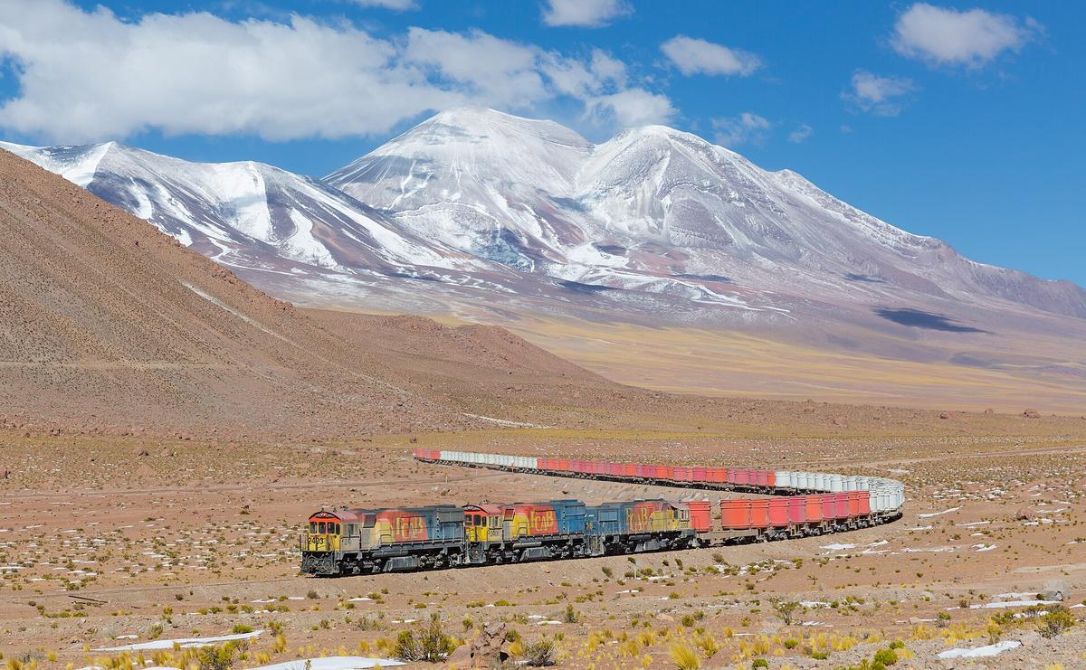
The Atacama Desert operates on its own logic. The Norte Grande is the driest non-polar desert on Earth. Key attractions sit at 2,400 to 4,500 metres. El Tatio Geysers at 4,320 metres require a pre-dawn start and multiple layers. San Pedro de Atacama at 2,400 metres needs two acclimatisation days before you head higher. The Valle de la Luna is a cracked salt crust best seen at sunset. The altiplano lakes and salt flats demand a four wheel drive or a tour. Book accommodation in San Pedro six months ahead for December through February.
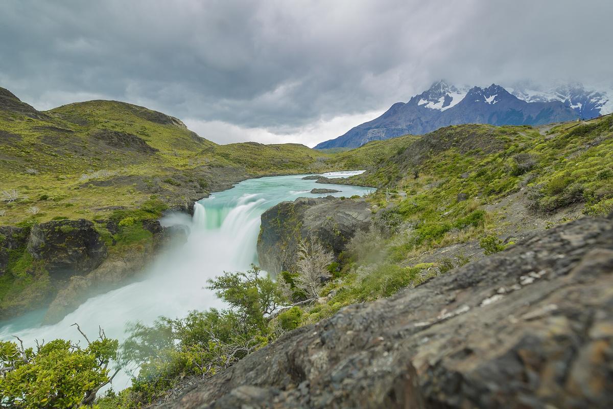
Southern Patagonia runs on wind and money. Torres del Paine is the icon. The Base Las Torres lookout requires an 8 to 10 hour hike. The park entry system is strict: book your campsite or refugio before you book your flight. Grey Glacier permits kayaking among icebergs. The wind is a physical hazard. Car doors get ripped off their hinges. Lightweight tents are shredded. Bring a four season tent and a windproof shell that reaches your wrists.
The Carretera Austral is the end of the road. Fuel availability is the limiting factor. Petrol stations are separated by 200 to 400 km. Card machines go down. Cash is required. Vehicle ferries connect Hornopirén to Caleta Gonzalo and other fjord crossings. Frequency varies seasonally. There is no road connection between the Aysén and Magallanes regions. Overland travel between them requires crossing into Argentina.
Easter Island Is Its Own Trip
Easter Island lies 3,700 km west of the mainland. The flight from the capital takes five hours. LATAM Airlines operates the only route. Cancellations due to weather or mechanical issues can strand visitors for days. The maximum stay for non resident foreigners is 30 days. You need a completed entry form and proof of accommodation. Book a minimum of three to five days. Do not attempt it as a weekend side trip.
Valparaíso And The Central Valley Are The Easy Wins
Valparaíso and Viña del Mar sit 90 minutes from the capital by Turbus. A dense day covers street art in the cerros and beaches. The Ascensores funiculars are rickety and only a handful work. Cajón del Maipo is 90 minutes by car for Andean reservoir views and hot springs. The wine valleys of Colchagua and the Maipo Valley sit within two hours of the capital. Book tastings ahead during peak season.

How Chilean Culture Shapes Your Trip
Chilean culture is famously reserved. The Spanish is fast and heavily idiomatic, using a unique voseo form and slang that remains impenetrable even for fluent Spanish speakers. Casual social connection can feel surprisingly elusive. Do not mistake the reserve for unfriendliness. It is a matter of pace. Conversations warm slowly.
Fiestas Patrias on September 18 and 19 causes nationwide travel chaos. Sold out buses. Closed businesses for a full week. Avoid travel during that period unless you are attending the celebrations. The PDI receipt is a fragile slip of paper. Losing it prevents hotel check-in and exit. Keep it inside your passport.
Chile is one of the most seismically active countries in the world. Building codes are strict. Evacuation protocols are posted in coastal areas for tsunami risk. Download the national emergency service app and know the evacuation route from your accommodation.
Chile is for You If
Chile suits adventure road trippers willing to self-drive for weeks. It suits serious hikers and mountaineers targeting Patagonia or the Atacama. It suits wine and food enthusiasts focused on the Central Valley. It suits astronomers and desert lovers seeking extreme aridity. It suits long term backpackers stringing together South American highlights.
Chile is not for travellers seeking dense, walkable urban charm or spontaneous village hopping. Its cities are functional grids. The distances between towns are vast. A tight one week schedule will feel maddeningly inefficient. Budget travellers expecting a cheap Latin American destination will find costs closer to Europe. Anyone who dislikes long, monotonous driving should skip the self-drive fantasy entirely.
Common Questions
How many days do I need for Chile?
14 days minimum. Anything less forces you to burn days on internal flights and miss either the north or the south entirely. Two weeks is enough for a single region. Three weeks lets you combine the Atacama with the lake district or the lake district with Patagonia, but not the Atacama with Patagonia.
Do I need a visa for Chile?
US, Canada, UK, EU, Australia, New Zealand, Japan, South Korea, and most Latin American citizens do not need a visa for tourism up to 90 days. Australians previously paid a reciprocity fee on arrival by air, but that fee has been abolished for all nationalities. All visitors receive a PDI receipt on entry. Losing this prevents hotel check-in and exit. Guard it like your passport.
What is the best month to visit Chile?
October or March. These shoulder months sit between the peak season crowds and the winter closures. Patagonia is still accessible. The Atacama is cool but clear. The capital is not empty. Prices are lower than December through February.
Is tap water safe to drink in Chile?
Yes, in the capital and most urban areas. Bottled water is recommended in San Pedro de Atacama and remote Patagonia. The high mineral content in desert water can cause stomach upset even if it is technically potable.
How do I get from Santiago to Patagonia?
Fly from the capital to Punta Arenas (PUQ) or Puerto Montt (PMC). LATAM, Sky Airline, and JetSMART operate the route. From Punta Arenas, it is a three hour bus or rental car drive to Puerto Natales, then another hour to the Torres del Paine entrance. Budget a full day for the transfer.
Can I use my credit card everywhere?
No. Cards are widely accepted in cities and tourist zones. Cash is required in rural areas, small towns, and for Carretera Austral fuel. ATMs in Patagonia and the Atacama run out of money by midday on weekends. Carry enough cash for three days in rural areas.
How bad is the wind in Patagonia?
Gusts over 100 km/h are routine in summer. Car doors get ripped off their hinges. Lightweight tents are shredded. Use a four season tent. Park your car facing into the wind. Do not open both doors at once.
Read next
-
 Staying Connected in Chile, eSIM, Local SIM, or Offline Maps
How to get online in Chile: the RUT barrier for local SIMs, the eSIM alternative, and where on the Carretera Austral and in the Atacama you will have zero signal.
Staying Connected in Chile, eSIM, Local SIM, or Offline Maps
How to get online in Chile: the RUT barrier for local SIMs, the eSIM alternative, and where on the Carretera Austral and in the Atacama you will have zero signal.
-
 Best Time to Visit Chile by Region and What Each Season Actually Delivers
Chile spans three climate zones: Patagonia peaks in summer, the Atacama can flood in January, and Fiestas Patrias shuts the country in September.
Best Time to Visit Chile by Region and What Each Season Actually Delivers
Chile spans three climate zones: Patagonia peaks in summer, the Atacama can flood in January, and Fiestas Patrias shuts the country in September.
-
 Getting Around Chile Without Underestimating the Map
Chile's long-distance buses are comfortable but slow, and flying between the Atacama and Patagonia means backtracking through Santiago every time.
Getting Around Chile Without Underestimating the Map
Chile's long-distance buses are comfortable but slow, and flying between the Atacama and Patagonia means backtracking through Santiago every time.
-
 Chile Visa Rules and the PDI Receipt You Must Not Lose
Most Western passport holders enter Chile visa-free but receive a PDI receipt on arrival—losing it prevents hotel check-in and exit.
Chile Visa Rules and the PDI Receipt You Must Not Lose
Most Western passport holders enter Chile visa-free but receive a PDI receipt on arrival—losing it prevents hotel check-in and exit.
-
 Cash and Cards in Chile, Where the Peso Still Rules
Cards work in Chilean cities but rural buses and Patagonian guesthouses still demand cash, and ATMs in remote towns run out on weekends.
Cash and Cards in Chile, Where the Peso Still Rules
Cards work in Chilean cities but rural buses and Patagonian guesthouses still demand cash, and ATMs in remote towns run out on weekends.
-
 Chile Safety Advice Without the Overblown Warnings
Chile is safer than most of Latin America, but Patagonian wind destroys tents and car doors, and remote roads mean help is far away.
Chile Safety Advice Without the Overblown Warnings
Chile is safer than most of Latin America, but Patagonian wind destroys tents and car doors, and remote roads mean help is far away.
-
 A Ground-Level Logistics Guide to Independent Travel in China
First-time independent travel in China: what you need to know about visas, rail booking, eSIMs, mobile payments, and power adapters.
A Ground-Level Logistics Guide to Independent Travel in China
First-time independent travel in China: what you need to know about visas, rail booking, eSIMs, mobile payments, and power adapters.
-
 How Solo Travelers Stay Ahead of Flight Delays and Cancellations
How solo travelers can track inbound aircraft, claim rebooking rights, and adjust ground transport when flights go wrong — step by step.
How Solo Travelers Stay Ahead of Flight Delays and Cancellations
How solo travelers can track inbound aircraft, claim rebooking rights, and adjust ground transport when flights go wrong — step by step.
-
 Why Your eSIM Might Not Work Abroad and How to Check Before You Go
Buying an eSIM doesn't guarantee signal abroad. Learn why coverage fails by location and how to verify reach before you commit to a plan.
Why Your eSIM Might Not Work Abroad and How to Check Before You Go
Buying an eSIM doesn't guarantee signal abroad. Learn why coverage fails by location and how to verify reach before you commit to a plan.