North America Travel Guide to a Continent of Extreme Contrasts
North America spans the United States, Canada, and Mexico across punishing distances best tackled by car, with cultural shifts at every border.
North America Travel Guide to a Continent of Extreme Contrasts
A single road trip across the United States, Canada, and Mexico can move from English to Spanish to French, from dollar to peso, and from rigid queueing to fluid negotiation within one day's drive. This guide sets honest expectations about the punishing scale, the non negotiable role of the private car, and the sharp cultural shifts at borders. The continent spans 24,709,000 km² and 11 time zones, from Cape Columbia at 83°06′N to the Suchiate River mouth at 14°32′N. The longest road distance, Prudhoe Bay, Alaska to Chetumal, Mexico via segments of the Pan American Highway, runs approximately 10,000 km. That is the real geography. A ten day itinerary stringing together New York, Los Angeles, Cancún and Banff is a fantasy, not a plan.
- Countries Covered: Canada, United States, Mexico
- Total Land Area: 24,709,000 km²
- Time Zones: 11 (UTC-10 to UTC-5, plus UTC-4 for Atlantic Canada)
- Northernmost Point: Cape Columbia, Ellesmere Island, Canada (83°06′N)
- Southernmost Point: Suchiate River mouth, Chiapas, Mexico (14°32′N)
- Longest Road Distance: Approx. 10,000 km (Prudhoe Bay, Alaska to Chetumal, Mexico)
- Land Borders: 2 (Canada, United States: 8,891 km; United States, Mexico: 3,145 km)
- Official Languages (Federal Level): English and French in Canada; Spanish in Mexico; none at US federal level
- Currencies: Canadian dollar (CAD), United States dollar (USD), Mexican peso (MXN)
- Mains Voltage: Canada and United States: 120 V, 60 Hz; Mexico: 127 V, 60 Hz
Road Trip Across North America: What the Maps Do Not Show
The private car dominates ground transport across all three countries. Outside a handful of city cores, a car is non negotiable. Rent one with a credit card, equip your phone with a data plan and offline maps, and accept that cellular dead zones are extensive in the Mountain West, northern Canada, and Mexico's interior. Download offline maps before crossing into rural zones in all three countries.
Rental Car Border Restrictions
The single thing that trips visitors up is assuming you can cross a border with a rental car. Most US rental contracts forbid driving into Mexico, and one way cross border drop offs between the US and Canada are rare and expensive. If your road trip includes both countries, plan separate rentals or confirm the policy with the specific agency before booking.
Distances That Punish Optimism
New York City to Los Angeles is approximately 4,500 km by road, about 41 hours of non stop driving. Toronto to Vancouver is 4,400 km, around 40 hours. Mexico City to Tijuana is 3,200 km, about 34 hours. These are not weekend drives. Roads where a car stops being optional include the Dempster Highway in Canada, with services more than 350 km apart, and the Dalton Highway in Alaska, with services more than 190 km apart. In Baja California, Ruta 5 south of San Felipe has no scheduled public transport and services more than 200 km apart.
Ferries As Essential Links
Where roads end, ferries begin. The Alaska Marine Highway System connects coastal communities with no road access, running from Bellingham, Washington to Dutch Harbor, Alaska. BC Ferries links Vancouver Island and coastal British Columbia communities to the mainland. Ferries connect Cozumel and Isla Mujeres to mainland Quintana Roo, Mexico. Factor these into your timeline; they run on schedules, not on demand.
No single transcontinental rail passenger service crosses all three countries. Amtrak and VIA Rail operate separate networks, and no passenger rail crosses the US Mexico border. Long distance bus networks including Greyhound, FlixBus, and ADO operate separate national systems, with cross border services limited to major city pairs.

North America Itinerary Planning: Three Weeks or Pick One
Minimum days to sample two of the three countries without collapsing into exhaustion: 21. Anything shorter forces you to pick one country or one narrow corridor. Visitors routinely plan itineraries that string together New York, Los Angeles, Cancún, and Banff in ten days, not grasping that a flight from New York to Los Angeles alone is six hours, the continent spans four time zones, and jet lag plus driving fatigue will eat half the trip. That is the most common mistake on the continent, and the one that ruins more trips than any other.
Pick A Corridor, Not The Whole Map
For trips under three weeks, choose one of these: the US Northeast corridor from Washington DC to Boston, a slice of the US Mountain West from Denver to Salt Lake City via the national parks, Canada's southern belt from Vancouver to Banff, or Mexico's Central Highlands from Mexico City to Oaxaca. Each offers enough density of landmarks and cultural variation to fill two weeks without transit burnout. The Yucatán Peninsula works as a self contained trip built around Chichén Itzá, Tulum ruins, and the colonial cities of Mérida and Campeche.
Peak Season And Avoid Windows
Peak season runs June through August, driven by school holidays across the US and Canada, warm weather in the northern national parks, and hurricane season avoidance in the Caribbean facing coasts. Prices spike, national park lodges sell out months ahead, and southern regions like Mexico's Yucatán and the US desert Southwest become dangerously hot. Avoid late November for US Thanksgiving week when airports and highways gridlock. Christmas to New Year brings peak pricing and closures everywhere. March through early April sees US and Canadian spring break crowds swamping Mexico's beaches and Florida. Avoid the US Gulf and Atlantic coasts and Mexico's Caribbean coast August through October for hurricane risk.
| Airport | Public Transport Option | Time | Cost |
|---|---|---|---|
| New York JFK | AirTrain to Jamaica Station, then LIRR to Penn Station | 50 min | Roughly $15–$20 USD |
| Los Angeles LAX | FlyAway bus to Union Station | 45–60 min | $10 USD |
| Toronto YYZ | UP Express train to Union Station | 25 min | CAD $12.35 |
| Mexico City MEX | Metrobús Line 4 or authorised airport taxi | 30–60 min | Taxi: MXN $250–$350 |
USA Canada Mexico Travel: Borders, Advisories, and Entry
The United States Department of State issues a travel advisory for Mexico; the same department also issues a travel advisory for Canada. The Government of Canada issues travel advisories for the United States. These are the issuing governments. Their risk assessments change annually. Check the version in force before you book, not the one your friend used last year. No single domestic advisory exists for the United States, but foreign governments including the UK FCDO and the Government of Canada issue their own.
Entry Authorizations
For the United States, visa waiver nationals need an ESTA, valid 2 years for multiple entries, administered by US Customs and Border Protection. For Canada, visa exempt foreign nationals arriving by air need an eTA, valid 5 years or until passport expiry, administered by Immigration, Refugees and Citizenship Canada. For Mexico, visa exempt foreign nationals receive an FMM on arrival, maximum stay 180 days, no electronic pre authorization. At land borders, citizens and permanent residents of Canada and the United States cross without electronic authorization; foreign nationals need the relevant visa, eTA, or ESTA as applicable. Mexican nationals with a Border Crossing Card cross the US Mexico border without pre authorization; foreign nationals need a visa or ESTA.
Currency And Friction
Three currencies operate across the three countries: the Canadian dollar, the United States dollar, and the Mexican peso. Tipping pressure in the US and Canada is relentless and expected at 18 to 25 percent in restaurants, bars, taxis, and salons; not tipping is a hostile act. Sales tax is never included in displayed prices in the US and Canada; the sticker price is a lie, and the final total is higher. Public restrooms are scarce in US and Canadian cities and often locked for customers only; in Mexico they may lack seats and charge a few pesos for paper. The US healthcare system is expensive and unforgiving; a single emergency room visit without insurance can cost thousands. Altitude sickness hits visitors to Mexico City, Denver, and Rocky Mountain parks who go from sea level to 2,000m or more in one day.
Connectivity
SIM cards and eSIMs are easy to buy on arrival in all three countries, but a single SIM rarely covers the continent well. You will likely need separate plans for the US, Canada, and Mexico. Public Wi Fi is common in US and Canadian cafés and libraries; in Mexico, look for Wi Fi gratis signs in plazas and restaurants.
,_Lake_Minnewanka_--_2022_--_2274.jpg)
North America Continent Guide: Districts, Landmarks, and Food
The US Northeast is dense, fast, expensive, and four season. The US South is humid, hospitable, slower, food obsessed, and church heavy. The US Midwest is agricultural, industrial, with Great Lakes shorelines and underrated cities. The US Mountain West is high altitude, arid, public land dominated, and cowboy mythic. The US West Coast is coastal, tech driven, wildfire prone, and dramatic. Canada's southern belt is a thin urban strip hugging the US border, polite, and cold. Canada's North is vast, subarctic, fly in, Indigenous led, and extreme. Mexico's Central Highlands are high altitude, colonial, volcanic, and the cultural core. Mexico's Yucatán Peninsula is limestone, cenotes, Maya ruins, tropical, and tourism heavy. Mexico's North is desert, maquiladora cities, beef culture, and cartel shadowed.
Landmarks Worth The Travel
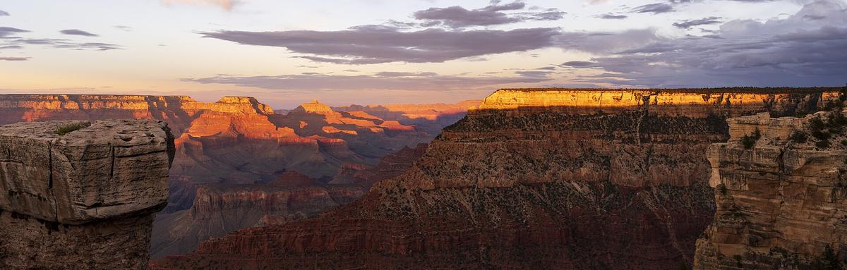
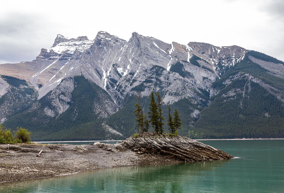
Grand Canyon South Rim in Arizona requires permits for below rim hikes. Yellowstone National Park in Wyoming has geysers and bison; lodge bookings open 12 months ahead. Banff National Park in Alberta has turquoise lakes; the Moraine Lake shuttle is now mandatory. Chichén Itzá in Yucatán has the famous pyramid; arrive at opening to beat crowds. Teotihuacán in Estado de México has massive pyramids, no shade, and is walkable from Mexico City. Statue of Liberty in New York requires ferry access; crown tickets book months ahead. Golden Gate Bridge in San Francisco is free to walk but often fogged in summer. French Quarter in New Orleans has live music and decayed elegance; avoid mid summer. Old Québec in Québec City is a fortified colonial core, French speaking, with a winter carnival. Niagara Falls on the Ontario New York border has thundering water; the Canadian side has the better panorama. Tulum ruins in Quintana Roo is a cliffside Maya site, small, and crowded by 10 AM. Redwood National and State Parks in California has towering coastal giants, is remote and wet. Denali National Park in Alaska has one road, grizzlies, and advance bus reservations required. Washington Mall in DC has a monument cluster and free museums; cherry blossom peak is late March.
Food That Defines Regions
US Southern barbecue splits between Texas brisket, Carolina pulled pork, and Memphis ribs. Mexican street tacos are al pastor and suadero with fresh salsa, eaten standing at a steel counter. Canadian poutine is fries, cheese curds, and brown gravy, a late night staple in Québec. New England lobster roll is cold with mayo in Maine and hot with butter in Connecticut. Yucatecan cochinita pibil is slow roasted pork in achiote and sour orange, eaten in a torta or tacos. California burrito is carne asada with fries inside, a San Diego invention. Southern US biscuit sandwich is buttermilk biscuit with fried chicken or sausage, breakfast only. New York bagel with lox and schmear is dense, chewy, boiled then baked, a breakfast ritual.
Who This Continent Suits and Who Should Skip it
North America suits road trippers who genuinely love long haul driving and do not mind multi day slogs between highlights. It suits urban explorers who want to compare the continent's heavyweight cities back to back. It suits wilderness seekers ready for serious backcountry logistics in national parks. It suits cultural travellers tracing Indigenous histories, colonial layers, and immigrant foodways across three massive countries. It suits multi generational families needing infrastructure that works, from car seats to accessible hotel rooms.
North America is not for budget backpackers on a shoestring; accommodation and intercity transport costs are punishing outside Mexico. It is not for travellers who dislike driving or cannot rent a car; you will be stranded in most of the continent. It is not for anyone seeking a compact, walkable, rail connected experience like Europe or Japan. It is not for people who want to do the continent in one trip. You cannot, and trying will make you miserable.
Countries in North America
-
 Canada
 is the second-largest country on earth, and its vastness punishes anyone who mistakes it for a quick trip between iconic sights.
Canada
Canada is the second-largest country on earth, and its vastness punishes anyone who mistakes it for a quick trip between iconic sights.
-
 Mexico
 is a high-contrast country where ancient pyramids meet chaotic megacities and Caribbean reefs sit hours from arid canyons. Here is how to choose your route.
Mexico
Mexico is a high-contrast country where ancient pyramids meet chaotic megacities and Caribbean reefs sit hours from arid canyons. Here is how to choose your route.
-
 United States
The United States delivers extraordinary geographic and cultural variety, but its sheer scale, car dependency, and tipping economy surprise first-timers. Start here.
United States
The United States delivers extraordinary geographic and cultural variety, but its sheer scale, car dependency, and tipping economy surprise first-timers. Start here.
Common Questions
How do I realistically scope a multi-country trip across the United States, Canada, and Mexico without underestimating distances?
Accept that the continent covers 24,709,000 km² and 11 time zones. The longest road distance is approximately 10,000 km. For any trip under three weeks, pick one country or one narrow corridor. Trying to hit New York, Los Angeles, Cancún, and Banff in ten days will fail because a flight from New York to Los Angeles alone is six hours.
Can I drive a rental car from the United States into Mexico?
Almost never. Most US rental contracts forbid driving into Mexico. One way cross border drop offs between the US and Canada are rare and expensive. Confirm the policy with the specific rental agency before booking.
Which government issues travel advisories for Mexico?
The United States Department of State issues a travel advisory for Mexico. The Government of Canada also issues advisories for Mexico. Their risk assessments change annually; check the version in force before you book.
What entry authorization do I need for Mexico as a visa-exempt traveller?
Visa exempt foreign nationals receive an FMM on arrival, valid for a maximum stay of 180 days. No electronic pre authorization is required.
How much should I tip in the United States and Canada?
Tip 18 to 25 percent in restaurants, bars, taxis, and salons. Not tipping is considered a hostile act. In Mexico, tipping practices vary but 10 to 15 percent is standard in tourist oriented restaurants.
What is the best season to visit the Yucatán Peninsula?
The dry season runs November through April. The rainy season runs May through October. Avoid the Atlantic hurricane peak from August through October.
Is there a passenger train that crosses the US Mexico border?
No. Amtrak and VIA Rail operate separate networks in the US and Canada. No passenger rail service crosses the US Mexico border.
Read next
-
Mexico
Mexico is a high-contrast country where ancient pyramids meet chaotic megacities and Caribbean reefs sit hours from arid canyons. Here is how to choose your route.
-
 Central America
 is a chain of compact, wildly diverse nations stitched together by long bus rides and border crossings that eat half a day.
Central America
Central America is a chain of compact, wildly diverse nations stitched together by long bus rides and border crossings that eat half a day.
-
United States
The United States delivers extraordinary geographic and cultural variety, but its sheer scale, car dependency, and tipping economy surprise first-timers. Start here.
-
Canada
Canada is the second-largest country on earth, and its vastness punishes anyone who mistakes it for a quick trip between iconic sights.
-
 A Ground-Level Logistics Guide to Independent Travel in China
First-time independent travel in China: what you need to know about visas, rail booking, eSIMs, mobile payments, and power adapters.
A Ground-Level Logistics Guide to Independent Travel in China
First-time independent travel in China: what you need to know about visas, rail booking, eSIMs, mobile payments, and power adapters.
-
 How Solo Travelers Stay Ahead of Flight Delays and Cancellations
How solo travelers can track inbound aircraft, claim rebooking rights, and adjust ground transport when flights go wrong — step by step.
How Solo Travelers Stay Ahead of Flight Delays and Cancellations
How solo travelers can track inbound aircraft, claim rebooking rights, and adjust ground transport when flights go wrong — step by step.
-
 Why Your eSIM Might Not Work Abroad and How to Check Before You Go
Buying an eSIM doesn't guarantee signal abroad. Learn why coverage fails by location and how to verify reach before you commit to a plan.
Why Your eSIM Might Not Work Abroad and How to Check Before You Go
Buying an eSIM doesn't guarantee signal abroad. Learn why coverage fails by location and how to verify reach before you commit to a plan.