New Zealand Travel Safety Advice for Roads, Coast and Backcountry
New Zealand has a low crime rate, but the real risks are driving fatigue, alpine weather swings, and sandfly swarms. Here is what the safety pamphlets underplay.
Is New Zealand Safe for Travellers
You drive for three hours on a sealed two-lane highway, no median barrier, a 100 km/h limit you cannot reach because the road curves through a mountain pass and the rain has turned to sleet. You are watching the road surface for black ice, the rearview mirror for the campervan behind you, and the GPS for the next one-lane bridge. This is the moment when most travellers realise that safety in this country has almost nothing to do with crime. Violent crime is low. Real risks are not.
New Zealand Natural Hazards Driving: the Real Road Risk
New Zealand's roads kill more visitors than any criminal does. The state highway network runs roughly 94,000 km. About 65% is sealed. That leaves long stretches of gravel, winding alpine passes, and single-lane bridges that require you to yield to traffic already on the bridge. Tourists freeze at these bridges constantly. They misread the signs. The red arrow gives way; the black arrow has right of way. Hesitate and you cause a crash.
Why Your Drive Takes Longer Than The Map Says
Google Maps assumes you will drive 100 km/h. You will not. On the narrow, winding roads of the South Island West Coast, across the Mackenzie Basin, or up the Desert Road, add 25 to 30% to any journey over 100 km. A drive from Christchurch to Franz Josef Glacier takes five hours, not four. A Queenstown to Milford Sound coach cruise becomes a 12-hour day.
Winter Driving And Where Chains Are Mandatory
Winter driving adds black ice on shaded roads and alpine passes. The Lindis Pass, Arthur's Pass, the Milford Road, and the Desert Road all require snow chains when conditions dictate. Entry-point signs post the requirement. Carry chains in the car between June and October. Police check.
Petrol is expensive and stations are sparse. Fill up before you leave town, especially on the West Coast and across the Mackenzie Basin. Running out on a rural stretch means walking kilometres with no mobile coverage to the nearest farmhouse.

| Rule | What To Do | Penalty |
|---|---|---|
| One-lane bridge protocol | Yield to traffic already on the bridge; follow signposted priority direction | Collision risk; no fine |
| Give way rule at intersections | Left-turning vehicle gives way to oncoming right-turning traffic | Collision risk; fine for fail to give way |
| Roundabout rule | Give way to vehicles on the roundabout coming from the right | Collision risk; fine |
| Mobile phone use while driving | Do not touch a hand-held phone at all while driving | Instant fine |
| Blood alcohol limit for full licence | 0.05% | Fine, court appearance, loss of licence |
| Blood alcohol limit under 20 years | 0.00% | Fine, court appearance, loss of licence |
Sandfly Bites New Zealand Prevention: the Misery You Were Not Warned About
Sandflies are not a joke. They are a genuine quality-of-life issue on the West Coast of the South Island, in Fiordland, at Milford Sound, and anywhere near lakes or rivers in the west. They bite through thin clothing. They are most active at dawn and dusk. Their peak season runs from spring through autumn, exactly when most tourists visit.
Where You Need Repellent And Where You Do Not
DEET repellent is non-negotiable. Products containing picaridin also work, but DEET is the standard. Treat your clothing with permethrin if you are heading into Fiordland or Abel Tasman National Park for multiple days. Sandflies are absent or sparse in most urban and eastern areas. Auckland, Christchurch, Queenstown town centre, and the east-coast beaches of the South Island have few or none. Skip the repellent there. You absolutely need it at the Pancake Rocks at Punakaiki, on any walk near Lake Matheson, and at the Milford Sound visitor centre.
Milford Sound Road Avalanche Risk: Winter Closures That Wreck Plans
The Milford Road, State Highway 94, runs from Te Anau to the sound through the Homer Tunnel. In winter and spring, avalanche risk closes this road for hours or days at a time. The New Zealand Mountain Safety Council issues avalanche advisories for alpine areas. NZ Transport Agency avalanche teams control the road, firing explosives at the slopes to trigger controlled slides. When they close it, they close it. There is no alternate route. One road in, one road out.
How To Book Around A Closure
If you book a cruise from Queenstown between June and October, build in a buffer day. The coach trip each way means a 12-hour day even without delays. If the road closes while you are on the far side, you sleep in the car park. No hotels absorb that many people. Check the MetService forecast and the NZ Transport Agency road status before you leave Queenstown. Heavy snow or rain in the forecast the day before means reschedule.
New Zealand Hiking Track Safety: the Risks That Send Rescue Teams Out
Two things dominate track safety here: weather that changes in an hour and rivers that rise while you cross them. The Tongariro Alpine Crossing is a 19.4 km day hike that kills people who ignore the forecast. The track crosses exposed alpine terrain at 1886 metres. A clear morning turns to gale-force winds and whiteout by noon. The Outdoor Safety Code from the New Zealand Mountain Safety Council reads: plan your trip, tell someone, be aware of the weather, know your limits, take sufficient supplies. That is not a slogan. It is the checklist that separates a great day from a call to the Rescue Coordination Centre NZ.
River Crossings And Backcountry Water
River crossings kill trampers on multi-day walks in Fiordland, on the Routeburn Track, and on the Rees-Dart circuit. The water comes from rain or snowmelt and rises fast. If the water is above your knee, the current is stronger than it looks. Giardia is present in some backcountry water. Boil or filter everything. Do not rely on finding huts with drinkable tap water.
Booking The Great Walks
Book your Great Walks in advance. The booking system opens annually. Slots fill within hours for the Milford, Routeburn, Kepler, and Abel Tasman tracks. Walk these tracks outside the official season, late October to late April, and you face reduced facilities, no hut wardens, and higher avalanche risk in the alpine passes.

Reading Between the Lines of Official Advice
The government travel advisory from SafeTravel, the Ministry of Foreign Affairs and Trade unit, is accurate but general. It tells you the crime rate is low and the roads are narrow. It does not tell you that the sandfly misery at Milford Sound will drive you indoors an hour before sunset in December. It does not tell you that kea parrots in the Homer Tunnel car park will strip the rubber seals from your rental windscreen wipers while you take a photo. It does not tell you that supermarket trading hours in small towns stop at 6 pm and nothing is open on Sunday.
Your home-country foreign ministry issues its own advice. Read it. Then read the local forecasts. Then add a buffer day.
What to Do Next: the Single Most Common Traveller Failure
Underestimate driving time. Every traveller does it. You look at the distance between Queenstown and Milford Sound, see a plausible number on the map, and book a 10 am cruise. Then you drive the Milford Road behind a campervan doing 60 km/h, stop for photos, hit roadworks, and arrive at 12:15 pm having missed your boat. The ticket is non-refundable. Take the Google Maps time, add 30%, and book the next sailing after that. Then you are not the person sleeping in the Milford Sound car park.
New Zealand Travel Safety Advice: Common Questions
What is the emergency number in New Zealand?
111 connects you to police, ambulance, and fire. An interpreter service is available through 111. For non-emergency police matters, call 105. For free 24-hour medical advice, call Healthline on 0800 611 116.
Do I need travel insurance for New Zealand?
Yes. The Accident Compensation Corporation (ACC) covers visitors for accidental injury treatment costs regardless of fault. It does not cover illness, non-acute care, or medical evacuation. Travel insurance covers those gaps. The New Zealand government strongly recommends it.
Is the tap water safe to drink everywhere?
Yes, in all municipal supplies and most rural rainwater-tank supplies unless signposted otherwise. In the backcountry, Giardia is present in some rivers, lakes, and streams. Boil or filter backcountry water.
What is the speed limit and do speed cameras enforce it strictly?
The default urban limit is 50 km/h. The default rural limit is 100 km/h. School zones are variable 30 to 40 km/h during active times. Speed cameras may trigger at 4 km/h over the limit. Tolerance varies by region and camera type. The official enforcement standard is published by the NZ Police. Do not assume a buffer.
Can I use my overseas driver licence?
Yes, for up to 12 months from your arrival, provided the licence is in English or accompanied by an accurate translation. An International Driving Permit is accepted. New Zealand drives on the left.
What should I do in an earthquake?
Drop, cover, and hold. If you are on the coast and feel a long or strong earthquake, move inland or to high ground immediately. That is your natural tsunami warning. GNS Science issues volcanic alert levels for active volcanoes. Stay out of geothermal areas marked as closed.
What is the sandfly situation and how do I protect myself?
Sandflies are thick on the West Coast, in Fiordland, and at Milford Sound year-round, peaking at dawn and dusk from spring through autumn. They bite through thin clothing. DEET repellent is non-negotiable. They are absent or sparse in most urban and eastern areas.
Read next
-
 Staying connected in New Zealand eSIM local SIM or offline maps
New Zealand cannot fix its mobile service. No carrier will, because the geography does not permit it.
Staying connected in New Zealand eSIM local SIM or offline maps
New Zealand cannot fix its mobile service. No carrier will, because the geography does not permit it.
-
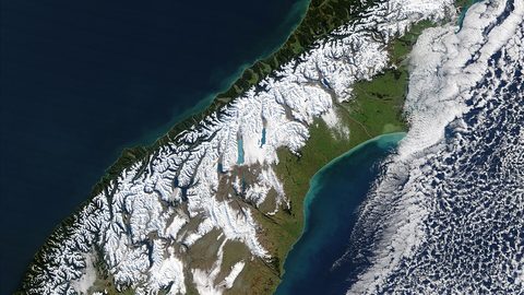 Best Time to Visit New Zealand, What Each Season Actually Delivers
New Zealand summer runs December to February and brings crowds, sandflies, and booked-out campsites. Here is what each season actually means for your trip.
Best Time to Visit New Zealand, What Each Season Actually Delivers
New Zealand summer runs December to February and brings crowds, sandflies, and booked-out campsites. Here is what each season actually means for your trip.
-
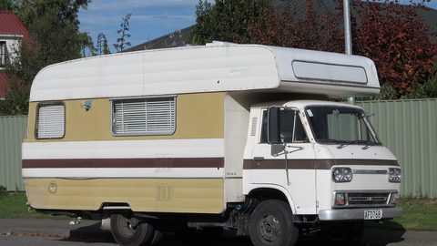 Getting Around New Zealand, Why Self-Drive Is the Default and What the Map Hides
New Zealand has no efficient inter-regional public transport. A rental car is the default, and driving times are far longer than the map suggests.
Getting Around New Zealand, Why Self-Drive Is the Default and What the Map Hides
New Zealand has no efficient inter-regional public transport. A rental car is the default, and driving times are far longer than the map suggests.
-
 New Zealand Visa Requirements, Who Needs an NZeTA and Who Does Not
Most visitors need an NZeTA before boarding a flight to New Zealand. Here is who needs a full visa, who qualifies for the waiver, and how long each takes.
New Zealand Visa Requirements, Who Needs an NZeTA and Who Does Not
Most visitors need an NZeTA before boarding a flight to New Zealand. Here is who needs a full visa, who qualifies for the waiver, and how long each takes.
-
 Money in New Zealand, Cards, Cash and What Actually Works at the Till
New Zealand runs on contactless cards and EFTPOS, but rural cafes and roadside stalls still want cash. Here is what to carry and when.
Money in New Zealand, Cards, Cash and What Actually Works at the Till
New Zealand runs on contactless cards and EFTPOS, but rural cafes and roadside stalls still want cash. Here is what to carry and when.
-
 What a trip to New Zealand costs shaped by season and style not a single number
How a New Zealand trip budget actually works, from the big unavoidable costs to the seasonal spikes and the spending leaks that catch first-timers out.
What a trip to New Zealand costs shaped by season and style not a single number
How a New Zealand trip budget actually works, from the big unavoidable costs to the seasonal spikes and the spending leaks that catch first-timers out.
-
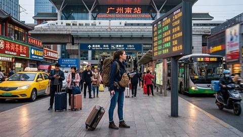 A Ground-Level Logistics Guide to Independent Travel in China
First-time independent travel in China: what you need to know about visas, rail booking, eSIMs, mobile payments, and power adapters.
A Ground-Level Logistics Guide to Independent Travel in China
First-time independent travel in China: what you need to know about visas, rail booking, eSIMs, mobile payments, and power adapters.
-
 How Solo Travelers Stay Ahead of Flight Delays and Cancellations
How solo travelers can track inbound aircraft, claim rebooking rights, and adjust ground transport when flights go wrong — step by step.
How Solo Travelers Stay Ahead of Flight Delays and Cancellations
How solo travelers can track inbound aircraft, claim rebooking rights, and adjust ground transport when flights go wrong — step by step.
-
 Why Your eSIM Might Not Work Abroad and How to Check Before You Go
Buying an eSIM doesn't guarantee signal abroad. Learn why coverage fails by location and how to verify reach before you commit to a plan.
Why Your eSIM Might Not Work Abroad and How to Check Before You Go
Buying an eSIM doesn't guarantee signal abroad. Learn why coverage fails by location and how to verify reach before you commit to a plan.