How to Think About Safety in the United States
Safety in the United States is hyperlocal, and the visible poverty in public spaces can jar first-timers. Here is how to read the advice without being misled.
How to Think About Safety in the United States
You step out of a New York City subway at 23:00. The block is empty except for three people sleeping against a steam grate. A block west, a doorman stands outside a tower with a marble lobby. Five blocks north, a street fair is still running. This is the central fact of United States safety for travellers: the country is not uniformly safe or unsafe. Safety is block by block, hour by hour. It demands a different kind of attention than most visitors are used to.
The statistics published by the U.S. Department of State and local police departments are truthful but useless at the block level. A city with a middling crime rate can contain neighbourhoods that rank among the safest in the world and streets where you should not walk alone after dark. The question a visitor needs to answer is not whether America is safe. It is how to read the signals in the place where you actually are.

| Region | Primary Risk | Peak Season | What To Do |
|---|---|---|---|
| Gulf Coast (Texas to Florida) | Hurricanes | June 1 - November 30, peak August-October | Monitor National Hurricane Center during hurricane season; avoid late August to early September; evacuate if instructed |
| Great Plains (Texas to Dakotas) | Tornadoes | March-June, secondary peak November in Deep South | Know the difference between a watch (conditions possible) and a warning (tornado sighted); shelter in an interior room, no windows |
| West Coast (California to Washington) | Wildfires and Earthquakes | May-October for fires, year-round for quakes | Check AirNow.gov for smoke conditions; pack N95 masks if visiting in fire season; know earthquake drop-cover-hold-on protocol |
| Rocky Mountain West (Colorado to Montana) | Wildfires and Altitude Sickness | May-October for fires; altitude affects visitors above 8,000 ft (2,440 m) | Acclimatise for 24 hours before hiking; carry water; check InciWeb for fire closures |
| Northeast and Midwest | Winter Storms and Heat | November-March for snow; June-September for heat | Check 511 road condition systems in winter; never drive through flooded streets in summer |
Is America Safe for Tourists? the Honest Answer
What the Data Actually Shows
Yes, for the vast majority of visitors, in the vast majority of places. But the answer comes with conditions. Violent crime against tourists is rare. The risks that will affect your trip are smaller, more mundane, and more predictable than the headlines suggest.
The single biggest danger you face in the United States is driving. Road crashes kill far more people than violent crime does. Visitors are especially vulnerable because they are unfamiliar with the rules. Seat belts are mandatory for all occupants in every seating position in every state. The blood alcohol limit for drivers aged 21 and over is 0.08% in all 50 states. Right turn on red is permitted everywhere after a complete stop unless a sign prohibits it. New York City bans it by default. Speed limits on rural interstates run 65 to 80 mph (105 to 129 km/h) depending on the state, and the distances are longer than they look on a map. A five-hour drive between two dots is normal. The single biggest trip-up: assuming you can make that drive in three.
Smaller Risks That Trip People Up
Jaywalking laws are enforced unpredictably and fines are real in some downtowns. Police ticket pedestrians in specific cities. You cannot assume that crossing against the light is tolerated everywhere, even if locals do it. Public restrooms are scarce in most cities; you are expected to buy something to use a cafe's facilities. Tap water is safe from municipal supplies everywhere except in parts of the rural Southwest and Plains where it tastes strongly of minerals or sulphur, and on tribal lands where local boil water advisories may be in effect.
US Gun Laws and Visitors: What You Actually Need to Know
Firearm possession by non-immigrant aliens is prohibited unless you are entering for hunting or sporting purposes with a valid hunting license or meeting a state-specific exception. You are not going to be stopped and asked. You are not going to encounter firearms in most places you visit as a tourist.
The prevalence of firearms is a cultural reality. It is visible in some states more than others. Talk about it with your travel companions before you go, not after you arrive. If the fact that the United States has no federal universal healthcare, widespread firearms ownership, and a tipping culture that is effectively mandatory at sit-down restaurants (18 to 22% of the pre-tax bill) is genuinely stressful to you rather than just different, skip it. The country is not for everyone.
Avoid political arguments about gun laws with strangers. Do not touch or handle firearms even out of curiosity at a shooting range unless you are sure you want to. Most visitors never see a gun outside of a police holster.
Neighborhood Safety United States: Reading the Block by Block Reality
Learn to Read a Block in 30 Seconds
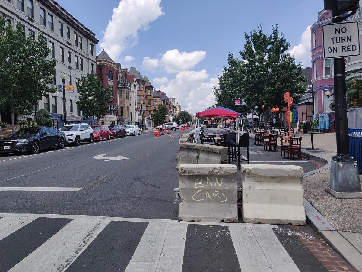
The most useful skill you can develop as a visitor is learning to read a neighbourhood fast. A few blocks can change the character of a place. The poverty is visible. The inequality in public spaces can be jarring for visitors expecting a polished experience everywhere. The lack of a social safety net means you may encounter more visible homelessness than you expected.
Here is how to read a block:
- Lighting. Well-lit streets with active businesses at street level are safer after dark than residential blocks with gaps between houses. If the street is dark and the shops are shuttered, do not walk it alone at night.
- Foot traffic. A street with people on it at 22:00 is safer than an empty one. This is not a judgement about the people; it is a practical observation about visibility.
- Bars on windows. In many American cities, bars on ground-floor windows are not a sign of a bad neighbourhood. They are a sign of a neighbourhood that has been through cycles of disinvestment and reinvestment. Use your judgement.
- Transit stops. Subway stations and bus stops that are isolated after dark are higher risk. Wait for the next train in a well-lit area near a shop or cafe that is still open.
What You Will See and How to Handle It
The visible poverty and homelessness can be uncomfortable. It is not dangerous. It is a reality of the country. Be prepared for it emotionally. Treat the people you encounter with the same dignity you would anywhere else.
.jpg)
Natural Disaster Risks USA Travel: What to Prepare for
Hurricanes and Wildfires
Hurricanes. If you are travelling to the Gulf Coast (Texas, Louisiana, Mississippi, Alabama, Florida) or the Southeast coast (Georgia, the Carolinas) between June 1 and November 30, check the National Hurricane Centre website daily. Peak activity runs August through October. If a hurricane is forecast to hit your location within 72 hours, leave. Do not wait. Avoid Gulf Coast states from late August to early September for hurricane risk and peak humidity.
Wildfires. In the West and Southwest, wildfire season runs approximately May through October, with the peak in late summer. Parts of California face a year-round risk. Check AirNow.gov for air quality before you travel. If the air quality index is high, wear an N95 mask outdoors and consider whether the trip is worth the health risk, especially if you have respiratory conditions.
Earthquakes, Heat, and Winter Storms
Earthquakes. The Pacific Coast, particularly California, Oregon, and Washington, faces seismic risk. The last major earthquake on the San Andreas Fault was in 1906. It will happen again. When you check into a hotel, note the evacuation routes. Know the drop, cover, and hold-on protocol. Do not stand in a doorway; that is outdated advice. Get under a sturdy desk or table.
Heat. In the Southwest, southern Great Plains, and Deep South, temperatures regularly exceed 100 degrees Fahrenheit (38 degrees Celsius) from June through September. The desert heat is dry, which makes it easier to tolerate but also easier to dehydrate without noticing. Drink water before you are thirsty. Carry a refillable bottle. Avoid hiking in the middle of the day.
Winter storms. In the northern tier states, Midwest, and Northeast, winter storms run November through March. Mountain snow arrives as early as October and can last through May. If you are driving in winter, carry tyre chains in mountain passes. Many states require them in chain-control areas. The 511 phone and web systems operated by state departments of transportation give current road conditions and closures. Check them before you drive.
The Uncomfortable Truths: Visible Poverty, Inequality, and the Absence of a Safety Net
What You Will Encounter
The United States has no universal healthcare. It has no nationalised public restroom system. It has no guaranteed housing for people who fall through the cracks. As a visitor, you will see the consequences of these absences in ways that can be confronting.
You will encounter people living on the street in cities like Los Angeles, San Francisco, Portland, Seattle, New York, and Washington DC. You will see encampments under highway overpasses and in public parks. You will be asked for money. This is one of the things that makes the United States not for travellers who find this kind of inequality genuinely stressful rather than just different.
How to Respond
Carry small bills if you want to give. If you do not want to give, a polite no is fine. Do not engage in arguments. Do not take photos of people without their permission. Understand that this is not a failure of the city you are visiting; it is a policy choice made over decades.
Tipping culture is effectively mandatory at sit-down restaurants (18 to 22% of the pre-tax bill). Sales tax is added at the register, not displayed on shelf prices, and varies by city and county. The lack of a social safety net extends to how service workers are paid: tipped wages are below the minimum wage in many states. Not tipping is seen as withholding wages, not expressing dissatisfaction.
What to Do Before You Arrive
Book Early and Get Connected
Book accommodation 12 months ahead for Grand Canyon South Rim, Yellowstone, and Yosemite Valley if you want to stay inside the parks. Entry reservations are required for Yosemite during peak season. Timed entry reservations are also needed at some other popular parks; the system varies by park and changes annually. Check Recreation.gov before you book flights.
Download offline maps before you drive through the Mountain West or Great Plains, where cell phone coverage is patchy. Prepaid eSIMs from uPhone work well for data. A physical US SIM from T-Mobile or AT&T bought at an airport gives better rural coverage. Free Wi-Fi is widespread in chain hotels and coffee shops but patchy in national parks and rural areas.
Documents and Entry Requirements
Check your passport validity. For Visa Waiver Program (VWP) travellers from 42 countries, your passport must be valid for the entire period of your intended stay; there is no six-month rule for VWP entries. If you need a B-2 visitor visa, apply through a US embassy or consulate abroad. ESTA authorisation is required in advance for VWP travellers and is valid for two years or until your passport expires, whichever comes first.
Common Questions
Is the United States safe for solo female travellers?
Yes, with the same caveats that apply everywhere. The block-by-block rule matters most. Do not walk alone after dark in any area you have not scouted during daylight. Use ride-hailing services (Uber and Lyft operate in most urban areas) instead of walking through empty streets. Share your location with a friend back home. The emergency telephone number is 911, and language interpretation services are available in most jurisdictions.
What should I do if I get sick or injured while visiting the US?
Call 911 for emergencies. Federal law (EMTALA) requires hospital emergency departments to provide medical screening and stabilising treatment regardless of your ability to pay. You will be billed after the fact, and costs are high. Get medical evacuation insurance and travel health insurance with high coverage limits. Foreign health insurance is not accepted by most US providers. Urgent care centres are a lower-cost option for non-life-threatening conditions.
Do I need to worry about wildlife in national parks?
Yes, and the risks are specific. In Yellowstone and Grand Teton, bison and elk injure more people than bears do. Stay at least 25 yards from bison and elk, and at least 100 yards from bears. Black bears are present in many forested regions; grizzly (brown) bears are in Alaska, Montana, Wyoming, Idaho, and Washington. Food storage regulations are enforced in bear country. Do not leave food in your car or tent. In the Southeast, alligators are present in freshwater. Do not approach them.
How do I find out if a neighbourhood is safe before I go?
Ask your hotel front desk. They know the block-level reality. Use Google Street View to see what the area looks like during the day and at night. Check local subreddits for the city you are visiting. Do not rely solely on citywide crime statistics; they are not granular enough to tell you whether a specific street is safe at 02:00.
Is it safe to drive across the United States?
Road crashes are the biggest danger you face as a visitor. The distances are enormous, and the single biggest trip-up is underestimating driving times. A five-hour drive is short in the United States. Seat belts are mandatory for all occupants. The speed limit on rural interstates is 65 to 80 mph (105 to 129 km/h). Do not drive tired. Do not drive after drinking. The blood alcohol limit is 0.08% for drivers 21 and over in all 50 states.
What about gun violence in schools or public places?
These events are statistically very rare, but they dominate news coverage outside the US. They are not listed as a risk factor for tourists because the odds of being involved in one are vanishingly small. Your real risks are driving, heat, and dehydration in national parks. The prevalence of firearms is a cultural reality that may make you uncomfortable. It is not a daily danger for visitors who stay in tourist areas.
Do I need special vaccinations to enter the United States?
No routine vaccination requirements for entry. The CDC recommends routine vaccines and issues annual disease-specific guidance. There is no mandatory vaccination requirement for visitors. Tick-borne diseases (Lyme disease in the Northeast and Upper Midwest from April to October, Rocky Mountain spotted fever in the Southeast) are real risks if you hike in tall grass. Mosquito-borne diseases (West Nile virus is present in all 48 contiguous states during warm months) are also a concern. Use insect repellent.
Read next
-
 Staying Connected While Traveling Through the United States
Prepaid eSIMs work well in US cities, but a physical T-Mobile or AT&T SIM bought at arrival gives better rural coverage for national parks and long highway drives.
Staying Connected While Traveling Through the United States
Prepaid eSIMs work well in US cities, but a physical T-Mobile or AT&T SIM bought at arrival gives better rural coverage for national parks and long highway drives.
-
 Best Time to Visit the United States by Region and Season
The United States spans so many climates that no single season works everywhere. Here is what each region delivers, and when to stay away.
Best Time to Visit the United States by Region and Season
The United States spans so many climates that no single season works everywhere. Here is what each region delivers, and when to stay away.
-
 Getting Around the United States Without Underestimating the Distances
Outside the Northeast Corridor, the United States runs on cars and domestic flights. Distances are enormous and Amtrak is scenic but slow.
Getting Around the United States Without Underestimating the Distances
Outside the Northeast Corridor, the United States runs on cars and domestic flights. Distances are enormous and Amtrak is scenic but slow.
-
 United States Visa Rules and the ESTA Process Explained Simply
Most visitors to the United States need either an ESTA authorization or a B-2 tourist visa. Here is who needs which and how the process runs.
United States Visa Rules and the ESTA Process Explained Simply
Most visitors to the United States need either an ESTA authorization or a B-2 tourist visa. Here is who needs which and how the process runs.
-
 Money in the United States, Cards, Cash, Tipping and That Extra Tax
The United States runs on cards, but sales tax is added at the register and tipping 18-22% is effectively mandatory. Here is how money actually works.
Money in the United States, Cards, Cash, Tipping and That Extra Tax
The United States runs on cards, but sales tax is added at the register and tipping 18-22% is effectively mandatory. Here is how money actually works.
-
 What It Costs to Travel Across the United States Without Blowing Your Budget
How a United States trip budget is shaped by the non-negotiable cost of a car, the tipping layer on every meal, and sales tax that appears only at the register.
What It Costs to Travel Across the United States Without Blowing Your Budget
How a United States trip budget is shaped by the non-negotiable cost of a car, the tipping layer on every meal, and sales tax that appears only at the register.
-
 Nevada
 is a state of extreme contrasts: the 24-hour artificial fantasy of the Las Vegas Strip gives way to vast, silent desert where services vanish and the
Nevada
Nevada is a state of extreme contrasts: the 24-hour artificial fantasy of the Las Vegas Strip gives way to vast, silent desert where services vanish and the
-
 Maryland
 is built around the Chesapeake Bay, where steamed crabs and slow ferries set the pace and the two shores are close on a map but far apart by road.
Maryland
Maryland is built around the Chesapeake Bay, where steamed crabs and slow ferries set the pace and the two shores are close on a map but far apart by road.
-
 California
Eight hundred miles of desert, alpine range, and temperate coast in one state. The season that suits one part rules out another.
California
Eight hundred miles of desert, alpine range, and temperate coast in one state. The season that suits one part rules out another.