When to Go to the United States and What Each Season Actually Delivers
The United States spans so many climates that no single season works everywhere. Here is what each region delivers, and when to stay away.
When to Go to the United States and What Each Season Actually Delivers
By late June, the Grand Canyon South Rim parking lots fill by 9am and the shuttle queue back to Flagstaff can run past an hour. The same scene plays out from Yellowstone to Great Smoky Mountains. The United States does not have one season that suits every traveller. Your best window depends entirely on which region you target and what you plan to do, because this country spans six time zones, eight primary climate zones, and a latitude range from 24°N in Key West to 49°N at the Northwest Angle in Minnesota.
Summer is peak season for the national parks and coasts. It also brings high-season prices, heat, and crowds that turn a scenic overlook into a queue. Winter means ski resorts and holiday travel crush in late December, plus road closures in the Rockies and the Northeast. Spring and fall deliver the mildest conditions for most regions, but each carries specific risks depending on latitude and elevation. Here is what each season actually delivers across the country's major geographic districts, and the windows you should actively avoid.
The United States rewards road-trippers willing to drive long hours and national-park collectors who plan months ahead. It is not for anyone unwilling to fly repeatedly or spend 14 days minimum. Anything less misrepresents the country's diversity. The lack of a social safety net means visible poverty in public spaces can be jarring. Widespread firearms and a mandatory tipping culture of 18 to 22 percent at sit-down restaurants can be stressful for some visitors.


United States Seasons by Region
The contiguous 48 states follow a four-season cycle. Winter runs December to February, spring March to May, summer June to August, and fall September to November. Southern Florida and Hawaii operate on a two-season cycle: wet season from May to October and dry season from November to April. Northern Alaska has a long winter from October to April and a short summer from June to August, with brief transitional periods.
Latitude splits the seasonal calendar around the 35°N to 40°N line. North of that line, the four-season cycle is pronounced: cold winters, mild summers, distinct spring and fall windows. South of it, winters are milder and summers longer and hotter. Altitude matters as much as latitude. Elevations above roughly 2,100 metres (7,000 feet) in the Southwest and Rockies experience winter conditions from October to May regardless of latitude. Elevations below roughly 300 metres (1,000 feet) in the Southwest experience summer heat extremes and mild winters regardless of latitude.
Regional Climate Breakdowns
The Northeast Corridor cities from Boston to Washington DC have a four-season climate with humid summers and snowy winters. The South from Texas to Florida is subtropical with high humidity and mild winters. The Pacific Coast has a Mediterranean climate with dry summers and a rainy season November to April. The Pacific Northwest west of the Cascades is cool and wet from October to May, dry and mild in summer.
Summer Travel in the USA: Peak Crowds and Heat
June to August is the primary peak season. Schools are out. Domestic demand spikes. National parks are fully open and coastal areas reach their warmest water temperatures. All mountain passes in the Rocky Mountain West are open, which is the only window to access high-elevation trails without snow. The Pacific Northwest west of the Cascades is dry and mild, making it one of the best summer regions in the country. In Alaska, all roads and facilities are open, daylight hours are long, and mosquitoes are abundant in the interior.
Where Summer Hurts
The downside is extreme heat in the Southwest deserts where low elevations regularly exceed 43°C (110°F). The monsoon season from July to September brings flash floods and dust storms. The Southeast and Gulf Coast are hot and extremely humid, with afternoon thunderstorms daily in Florida. Summer is also wildfire season across the western states, typically May to October, extending into November in California during dry years. Wildfire smoke can disrupt travel and affect air quality in the Pacific Northwest, California, and the Rocky Mountain region.
How to Beat the Crowds
Book national park lodging 12 months ahead for Grand Canyon, Yellowstone, and Yosemite. July 4th weekend and Labor Day weekend create the worst park crowding of the year. Arrive without reservations at those times and you will likely be turned away at entry gates. Get to the Grand Canyon South Rim by 8am or plan to wait. Use the shuttle system at Zion Canyon where private vehicles are restricted. For Yosemite, timed entry reservations are required during peak season and sell out weeks in advance.
| Region | Conditions | Key Problems |
|---|---|---|
| Northeast and Midwest | Warm to hot and humid; peak for beaches, lakes, and parks | Thunderstorms common |
| Southeast and Gulf Coast | Hot and extremely humid; hurricane season begins June 1 | Afternoon thunderstorms daily in Florida |
| Rocky Mountain region | All passes open; peak for hiking, camping, and parks | Afternoon thunderstorms with lightning risk at elevation |
| Southwest deserts | Extreme heat above 43°C (110°F) at low elevation | Monsoon flash floods and dust storms July to September |
| Pacific Northwest | Dry and mild west of Cascades | Wildfire smoke possible from regional fires |
| California | Dry statewide; coastal fog in morning | Extreme heat in interior deserts; wildfire smoke possible |
| Alaska | Peak season; all roads and facilities open | Mosquitoes abundant in interior |
| Hawaii | Warm year-round; hurricane season in effect | South shores calmer for swimming |
National Parks: Best Months to Visit
The 63 national parks draw the most visitors in July and August, but the best months for most parks are May, June, September, and October. In those shoulder windows, daytime temperatures are tolerable, seasonal roads are typically open, and lodging availability improves if you book ahead.
Park-by-Park Timing
For Yellowstone, target May and September. The geyser basins and wildlife viewing are accessible without summer gridlock. Book in-park lodging 12 months ahead for any date. The same rule applies to the Grand Canyon South Rim, where lodging fills a year in advance. May and October are the sweet spots for Yosemite Valley, when waterfalls peak from snowmelt in spring and crowds thin in fall. Entry reservations are required during peak season.
Great Smoky Mountains, the most-visited national park, is free to enter but traffic-choked in July and October. Visit in June or November instead. For Zion Canyon in Utah, spring and fall avoid the heat and the shuttle queue, but Angel's Landing requires a permit lottery that opens months before your trip. Denali in Alaska operates bus-only access past Mile 15. The busiest window is June to August. Book those bus tours before booking your flights.
Mountain Access Windows
High-elevation parks in the Southwest and Rockies, including Rocky Mountain National Park and Grand Canyon, receive snow at elevations above 2,100 metres (7,000 feet) from October to May. Trail Ridge Road in Rocky Mountain National Park typically opens only from late May to October. In California, the Sierra Nevada passes close in winter and reopen in late spring. Yosemite's Tioga Road usually opens in June. Download offline maps before driving through the Mountain West. Cell coverage is patchy or nonexistent in most parks.
Hurricane Season on the Gulf Coast
Hurricane season for the Atlantic and Gulf coasts runs from June 1 to November 30, with peak activity from mid-August to October. The Gulf Coast states include Texas, Louisiana, Mississippi, Alabama, and Florida. Late August to early September is the highest-risk window for landfalling hurricanes, and it coincides with peak humidity that makes outdoor activity miserable even when the weather is calm.
Stay away from the Gulf Coast from late August to early September unless you have a specific reason to be there and accept the risk. If you are in New Orleans or along the Florida Panhandle in late August, monitor the National Hurricane Center daily. Storm tracks change quickly. Rental car availability evaporates during evacuation orders. Get travel insurance that covers weather-related cancellations for any Gulf Coast trip between August and October.
The hurricane season for Hawaii runs from May 15 to November 30, but direct hits are less frequent than in the Gulf. The wet season in Hawaii from May to October brings afternoon showers and higher ocean variability. South shores are calmer for swimming during this period. For travellers focused on Hawaii's dry season, November to April offers the most reliable weather on leeward coasts.
Winter Travel by Region: Ski Crowds and Road Closures
Late December is the secondary peak season for ski regions and holiday travel. Snow and ice disrupt road and air travel in the Northeast and Midwest. Many secondary seasonal roads close entirely. Winter sports destinations in the Rocky Mountain region are in full operation, but high mountain passes close or require chains. Avalanche risk affects some highways. Check local road conditions before driving any mountain route.
Where Winter Works
In the Southeast and along the Gulf Coast, winter means mild temperatures and is the peak season for snowbird tourism from colder regions. Occasional cold snaps can cause localized disruption, but this is the best time for beach towns without summer crowds. In the Southwest deserts, daytime is mild but nights are cold. Low-elevation parks like Saguaro and Joshua Tree are at peak visitation. High-elevation areas like the Grand Canyon rim and Flagstaff receive snow. Pack for winter conditions even if you are heading to the desert.
Where Winter Bites
The Pacific Northwest is persistently rainy and overcast west of the Cascades in winter. Heavy snow falls east of the Cascades and in mountain passes. Some national park roads close. California enters its rainy season statewide. Sierra Nevada roads close or require chains. Death Valley and the low deserts are at their peak season in winter because summer heat is unbearable. In Alaska, extreme cold and darkness dominate the interior and north. Limited road access remains, but winter sports and aurora viewing draw dedicated visitors. Hawaii is in its high season with dry weather on leeward coasts and large north-shore surf.
Thanksgiving week in late November brings the year's worst domestic air travel crush and price spikes. Book flights months ahead and expect delays. The Northeast Corridor's Amtrak service is also heavily booked over Thanksgiving. Outside that week, winter is the cheapest time to fly domestically except for routes to ski destinations.

.jpg)
Spring and Fall Shoulder Seasons: Trade-Offs by Region
Spring from April to May and fall from September to October are the shoulder seasons for most regions. These windows offer milder weather than summer or winter and fewer crowds, but each region has specific trade-offs.
Northeast, Midwest, and Southeast
In the Northeast and Midwest, spring brings unpredictable weather with late snow possible and mud season that closes unpaved roads. Waterfalls peak in volume during spring snowmelt. Fall is the foliage tourism peak from September to October with crisp, dry weather. First snow arrives in northern areas by late October. The trade-off in both seasons: some attractions and seasonal roads are not yet open or already closed.
In the Southeast, spring is warm and pleasant but spring break crowds pack beaches. Tornado risk peaks from March to June in the southern Plains and lower Mississippi Valley. Fall shoulder has lower humidity and fewer crowds than summer, but hurricane risk remains from August to October. Late October to November is the most pleasant travel window for the Gulf Coast, when heat and humidity ease.
Rockies, Southwest, and West Coast
In the Rocky Mountain region, ski resorts operate into April. High passes remain closed into May or June. Lower elevations green up in spring. Aspen foliage peaks in late September. First snow closes high passes by late October. The shoulder trade-off is lower prices and fewer crowds than summer, but high-elevation access is limited by snow. In the Southwest deserts, spring brings peak wildflower bloom in lower deserts depending on winter precipitation. Temperatures rise toward summer extremes by May. Fall breaks the summer heat and is high season for desert parks. The trade-off is pleasant temperatures but no wildflower or monsoon spectacle.
In the Pacific Northwest, rain continues west of the Cascades through spring. Snowmelt swells rivers and waterfalls. Higher-elevation trails remain snow-covered. Early fall offers a chance of dry weather before rain returns in October. Spring shoulder means waterfalls at peak but muddy trails. In California, wildflowers bloom in low deserts and the Central Valley in spring. Sierra passes remain closed into late spring. Waterfalls peak in Yosemite. Fall is warm and dry through October, but fire risk remains high until rains arrive. The shoulder trade-off in California: fewer crowds than summer but fire and smoke risk in fall, and Sierra access limited in spring.
Alaska and Hawaii
Alaska's shoulder windows are very short. Spring breakup from April to May brings mud, slush, and limited access. Many seasonal facilities are not yet open. Fall lasts only through September with first snow arriving late in the month. Aurora viewing season begins, but seasonal facilities close. In Hawaii, fall transitions to the wet season with lower visitor numbers and prices, but ocean conditions become less predictable.
Getting Around the United States: Driving Distances and Public Transport Limits
The dominant mode of transport is the private automobile. You need a credit card to rent a car and a valid home-country driving licence. An International Driving Permit is recommended if your licence is not in English. The single biggest trip-up is underestimating driving times. What looks like a short hop on a map can be five to eight hours of highway driving, and there is often nothing in between.
Driving Essentials
The Interstate Highway System spans roughly 78,000 kilometres (48,000 miles) and reaches every state except Alaska and Hawaii, which have Interstate-funded highways but no physical connection to the contiguous system. The total road network is approximately 6.8 million kilometres (4.2 million miles). Driving is on the right. Rental cars use unleaded gasoline with 87 octane as the regular grade. Diesel is less common at retail stations. Electric vehicle chargers are available through multiple networks, with Tesla Supercharger as the largest single-brand network. CCS and J1772 connectors are the most common for non-Tesla vehicles.
Trains, Buses, and Flights
Outside the Northeast Corridor, Amtrak is scenic but slow, infrequent, and often hours late. Amtrak serves 46 states with no service to Alaska, Hawaii, South Dakota, or Wyoming. Greyhound Lines and regional carriers like FlixBus and Megabus cover intercity routes, but schedules are sparse outside major corridors. There are roughly 500 commercial service airports in the country and about 5,000 paved public-use airports total. The major intercontinental gateways are New York JFK, Los Angeles LAX, Chicago ORD, Miami MIA, San Francisco SFO, and Dallas DFW. From JFK, the AirTrain to Jamaica Station then the Long Island Rail Road to Manhattan Penn Station takes 50 to 70 minutes. From LAX, the FlyAway bus to Union Station takes 45 to 60 minutes. No direct rail link exists at LAX. Most other airports require a rideshare or rental car. Public-transit connections range from limited to nonexistent.
Connectivity
Prepaid eSIMs from Airalo or Holafly work well for general connectivity. A physical US SIM from T-Mobile or AT&T bought at an airport or big-box store gives better rural coverage. Download offline maps before driving through the Mountain West or Great Plains. Free Wi-Fi is widespread in chain hotels and coffee shops but patchy in national parks and rural areas.
Practical Tips Before You Arrive
Sales tax is added at the register and varies by state, county, and city, ranging from 0 percent to a combined rate of 10.25 percent. The price on the shelf is not what you pay. Tipping 18 to 22 percent at sit-down restaurants is effectively mandatory. Failing to tip is seen as withholding wages. Budget for it. Public restrooms are scarce in most cities. You are expected to buy something to use a cafe's facilities. Tap water is safe everywhere except in parts of the rural Southwest and Plains where it tastes strongly of minerals or sulphur. Jaywalking laws are enforced unpredictably, and fines are real in some downtowns.
Entry Requirements
For entry, travellers from Visa Waiver Program countries need ESTA authorisation, valid for two years or until passport expiry. As of 2026, 42 countries participate in the Visa Waiver Program. Passports must be valid for the duration of stay with no six-month rule for VWP countries. Travellers from non-VWP countries need a B-2 tourist visa issued by the U.S. Department of State at embassies and consulates abroad. Their passports must be valid for at least six months beyond the intended stay. Real ID enforcement for domestic air travel began on May 7, 2025. State-issued IDs must be Real ID-compliant or an alternative accepted ID is required.
Health, Money, and Utilities
Health insurance is not required for entry, but medical care is private and expensive. The U.S. Department of State strongly recommends travel health insurance. The emergency number is 911. The country code is +1. The currency is the United States dollar. The voltage is 120 V at 60 Hz. Plug types are Type A with two flat parallel pins and Type B with two flat parallel pins and a grounding pin. The date format is month/day/year. Temperature is measured in Fahrenheit. Weights and volumes use U.S. customary units of pounds, ounces, gallons, quarts, pints, miles, feet, and inches.
What Most Often Goes Wrong on a First Visit
The single most common mistake is underestimating driving times. A route that looks straightforward on a map between two mid-sized cities can take five to eight hours of highway driving with nothing in between for fuel or food. The distances are enormous and the car-dependent infrastructure outside a handful of urban cores means you cannot wing it without a vehicle. Budget for long drives. Download offline maps before leaving cell service. Carry cash for toll roads and small-town fuel stations that do not accept foreign credit cards.
The United States suits road-trippers, national-park collectors, big-city energy seekers, sports and live-music fans, and travellers who want to change climates and cuisines without changing currency or language. It does not suit travellers who prefer compact, walkable destinations with robust public transport. It fails those on a shoestring budget once they leave major cities. Skip it if you find the absence of universal healthcare, widespread firearms, or tipping culture genuinely stressful rather than just different.
Frequently Asked Questions
What is the best month to visit the United States overall?
There is no single best month for a country this large. For the national parks, May and September offer the best balance of accessible roads, tolerable temperatures, and manageable crowds. For the Northeast and Midwest, September and October deliver foliage and crisp weather. For the Southeast and Gulf Coast, November to April avoids heat and hurricane risk. For ski destinations, January and February have the deepest snow but the highest lodging prices.
When should I avoid the Gulf Coast due to hurricanes?
Avoid the Gulf Coast states of Texas, Louisiana, Mississippi, Alabama, and Florida from late August to early September. That is the peak of hurricane activity and the period of highest humidity. The entire Atlantic and Gulf hurricane season runs June 1 to November 30, but mid-August to October carries the highest risk of landfalling storms.
How far ahead should I book national park lodging?
Book in-park lodging at Grand Canyon, Yellowstone, and Yosemite 12 months ahead. Reservations open on a rolling window and sell out within hours for peak months. For Yosemite, timed entry reservations are also required during peak season and sell out weeks in advance. For Zion Canyon, the Angel's Landing permit lottery opens months before your trip. Great Smoky Mountains does not require reservations for entry but its lodging also fills early.
What is the cheapest season to fly domestically in the United States?
Winter outside the holiday period from early January to mid-February is the cheapest time to fly domestically. Thanksgiving week in late November and the late December holiday period are the most expensive and most crowded. The one exception is routes to ski destinations, where prices peak in January and February.
How much time do I need for a first trip to the United States?
A minimum of 14 days is required. Anything less means you see one region and a connecting flight, which misrepresents the country's diversity. The distances between cities and national parks are vast, and the car-dependent infrastructure outside a handful of urban cores means you cannot wing it without a vehicle. Even with 14 days, you will cover no more than two regions unless you fly repeatedly.
Read next
-
 Staying Connected While Traveling Through the United States
Prepaid eSIMs work well in US cities, but a physical T-Mobile or AT&T SIM bought at arrival gives better rural coverage for national parks and long highway drives.
Staying Connected While Traveling Through the United States
Prepaid eSIMs work well in US cities, but a physical T-Mobile or AT&T SIM bought at arrival gives better rural coverage for national parks and long highway drives.
-
 Getting Around the United States Without Underestimating the Distances
Outside the Northeast Corridor, the United States runs on cars and domestic flights. Distances are enormous and Amtrak is scenic but slow.
Getting Around the United States Without Underestimating the Distances
Outside the Northeast Corridor, the United States runs on cars and domestic flights. Distances are enormous and Amtrak is scenic but slow.
-
 United States Visa Rules and the ESTA Process Explained Simply
Most visitors to the United States need either an ESTA authorization or a B-2 tourist visa. Here is who needs which and how the process runs.
United States Visa Rules and the ESTA Process Explained Simply
Most visitors to the United States need either an ESTA authorization or a B-2 tourist visa. Here is who needs which and how the process runs.
-
 Money in the United States, Cards, Cash, Tipping and That Extra Tax
The United States runs on cards, but sales tax is added at the register and tipping 18-22% is effectively mandatory. Here is how money actually works.
Money in the United States, Cards, Cash, Tipping and That Extra Tax
The United States runs on cards, but sales tax is added at the register and tipping 18-22% is effectively mandatory. Here is how money actually works.
-
 Reading United States Safety Advice Without Being Misled by It
Safety in the United States is hyperlocal, and the visible poverty in public spaces can jar first-timers. Here is how to read the advice without being misled.
Reading United States Safety Advice Without Being Misled by It
Safety in the United States is hyperlocal, and the visible poverty in public spaces can jar first-timers. Here is how to read the advice without being misled.
-
 What It Costs to Travel Across the United States Without Blowing Your Budget
How a United States trip budget is shaped by the non-negotiable cost of a car, the tipping layer on every meal, and sales tax that appears only at the register.
What It Costs to Travel Across the United States Without Blowing Your Budget
How a United States trip budget is shaped by the non-negotiable cost of a car, the tipping layer on every meal, and sales tax that appears only at the register.
-
 Nevada
 is a state of extreme contrasts: the 24-hour artificial fantasy of the Las Vegas Strip gives way to vast, silent desert where services vanish and the
Nevada
Nevada is a state of extreme contrasts: the 24-hour artificial fantasy of the Las Vegas Strip gives way to vast, silent desert where services vanish and the
-
 Maryland
 is built around the Chesapeake Bay, where steamed crabs and slow ferries set the pace and the two shores are close on a map but far apart by road.
Maryland
Maryland is built around the Chesapeake Bay, where steamed crabs and slow ferries set the pace and the two shores are close on a map but far apart by road.
-
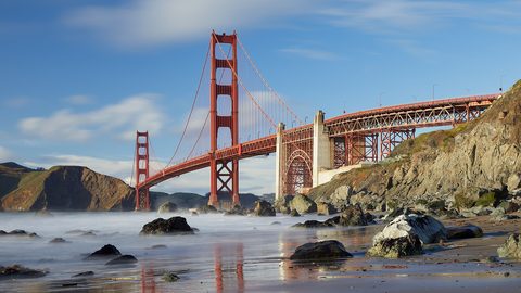 California
Eight hundred miles of desert, alpine range, and temperate coast in one state. The season that suits one part rules out another.
California
Eight hundred miles of desert, alpine range, and temperate coast in one state. The season that suits one part rules out another.