Getting Around California by Car Without Losing Half Your Trip to the Freeway
A rental car is non-negotiable outside San Francisco. Here is how tolls, deposits, and the real driving distances work before you end up with a fine or a
How to Move Around California and Where a Rental Car Stops Being Optional
The problem with getting around California by car is not the car. It is the 383 miles between Los Angeles and San Francisco, the 5.5 hour drive from the southern city to Yosemite Valley each way, and the fact that a scenic route like Highway 1 through Big Sur is a 10 hour, 440 mile slog with no shortcuts. A rental car is non negotiable outside San Francisco's core. That is the starting point for every trip plan. You need a credit card for the deposit, an electronic toll transponder account for the bridges and express lanes, and a realistic understanding of what the drive times actually are, not what the map says.
California Rental Car Requirements
You need a major credit card in the driver's name to pick up any rental car in California. Most agencies place a hold on the card for an amount set by the company, beyond the rental cost. A debit card will not work at most airport locations. If you only have a debit card, you face a hard credit check and a hold that can exceed $1,000. Car rental companies in California also require the driver to be at least 21 years old. Drivers under 25 pay an extra daily surcharge set by the rental company.


California Toll Road Payment
Almost every toll facility in California operates without cash booths. You pay with a FasTrak transponder, a license plate account, or within 48 hours online. The thing that catches visitors out: most express lanes on I 405, I 10, and I 110 in the southern metropolis and on I 680 in the Bay Area are pay to use, not carpool lanes you can drive free. If you enter one without a transponder or an online account, the rental car company gets the violation notice and charges you its own processing fee plus the toll. Open a FasTrak account online before you arrive. The transponder ships to your home address or you can pick one up at a Walgreens or Vons in California. Set it to the minimum prepay amount shown on the official FasTrak website. It works on all Bay Area bridges, the San Diego Express Lanes, and the 91 Express Lanes in Orange County. If you drive through a toll point without a transponder, go to the FasTrak website within 48 hours and pay the toll using your license plate number. After that, the toll agency adds a late fee to the original toll.
California Driving Distances Realistic
Map distance and drive time are two different things in California. Los Angeles to San Francisco is 383 miles on I 5 and takes 6 to 7 hours in typical traffic. The coastal route on CA 1 adds time, not scenery shortcuts: Big Sur is landslide prone with intermittent full closures lasting weeks to months during wet winters, and you cannot detour around it. San Francisco to Yosemite Valley is 170 miles on the map, but the drive is 3.5 to 4.5 hours because the last stretch climbs winding mountain roads. The southern city to Yosemite Valley is 280 miles and 5 to 6 hours.
Routes That Take Much Longer Than The Map Suggests
I 405 through West Los Angeles, US 101 through downtown, and I 80 between Berkeley and San Francisco all routinely exceed expected drive times by 50 to 100 percent during weekday peaks. US 50 to South Lake Tahoe is a 3.5 to 4.5 hour drive from San Francisco on a normal day. On a winter Friday afternoon or a summer Sunday, add another hour. Mountain passes subject to seasonal closure Tioga Pass on CA 120 through the national park, Sonora Pass on CA 108, Ebbetts Pass on CA 4, and Monitor Pass on CA 89 each close with the first heavy snow and open only from late spring through early autumn. Chain control zones apply on I 80 over Donner Summit, US 50 over Echo Summit, I 5 over the Grapevine, and CA 203 to Mammoth Lakes during winter storms.
California Public Transit Limits
Public transit functions as primary visitor transport in exactly three places. San Francisco's core works because BART connects SFO to downtown in 30 minutes and Muni Metro covers the city. Downtown San Diego works because the San Diego Trolley runs from the Santa Fe Depot to the border at San Ysidro and to eastern suburbs. Central Los Angeles works along Metro Rail corridors serving Hollywood, Santa Monica, and Pasadena.
Everywhere else assumes you have a car. Napa and Sonoma wine country, the Big Sur coast, every Sierra Nevada mountain town, Death Valley, Joshua Tree, the Shasta Cascade, the North Coast redwood parks, rural Gold Country, and most of the Central Valley require a rental car. The Pacific Surfliner from San Diego to San Luis Obispo via the southern city and Santa Barbara is a good train, but it does not get you to trailheads, vineyards, or coastal viewpoints. Amtrak Thruway buses fill some gaps statewide, but departure frequencies are low. FlixBus and Greyhound cover the Bay Area to the southern metropolis corridor at high frequency, but neither delivers you to a redwood grove or a desert trailhead.
Where Your Car Stops Being Optional
Death Valley National Park has no internal public transit. Neither does Joshua Tree National Park, Lassen Volcanic National Park, Pinnacles National Park, or Redwood National and State Parks. Yosemite Valley has a seasonal shuttle from late spring through early autumn, but you still need the car to reach the park entrance. Sequoia National Park and Kings Canyon also run seasonal shuttles. Every other national park in California requires you to drive to the trailhead. Arrive by 7:00 AM on weekends or face a long walk along the road.

Fuel, Parking, Fog, and What Breaks the Trip
Gas prices in California run well above the national average. Budget for it. Check the AAA or GasBuddy daily averages before you leave. Parking fills early. At popular trailheads and beaches on weekends, the lot is full by 7:00 AM and you are parking a mile away on the road shoulder. Inside Yosemite, overnight accommodation in the valley, Big Sur, and coastal state parks books solid 6 to 12 months ahead. If you did not book, you sleep outside the park and drive in each morning.
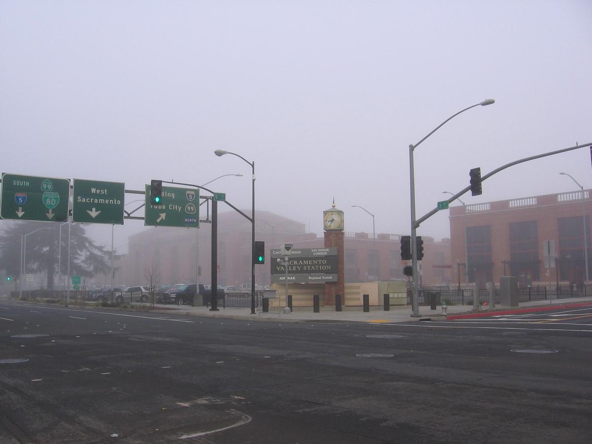
Coastal fog, called June Gloom or May Gray, erases ocean views for days. You are in a sweatshirt on a July beach in Monterey. Wildfire smoke from July through October closes highways and parks with little notice. Check Caltrans QuickMap for real time highway conditions before every leg of the drive. Cell service vanishes in the High Sierra backcountry, deep canyons, and remote desert parks. Download offline maps before you leave pavement. Never rely on streaming navigation on Highway 1 or mountain passes.
What Goes Wrong Most Often
Visitors underestimate driving distances and treat California like a compact destination. The 383 mile map distance from Los Angeles to San Francisco becomes a 6 to 7 hour drive that wipes out a morning. A quick trip from the southern city to Yosemite Valley is a 5 to 6 hour drive each way, not a day trip. The scenic coast on CA 1 from San Francisco to the southern city takes 10 hours with no shortcut. Arrive with a printed list of drive times from the research above and assume every journey takes the upper end of the range. California works for road trippers who genuinely love long drives, nature obsessives chasing specific biomes, food pilgrims with deep budgets, and families doing a loop of theme parks and beaches. It does not work for budget backpackers relying on public transit, anyone who hates driving, or travellers seeking compact walkable cities with old world charm.
Common Questions
Can I rent a car in California without a credit card?
Not at the major airport locations. Most rental companies require a major credit card in the driver's name for the deposit. A debit card may work at off airport branches but triggers a hard credit check and a hold that can exceed $1,000.
What happens if I miss a FasTrak toll payment?
You have a 48 hour window to pay the toll online using your license plate number. After that, the rental car company gets a violation notice and charges you a processing fee. The fine from the toll agency adds a late fee per missed payment.
Can I do a day trip from San Francisco to Yosemite and back?
You can, but you will spend 7 to 9 hours in the car for a 170 mile distance each way. Drive time is 3.5 to 4.5 hours one way. A day trip works if you leave by 6:00 AM and accept that you see only the valley floor and one short hike.
Is it possible to visit California without driving at all?
Yes, if you stay in San Francisco's core, downtown San Diego, or central Los Angeles along Metro Rail and rely on the Pacific Surfliner between coastal cities. You cannot visit Yosemite, Big Sur, Death Valley, Joshua Tree, Napa, the North Coast redwoods, or the Sierra Nevada.
Read next
-
 Best Time to Visit California When One Season Cannot Cover the Whole State
California spans desert, alpine range, and temperate coast. The season that suits Yosemite rules out Death Valley.
Best Time to Visit California When One Season Cannot Cover the Whole State
California spans desert, alpine range, and temperate coast. The season that suits Yosemite rules out Death Valley.
-
 Staying Safe in California From Wildfire Closures to Car Break-Ins
A San Francisco driver returns to their rented SUV in a SOMA parking lot to find the rear window smashed and an empty space where a duffel bag sat.
Staying Safe in California From Wildfire Closures to Car Break-Ins
A San Francisco driver returns to their rented SUV in a SOMA parking lot to find the rear window smashed and an empty space where a duffel bag sat.
-
 What a California Trip Costs in Real Terms Beyond the Sticker Price
California costs more than it looks online. Gas runs well above the national average, peak-season motels top $200 a night, and park lodges book out months
What a California Trip Costs in Real Terms Beyond the Sticker Price
California costs more than it looks online. Gas runs well above the national average, peak-season motels top $200 a night, and park lodges book out months
-
 United States Travel Guide for First-Timers Who Want the Real Picture
The United States delivers extraordinary geographic and cultural variety, but its sheer scale, car dependency, and tipping economy surprise first-timers. Start here.
United States Travel Guide for First-Timers Who Want the Real Picture
The United States delivers extraordinary geographic and cultural variety, but its sheer scale, car dependency, and tipping economy surprise first-timers. Start here.
-
 Staying Connected While Traveling Through the United States
Prepaid eSIMs work well in US cities, but a physical T-Mobile or AT&T SIM bought at arrival gives better rural coverage for national parks and long highway drives.
Staying Connected While Traveling Through the United States
Prepaid eSIMs work well in US cities, but a physical T-Mobile or AT&T SIM bought at arrival gives better rural coverage for national parks and long highway drives.
-
 Best Time to Visit the United States by Region and Season
The United States spans so many climates that no single season works everywhere. Here is what each region delivers, and when to stay away.
Best Time to Visit the United States by Region and Season
The United States spans so many climates that no single season works everywhere. Here is what each region delivers, and when to stay away.
-
 Getting Around the United States Without Underestimating the Distances
Outside the Northeast Corridor, the United States runs on cars and domestic flights. Distances are enormous and Amtrak is scenic but slow.
Getting Around the United States Without Underestimating the Distances
Outside the Northeast Corridor, the United States runs on cars and domestic flights. Distances are enormous and Amtrak is scenic but slow.
-
 How to Budget a Trip Based on Purchasing Power, Not Just Exchange Rates
Exchange rates tell only half the story. See how purchasing power shapes your real travel budget across Southeast Asia, Eastern Europe, and Latin America.
How to Budget a Trip Based on Purchasing Power, Not Just Exchange Rates
Exchange rates tell only half the story. See how purchasing power shapes your real travel budget across Southeast Asia, Eastern Europe, and Latin America.
-
 A Ground-Level Logistics Guide to Independent Travel in China
First-time independent travel in China: what you need to know about visas, rail booking, eSIMs, mobile payments, and power adapters.
A Ground-Level Logistics Guide to Independent Travel in China
First-time independent travel in China: what you need to know about visas, rail booking, eSIMs, mobile payments, and power adapters.