The Best Time to Visit California by Region and What You Actually Get
California spans desert, alpine range, and temperate coast. The season that suits Yosemite rules out Death Valley.
When to Go to California and What Each Season Actually Does to Each Region
You land at LAX in August, expecting the California of postcards: endless sun, a perfect wave, and a dry heat that evaporates before it touches you. Instead, the marine layer has erased the shoreline into a gray smear, the Central Valley is a blast furnace at 105°F, and every campsite in the Sierra Nevada booked out six months ago. The single best season does not exist. The best time to visit California by region is the only honest answer, because this state spans 840 miles of coast, 163,696 square miles of territory, and five distinct climatic regions that never cooperate.
California runs from the Oregon border to the Mexico line, a north-south drive of roughly 800 miles on I-5, and its east-west stretch hits 360 miles at the widest point. The highest point, Mount Whitney at 14,505 feet, sits 76 miles from the lowest, Badwater Basin in Death Valley at 282 feet below sea level. The annual precipitation range tells the whole story: less than 2 inches in the desert and more than 100 inches in the temperate rainforest of the far north. You choose a season by choosing a region, and you accept that your travel partner hiking the granite domes in the High Sierra in July is sweating while your other friend wears a fleece on a fog-shrouded beach in San Diego County. The honest answer to the question of when to go is always: it depends where you are going.
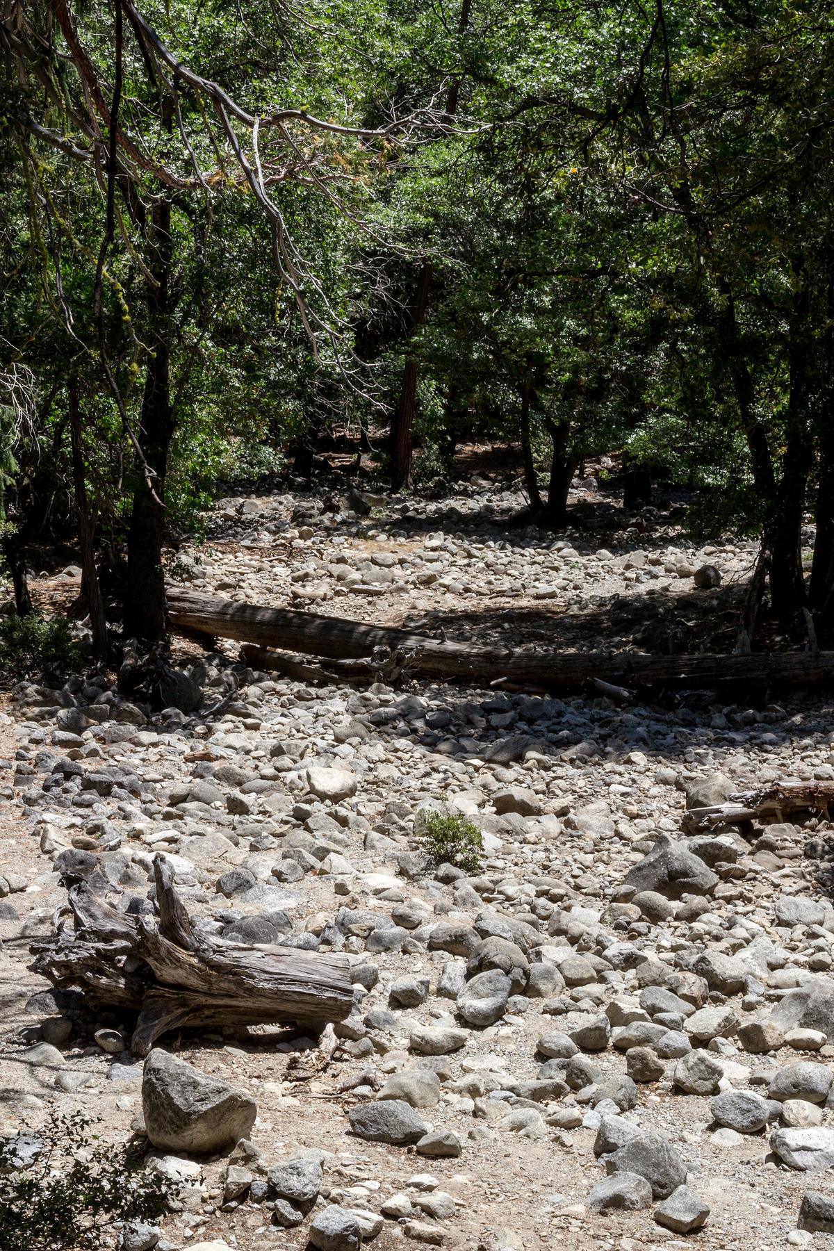
,_Yosemite_Valley_--_2012_--_4667.jpg)
| Region | Summer Pattern | Winter Pattern | Peak Window |
|---|---|---|---|
| Coastal | Marine layer fog mornings, clearing midday, highs 60–75°F | Rain storms, highs 50–65°F, snow on highest peaks | September–October (warmest ocean, least fog) |
| Desert | Daytime highs 100–120°F, lows 70–85°F | Daytime highs 60–75°F, nights 30–45°F, occasional frost | November–March |
| Mountain (Sierra Nevada) | Dry, highs 70–85°F at elevation, afternoon thunderstorms | Heavy snowfall, highs 20–40°F, high-pass road closures | July–September (trails clear, Tioga Pass open) |
| Central Valley | Dry, highs 90–105°F, low humidity | Rain, tule fog reducing visibility to near zero, highs 50–60°F | March–May and October–November |
| Urban Basin (Los Angeles) | Hot inland 90–100°F, cooler coast 70–80°F, smog | Rain, highs 65–70°F, clear between storms, snow on peaks | March–May and October–November |
California Seasonal Guide
The California seasonal guide breaks into three geographic bands that matter more than any calendar month. Northern California, from the Oregon border through the Bay Area, experiences its most reliable weather in autumn, when the fog lifts, the ocean hits its warmest temperature range of 55-70°F, and the Sierra Nevada stays dry and stable before the first snow arrives in October or November. Central California, including the Central Coast and Central Valley, is a study in extremes: the valley bakes at 90-105°F in summer while the coast stays 20 degrees cooler behind the marine layer. Southern California, from the Los Angeles Basin to the Mexico border, burns through summer with hot inland temperatures and smog, but the coast in September and October offers the clearest skies and the lowest chance of the persistent morning overcast locals call May Gray and June Gloom.
Central Valley Heat And Fog
The Central Valley deserves a warning. Summer daytime highs routinely exceed 100°F, and the low humidity offers no relief. The valley’s farm-to-table roots produce some of the state’s best food, but the experience of eating a Santa Maria-style tri-tip in 105°F heat is not the romantic farm tour you imagined. Winter brings tule fog, a dense ground fog that reduces visibility to near zero and shuts down stretches of I-5 and CA-99. The spring and autumn shoulders are the only comfortable windows, with warming temperatures and decreasing rain in spring, and the cooling harvest period in autumn before the fog begins in November.
June Gloom California Coast: Why the Beach Vibe Waits Until Afternoon
June Gloom on the California coast is not a rumor; it is the dominant summer weather pattern from roughly May through August for the entire shoreline south of Monterey. The marine layer rolls in overnight, blankets the coast in a gray overcast that can erase ocean views entirely, and leaves beachgoers shivering in sweatshirts at 10:00 AM. It burns off by early to midafternoon, producing the classic California beach afternoon, but it can persist for days, especially in June. The North Coast, including Redwood National and State Parks, relies on this fog: the heaviest fog period from June through August is essential for the ecology of the redwood region, delivering the moisture that sustains the tallest trees on Earth.
Shift Your Beach Schedule
The practical effect is a shift in your daily schedule. Do not plan sunrise ocean views or early morning beach time on the Central Coast or the Los Angeles Basin coast. Plan your coastal hikes for midday or late afternoon. The water temperature off Southern California in summer reaches 55-70°F, which is cold by any standard, so the wetsuit the surfers wear year-round is not optional. The fog also hides Big Sur’s cliff-edge highway from view for hours, making the drive less spectacular than the postcards suggest. The warmest ocean temperatures and reduced fog arrive in autumn, making September and October the true coastal summer for most of the state.
California Wildfire Smoke Season: July Through November
California wildfire smoke season peaks from July through November, with the most active fires occurring during Santa Ana wind events in autumn and Diablo wind events in the north. Smoke can blanket entire regions unpredictably, closing highways and parks with little notice. The 2024 and 2025 seasons demonstrated that even cities like San Francisco can see Air Quality Index readings above 200 for days, and that popular destinations like Yosemite Valley and the High Sierra can be inaccessible for weeks. The research on specific fire events changes annually: the California Department of Forestry and Fire Protection publishes current incident data, and the National Interagency Fire Center tracks seasonal outlooks.
Plan For Reroutes
Reserve a rental car not because you will evacuate, but because wildfire closures force reroutes that public transit cannot handle. A closure of CA-1 at Big Sur from a December, March landslide is one thing; a wildfire closure of I-5 in the Grapevine is another, adding hours to a drive between the Los Angeles Basin and the Central Valley. Check air quality monitors before you travel, and budget for the possibility that your planned route or park becomes impassable. The autumn months offer the clearest skies and the warmest ocean temperatures, but they also carry the highest fire risk. This is the trade you make for the best weather on the coast.
Death Valley Summer Heat Timing: When it is Not a Survival Test
Death Valley summer heat timing is the most restrictive seasonal window in the state. Death Valley National Park and the rest of California’s low desert should be avoided from June through early September unless you are heat-acclimated. Daytime highs routinely exceed 46°C, and the ground surface temperature at Badwater Basin can reach extreme levels. The park’s prime visitation window runs from November through March, when daytime highs range from 60 to 75°F and nighttime lows drop to 30-45°F, occasionally with frost. The spring shoulder offers highs of 75-95°F with the possibility of desert wildflower blooms, but the intensity of the bloom varies with winter rainfall, peaking in March or April. The autumn shoulder brings highs of 80-100°F, clear skies, and low wind, making it tolerable for most visitors.
Desert Timing Beyond Death Valley
Death Valley is not the only desert that demands timing. Joshua Tree National Park shares the same seasonal logic: visit between November and March for hiking among the surreal rockpiles without risk of heat stroke. The park has no water available, so you carry everything you need. The Coachella Valley, home to Palm Springs and the date shake made from local Medjool dates, shares the desert summer pattern. If you arrive in August, stay indoors between 11:00 AM and 5:00 PM. The flash flood risk in the desert peaks from July through September during the monsoon season, which can wash out roads and trails without warning.

High Sierra Snowpack, Yosemite Firefall, and the Narrow Windows
The High Sierra operates on snow, not calendar dates. The Sierra Nevada winter features heavy snowfall, with highs of 20-40°F at elevation and road closures on high passes. Tioga Pass, the east-west route through Yosemite National Park, closes from November until late May or June each year. The exact opening date depends on snowmelt. Sonora Pass and Ebbetts Pass follow a similar pattern, closing from November through April. Lassen Volcanic National Park’s main road closes from November through May, and snowpack can linger into July at the park’s higher elevations, where you find boiling mud and volcanic features near the road.
Yosemite Valley And Firefall
Yosemite Valley’s waterfall peak flow runs from May through June, when the Merced River roars and every major cascade hits its maximum volume. By August or September in dry years, the falls reduce to a trickle. Yosemite’s Firefall, the natural light effect on Horsetail Fall, is visible only in mid-to-late February and requires clear skies and adequate snowmelt. It draws crowds that fill the park’s limited parking before dawn. Overnight accommodation inside Yosemite Valley and along the Big Sur coast consistently books solid 6 to 12 months ahead. If you arrive without a reservation, you sleep outside the park and drive 1.5 to 2 hours each way for a day trip.
Eastern Sierra And Backcountry Prep
The Eastern Sierra fall color peaks from late September to mid-October, varying with elevation and cold snaps. Mosquito intensity in the Sierra Nevada peaks in June and July, varying with snowmelt timing. If you hike in July, bring repellent and expect swarms. The Sierra summer is dry with highs of 70-85°F at elevation, but afternoon thunderstorms can develop without warning. Cell service vanishes in the High Sierra backcountry, deep canyons, and remote desert parks. Download offline maps before you leave pavement and never rely on streaming navigation on Highway 1 or mountain passes.
Coastal Shoulders, Desert Blooms, and the Fog That Feeds the Redwoods
The coastal shoulder patterns offer the best compromise for most travelers. Spring sees decreasing fog, wildflower blooms along the Central Coast and the Los Angeles Basin, and intermittent rain. Autumn delivers the warmest ocean temperatures in Southern California, reduced fog, and dry conditions along the entire 840-mile coastline. The gray whale migration runs southbound from December through February and northbound from March through May. Blue whale feeding season off Southern California runs from May through October, with sightings most reliable in late summer. The monarch butterfly overwintering sites along the coast hold clusters from November through February.
Redwood Fog And Shasta Cascade
The North Coast, where the redwood cathedrals rise in Humboldt and Del Norte counties, receives its heaviest fog from June through August. That fog is essential for the redwood ecology, delivering moisture during the dry summer months. The redwood region’s fog pattern is so consistent that the trees depend on it for hydration. If you visit the North Coast in summer, expect fog, pack layers, and understand that the gray sky is what keeps the tallest trees on Earth alive. The Shasta Cascade region to the east, with Lassen Volcanic National Park and near-empty highways, operates on a different calendar: the main park road is closed from November through May, and snowpack can persist into July at higher elevations.
Desert Blooms And Eastern Sierra Color
Desert wildflower blooms in the low desert and the Coachella Valley vary in intensity with winter rainfall, peaking in March or April. The bloom is never guaranteed; a dry winter means a bare desert. The autumn window in the desert, with highs of 80-100°F, clear skies, and low wind, offers a reliable alternative for visitors who missed the spring bloom. The Eastern Sierra fall color, peaking from late September to mid-October, offers a different kind of seasonal spectacle, with aspen groves turning gold along the range’s eastern flank.
What Works and What Does Not
California works for road-trippers who genuinely love long drives, nature obsessives chasing specific biomes from desert to alpine, food-and-wine pilgrims with deep budgets, families doing a greatest-hits loop of theme parks and beaches, and surfers willing to wear a wetsuit year-round. The state does not work for budget backpackers relying on public transit, anyone who hates driving or sitting in a car for hours, or travelers seeking compact walkable cities with old-world charm. Skip it if you cannot stomach spending $200-plus per night on a forgettable motel room in peak season.
Drive Times And Reservations
The single thing that most often goes wrong here is underestimating driving distances and treating the state like a compact destination. A quick trip from Los Angeles to Yosemite Valley is a 5.5-hour drive each way. The scenic coast route from San Francisco to Los Angeles is a 10-hour, 440-mile slog with no shortcuts. Gas prices are among the highest in the nation, often $1.50 to $2.00 above the countrywide average, which shocks road-trippers at the pump. Parking at popular trailheads and beaches fills by 7:00 AM on weekends, forcing long roadside walks or trip abandonment. Book accommodation, book the rental car, book the park reservations, and accept that the answer to every question about when to go is the same: it depends on where you are going.
Common Questions
What is June Gloom and when does it happen?
June Gloom is the persistent morning overcast that blankets the California coast from roughly May through August. It burns off by early to midafternoon but can persist for days, especially in June. The marine layer erases ocean views and keeps beach temperatures 10-20 degrees cooler than inland areas.
When is the best time to visit Death Valley?
The prime visitation window for Death Valley National Park runs from November through March, when daytime highs range from 60 to 75°F. Avoid June through early September when highs routinely exceed 46°C. The spring shoulder offers the possibility of desert wildflower blooms in March or April, depending on winter rainfall.
When does Yosemite’s Firefall happen?
Yosemite’s Firefall, the natural light effect on Horsetail Fall, is visible only in mid-to-late February. It requires clear skies and adequate snowmelt. The event draws large crowds that fill the limited parking before dawn. Overnight accommodation inside Yosemite Valley books 6 to 12 months ahead.
How does wildfire smoke affect travel in California?
Wildfire smoke season peaks from July through November, with the most active fires during autumn Santa Ana wind events. Smoke can close highways and parks with little notice. Check air quality monitors before travel and budget for reroutes. The California Department of Forestry and Fire Protection publishes current incident data.
What is the minimum time needed for a California trip?
A minimum of 10 days is required, because any less forces you to choose between a single region or a miserable blur of freeway miles. Driving from San Francisco to Los Angeles via the scenic coast is a 10-hour, 440-mile slog with no shortcuts. A trip from Los Angeles to Yosemite Valley is a 5.5-hour drive each way.
Read next
-
 Getting Around California Without Losing Half Your Trip to the Freeway
A rental car is non-negotiable outside San Francisco. Here is how tolls, deposits, and the real driving distances work before you end up with a fine or a
Getting Around California Without Losing Half Your Trip to the Freeway
A rental car is non-negotiable outside San Francisco. Here is how tolls, deposits, and the real driving distances work before you end up with a fine or a
-
 Staying Safe in California From Wildfire Closures to Car Break-Ins
A San Francisco driver returns to their rented SUV in a SOMA parking lot to find the rear window smashed and an empty space where a duffel bag sat.
Staying Safe in California From Wildfire Closures to Car Break-Ins
A San Francisco driver returns to their rented SUV in a SOMA parking lot to find the rear window smashed and an empty space where a duffel bag sat.
-
 What a California Trip Costs in Real Terms Beyond the Sticker Price
California costs more than it looks online. Gas runs well above the national average, peak-season motels top $200 a night, and park lodges book out months
What a California Trip Costs in Real Terms Beyond the Sticker Price
California costs more than it looks online. Gas runs well above the national average, peak-season motels top $200 a night, and park lodges book out months
-
 United States Travel Guide for First-Timers Who Want the Real Picture
The United States delivers extraordinary geographic and cultural variety, but its sheer scale, car dependency, and tipping economy surprise first-timers. Start here.
United States Travel Guide for First-Timers Who Want the Real Picture
The United States delivers extraordinary geographic and cultural variety, but its sheer scale, car dependency, and tipping economy surprise first-timers. Start here.
-
 Staying Connected While Traveling Through the United States
Prepaid eSIMs work well in US cities, but a physical T-Mobile or AT&T SIM bought at arrival gives better rural coverage for national parks and long highway drives.
Staying Connected While Traveling Through the United States
Prepaid eSIMs work well in US cities, but a physical T-Mobile or AT&T SIM bought at arrival gives better rural coverage for national parks and long highway drives.
-
 Best Time to Visit the United States by Region and Season
The United States spans so many climates that no single season works everywhere. Here is what each region delivers, and when to stay away.
Best Time to Visit the United States by Region and Season
The United States spans so many climates that no single season works everywhere. Here is what each region delivers, and when to stay away.
-
 Getting Around the United States Without Underestimating the Distances
Outside the Northeast Corridor, the United States runs on cars and domestic flights. Distances are enormous and Amtrak is scenic but slow.
Getting Around the United States Without Underestimating the Distances
Outside the Northeast Corridor, the United States runs on cars and domestic flights. Distances are enormous and Amtrak is scenic but slow.